Chester, Wisconsin
Chester is a town in Dodge County, Wisconsin. The population was 960 at the 2000 census. The unincorporated communities of Atwater and East Waupun are located in the town.
Chester, Wisconsin | |
|---|---|
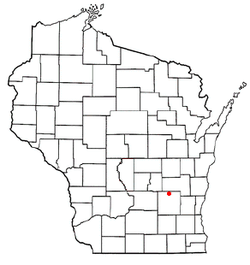 Location of Chester, Wisconsin | |
| Coordinates: 43°36′18″N 88°43′24″W | |
| Country | |
| State | |
| County | Dodge |
| Area | |
| • Total | 34.4 sq mi (89.1 km2) |
| • Land | 33.2 sq mi (86.0 km2) |
| • Water | 1.2 sq mi (3.2 km2) |
| Elevation | 886 ft (270 m) |
| Population (2000) | |
| • Total | 960 |
| • Density | 28.9/sq mi (11.2/km2) |
| Time zone | UTC-6 (Central (CST)) |
| • Summer (DST) | UTC-5 (CDT) |
| FIPS code | 55-14300[2] |
| GNIS feature ID | 1582950[1] |
History
A post office called Chester was established in 1847, and remained in operation until it was discontinued in 1918.[3] The town was named after Chester, Massachusetts.[4]
Geography
According to the United States Census Bureau, the town has a total area of 34.4 square miles (89.1 km²), of which, 33.2 square miles (86.0 km²) of it is land and 1.2 square miles (3.2 km²) of it (3.54%) is water.
Demographics
At the 2000 census there were 960 people, 280 households, and 211 families living in the town. The population density was 28.9 people per square mile (11.2/km²). There were 291 housing units at an average density of 8.8 per square mile (3.4/km²). The racial makeup of the town was 87.92% White, 9.38% African American, 1.04% Native American, 0.10% Asian, 0.62% from other races, and 0.94% from two or more races. Hispanic or Latino of any race were 3.54%.[2]
Of the 280 households 36.1% had children under the age of 18 living with them, 67.9% were married couples living together, 4.3% had a female householder with no husband present, and 24.6% were non-families. 21.4% of households were one person and 9.6% were one person aged 65 or older. The average household size was 2.62 and the average family size was 3.08.
The age distribution was 20.3% under the age of 18, 11.1% from 18 to 24, 40.1% from 25 to 44, 18.1% from 45 to 64, and 10.3% 65 or older. The median age was 35 years. For every 100 females, there were 171.2 males. For every 100 females age 18 and over, there were 198.8 males.
The median household income was $49,688 and the median family income was $55,125. Males had a median income of $32,188 versus $28,750 for females. The per capita income for the town was $20,915. About 3.3% of families and 3.0% of the population were below the poverty line, including 4.4% of those under age 18 and none of those age 65 or over.
Notable people
- Darius L. Bancroft, politician, lived in Chester.
- James Giddings, politician.
- Frank Glazer, pianist, composer, and professor of music, was born in Chester in 1915.
References
- "US Board on Geographic Names". United States Geological Survey. 2007-10-25. Retrieved 2008-01-31.
- "U.S. Census website". United States Census Bureau. Retrieved 2008-01-31.
- "Dodge County". Jim Forte Postal History. Archived from the original on 2 April 2015. Retrieved 28 February 2015.
- Chicago and North Western Railway Company (1908). A History of the Origin of the Place Names Connected with the Chicago & North Western and Chicago, St. Paul, Minneapolis & Omaha Railways. p. 55.
Municipalities and communities of Dodge County, Wisconsin, United States | ||
|---|---|---|
| Cities | 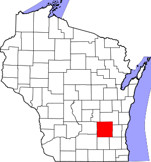 | |
| Villages | ||
| Towns | ||
| CDPs | ||
| Unincorporated communities |
| |
| Ghost towns | ||
| Footnotes | ‡This populated place also has portions in an adjacent county or counties | |
| Authority control |
|---|