Cheshire (CDP), Massachusetts
Cheshire is a census-designated place (CDP) located in the town of Cheshire in Berkshire County, Massachusetts, United States. The population was 514 at the 2010 census,[1] out of 3,235 in the entire town of Cheshire.
Cheshire, Massachusetts | |
|---|---|
 Town Hall | |
 Location in Berkshire County and the state of Massachusetts. | |
| Coordinates: 42°33′43″N 73°9′46″W | |
| Country | United States |
| State | Massachusetts |
| County | Berkshire |
| Town | Cheshire |
| Area | |
| • Total | 0.4 sq mi (1.0 km2) |
| • Land | 0.4 sq mi (1.0 km2) |
| • Water | 0 sq mi (0 km2) |
| Elevation | 994 ft (303 m) |
| Population (2010) | |
| • Total | 514 |
| • Density | 1,340/sq mi (517.4/km2) |
| Time zone | UTC-5 (Eastern (EST)) |
| • Summer (DST) | UTC-4 (EDT) |
| ZIP code | 01225 |
| Area code(s) | 413 |
| FIPS code | 25-13310 |
| GNIS feature ID | 0607347 |
Geography
Cheshire CDP is located in the center of the town of Cheshire at 42°33′43″N 73°9′46″W.[2] Massachusetts Route 8 passes through the center of the community, leading north to Adams and North Adams and south towards Pittsfield. The CDP sits at the head of the Hoosic River, where it flows out of the Cheshire Reservoir.
According to the United States Census Bureau, the Cheshire CDP has a total area of 0.39 square miles (1.0 km2), all land.[1]
References
- "Geographic Identifiers: 2010 Demographic Profile Data (G001): Cheshire CDP, Massachusetts". U.S. Census Bureau, American Factfinder. Archived from the original on February 12, 2020. Retrieved December 20, 2013.
- "US Gazetteer files: 2010, 2000, and 1990". United States Census Bureau. 2011-02-12. Retrieved 2011-04-23.
Municipalities and communities of Berkshire County, Massachusetts, United States | ||
|---|---|---|
| Cities | 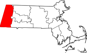 Berkshire County’s location in Massachusetts | |
| Towns | ||
| CDPs | ||
| Other villages | ||
This article is issued from Wikipedia. The text is licensed under Creative Commons - Attribution - Sharealike. Additional terms may apply for the media files.