Chae Hom District
Chae Hom (Thai: แจ้ห่ม, pronounced [t͡ɕɛ̂ː hòm]) is a district (amphoe) of Lampang Province, northern Thailand.
Chae Hom แจ้ห่ม | |
|---|---|
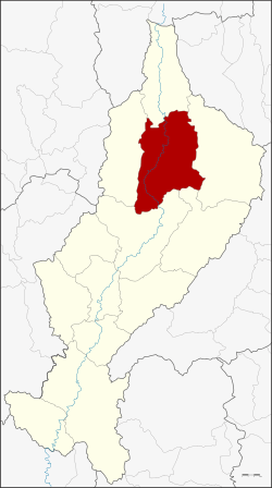 District location in Lampang Province | |
| Coordinates: 18°42′46″N 99°33′27″E | |
| Country | Thailand |
| Province | Lampang |
| Seat | Wichet Nakhon |
| Area | |
| • Total | 1,349.121 km2 (520.899 sq mi) |
| Population (2005) | |
| • Total | 42,457 |
| • Density | 31.2/km2 (81/sq mi) |
| Time zone | UTC+7 (ICT) |
| Postal code | 52120 |
| Geocode | 5206 |
Geography

Neighboring districts are (from the north clockwise): Wang Nuea, Ngao, Mae Mo, Mueang Lampang and Mueang Pan of Lampang Province.
Administration
The district is divided into seven subdistricts (tambons), which are further subdivided into 58 villages (mubans). Chae Hom is a township (thesaban tambon) which covers parts of tambon Chae Hom. There are a further seven tambon administrative organizations (TAO).
| No. | Name | Thai name | Villages | Pop. | |
|---|---|---|---|---|---|
| 1. | Chae Hom | แจ้ห่ม | 10 | 8,903 | |
| 2. | Ban Sa | บ้านสา | 7 | 5,299 | |
| 3. | Pong Don | ปงดอน | 8 | 5,188 | |
| 4. | Mae Suk | แม่สุก | 11 | 7,400 | |
| 5. | Mueang Mai | เมืองมาย | 5 | 3,332 | |
| 6. | Thung Phueng | ทุ่งผึ้ง | 6 | 4,121 | |
| 7. | Wichet Nakhon | วิเชตนคร | 11 | 8,214 |
External links
- amphoe.com (Thai)
This article is issued from Wikipedia. The text is licensed under Creative Commons - Attribution - Sharealike. Additional terms may apply for the media files.