Castelnau-Rivière-Basse
Castelnau-Rivière-Basse is a commune in the Hautes-Pyrénées department in south-western France. The commune shares its name with the village that lies within its boundaries.
Castelnau Rivière-Basse | |
|---|---|
.svg.png) Coat of arms | |
Location of Castelnau Rivière-Basse 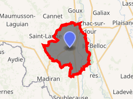
| |
 Castelnau Rivière-Basse  Castelnau Rivière-Basse | |
| Coordinates: 43°34′54″N 0°01′40″W | |
| Country | France |
| Region | Occitanie |
| Department | Hautes-Pyrénées |
| Arrondissement | Tarbes |
| Canton | Val d'Adour-Rustan-Madiranais |
| Government | |
| • Mayor (2014–2020) | Francis Loumagne |
| Area 1 | 18.5 km2 (7.1 sq mi) |
| Population (2017-01-01)[1] | 627 |
| • Density | 34/km2 (88/sq mi) |
| Time zone | UTC+01:00 (CET) |
| • Summer (DST) | UTC+02:00 (CEST) |
| INSEE/Postal code | 65130 /65700 |
| Elevation | 128–249 m (420–817 ft) (avg. 240 m or 790 ft) |
| 1 French Land Register data, which excludes lakes, ponds, glaciers > 1 km2 (0.386 sq mi or 247 acres) and river estuaries. | |
The actual village of Castelnau-Rivière-Basse stands on top of a hill above the main D935 road, although drivers on that road pass signs incorrectly indicating that they are entering and leaving the village. In late 2010 a local resident installed an improvised sign, hanging below the official 'leaving Castelnau-Riviere-Basse' road sign on the southbound direction on the D935, advising that the right turn up to the village itself is 800 metres distant. This has now been removed.
The wider commune encompasses the village, land mainly devoted to agricultural activity, and a small lake. On the main D935 route there is a small but well used truck stop comprising a 'Routier' style restaurant.
The Occitan Gascon translation of Castelnau-Rivière-Basse is Castèthnau de Ribèra Baisha.
References
- "Populations légales 2017". INSEE. Retrieved 6 January 2020.
| Wikimedia Commons has media related to Castelnau-Rivière-Basse. |
| Authority control |
|
|---|