Captieux
Captieux is a commune in the Gironde department in Nouvelle-Aquitaine in southwestern France.
Captieux | |
|---|---|
%2C_l'%C3%A9glise.JPG) The church in Captieux | |
.svg.png) Coat of arms | |
Location of Captieux 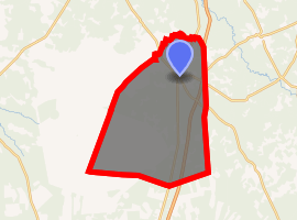
| |
 Captieux  Captieux | |
| Coordinates: 44°17′34″N 0°15′32″W | |
| Country | France |
| Region | Nouvelle-Aquitaine |
| Department | Gironde |
| Arrondissement | Langon |
| Canton | Le Sud-Gironde |
| Intercommunality | Captieux-Grignols |
| Government | |
| • Mayor (2008–2014) | Georges Bernard |
| Area 1 | 119.33 km2 (46.07 sq mi) |
| Population (2017-01-01)[1] | 1,281 |
| • Density | 11/km2 (28/sq mi) |
| Time zone | UTC+01:00 (CET) |
| • Summer (DST) | UTC+02:00 (CEST) |
| INSEE/Postal code | 33095 /33840 |
| Elevation | 69–136 m (226–446 ft) |
| 1 French Land Register data, which excludes lakes, ponds, glaciers > 1 km2 (0.386 sq mi or 247 acres) and river estuaries. | |
It lies near the border with the Landes and the Lot-et-Garonne departments.
The commune is in the east of the Parc naturel régional des Landes de Gascogne.
Between 1950 and 1967, the U.S. Army's 23,000-acre 571st Ordnance Ammunition Command (Captieux Ordnance Depot) was situated southwest of the village.[2][3]
The Itinéraire à Grand Gabarit, a route which has been modified to allow its use by the oversize road convoys conveying body sections and wings of the Airbus A380 airliner, bypasses Captieux using a specially created private track about 1 kilometre (0.62 mi) to the east of the village.[4]
Population
| Historical population | ||
|---|---|---|
| Year | Pop. | ±% |
| 1962 | 1,358 | — |
| 1968 | 1,646 | +21.2% |
| 1975 | 1,669 | +1.4% |
| 1982 | 1,742 | +4.4% |
| 1990 | 1,707 | −2.0% |
| 1999 | 1,503 | −12.0% |
| 2008 | 1,385 | −7.9% |
See also
- Communes of the Gironde department
- Parc naturel régional des Landes de Gascogne
References
- "Populations légales 2017". INSEE. Retrieved 6 January 2020.
- https://www.usarmygermany.com/Units/ArmyDepots/USAREUR_Ammo%20Depots.htm#Captieux
- https://books.google.com/books?id=wbDcDDZUepgC&dq
- "Itinéraire à grand gabarit : Transport des pièces de l'Airbus A380 entre Langon et Toulouse : Aménagements réalisés à Captieux" (in French). IGG.FR. Archived from the original on 2011-07-20. Retrieved 2010-08-16.
| Wikimedia Commons has media related to Captieux. |
| Authority control |
|
|---|
This article is issued from Wikipedia. The text is licensed under Creative Commons - Attribution - Sharealike. Additional terms may apply for the media files.