Bourg, Gironde
Bourg, also less formally known as Bourg-sur-Gironde, is a commune in the Gironde department in Nouvelle-Aquitaine in southwestern France.
Bourg | |
|---|---|
_mairie.JPG) The town hall in Bourg | |
.svg.png) Coat of arms | |
Location of Bourg 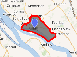
| |
 Bourg  Bourg | |
| Coordinates: 45°02′27″N 0°33′22″W | |
| Country | France |
| Region | Nouvelle-Aquitaine |
| Department | Gironde |
| Arrondissement | Blaye |
| Canton | L'Estuaire |
| Government | |
| • Mayor (2008–2014) | Denis Levraud |
| Area 1 | 10.54 km2 (4.07 sq mi) |
| Population (2017-01-01)[1] | 2,243 |
| • Density | 210/km2 (550/sq mi) |
| Time zone | UTC+01:00 (CET) |
| • Summer (DST) | UTC+02:00 (CEST) |
| INSEE/Postal code | 33067 /33710 |
| Elevation | 1–81 m (3.3–265.7 ft) (avg. 16 m or 52 ft) |
| 1 French Land Register data, which excludes lakes, ponds, glaciers > 1 km2 (0.386 sq mi or 247 acres) and river estuaries. | |
Population
| Historical population | ||
|---|---|---|
| Year | Pop. | ±% |
| 1793 | 3,200 | — |
| 1800 | 2,704 | −15.5% |
| 1806 | 2,534 | −6.3% |
| 1821 | 2,233 | −11.9% |
| 1831 | 2,306 | +3.3% |
| 1836 | 2,466 | +6.9% |
| 1841 | 2,564 | +4.0% |
| 1846 | 2,666 | +4.0% |
| 1851 | 2,694 | +1.1% |
| 1856 | 2,687 | −0.3% |
| 1861 | 2,781 | +3.5% |
| 1866 | 2,810 | +1.0% |
| 1872 | 2,735 | −2.7% |
| 1876 | 2,864 | +4.7% |
| 1881 | 2,771 | −3.2% |
| 1886 | 2,734 | −1.3% |
| 1891 | 2,780 | +1.7% |
| 1896 | 2,890 | +4.0% |
| 1901 | 2,832 | −2.0% |
| 1906 | 2,688 | −5.1% |
| 1911 | 2,555 | −4.9% |
| 1921 | 2,470 | −3.3% |
| 1926 | 2,334 | −5.5% |
| 1931 | 2,306 | −1.2% |
| 1936 | 2,182 | −5.4% |
| 1946 | 2,057 | −5.7% |
| 1954 | 2,199 | +6.9% |
| 1962 | 2,518 | +14.5% |
| 1968 | 2,560 | +1.7% |
| 1975 | 2,318 | −9.5% |
| 1982 | 2,107 | −9.1% |
| 1990 | 2,158 | +2.4% |
| 1999 | 2,118 | −1.9% |
| 2008 | 2,210 | +4.3% |
External links
| Wikimedia Commons has media related to Bourg (Gironde). |
| Authority control |
|
|---|
This article is issued from Wikipedia. The text is licensed under Creative Commons - Attribution - Sharealike. Additional terms may apply for the media files.