Campestre de Goiás
Campestre de Goiás is a municipality in central Goiás state, Brazil.
Campestre de Goiás | |
|---|---|
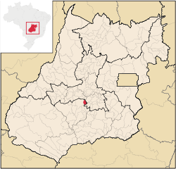 Location in Goiás state | |
 Campestre de Goiás Location in Brazil | |
| Coordinates: 16°45′19″S 49°41′14″W | |
| Country | Brazil |
| Region | Central-West |
| State | Goiás |
| Microregion | Vale do Rio dos Bois |
| Area | |
| • Total | 274.7 km2 (106.1 sq mi) |
| Elevation | 651 m (2,136 ft) |
| Population (2007) | |
| • Total | 3,411 |
| • Density | 12/km2 (32/sq mi) |
| Time zone | UTC-03:00 (BRT) |
| • Summer (DST) | UTC-02:00 (BRST) |
| Postal code | 75385-000 |
Location
There are municipal boundaries with:
- north: Santa Bárbara de Goiás
- south: Guapó
- east: Trindade
- west: Palmeiras de Goiás
Campestre is 56 kilometres west of the state capital, Goiânia and 26 kilometers west of Trindade. Connections are made by GO-060 / Trindade / GO-050.
Demographic and Political Data
- Population density in 2007: 12.46 inhabitants/km2
- Population growth rate 2000-2007: 1.07.%
- Population in 1980: 2,459
- Population in 1991: 2,316
- Urban population in 2007: 2,276
- Rural population in 2007: 1,135
- Eligible voters in 2007: 2,635
- City government in 2005: mayor (Selma do Socorro Lemes Manzi), vice-mayor (Roberto José da Costa), and 09 councilmembers
The economy
The economy is based on cattle raising, agriculture, and small retail and transformation units.
- Industrial units: 08 (2007)
- Retail units: 18
- Automobiles: 177 in 2007
Animal raising in 2006
- cattle: 30,500 head
- dairy cows: 6,600
Agricultural information 2006
- Number of farms: 260
- Total farm area: 24,226
- Planted area: 1,550 ha.
- Area of natural pasture: 17,162
- Workers in agriculture: 850
- Area of rice: 850 ha.
- Area of corn: 1,400 ha.
Health in 2007
- infant mortality rate in 2000: 25.29
- public health clinics: 01
- hospitals: none
Education in 2006
- literacy rate in 2000: 81.0%
- schools: 03
- classrooms: 18
- teachers: 54
- students: 868
- higher education: none
- Ranking on the Human Development Index: 0.715
- State ranking: 189 (out of 242 municipalities)
- National ranking: 2,732 (out of 5,507 municipalities)
History
Campestre de Goiás began in 1949 when Dimas and Antônio Viera settled with their families along the banks of the Córrego Campestre. In 1963 it was raised to a district of Trindade, and in the same year was dismembered to create a new municipality.
See also
- List of municipalities in Goiás
- Microregions of Goiás
References
Capital: Goiânia | |||||||||||||||||
|  | ||||||||||||||||
|
| |||||||||||||||||
| |||||||||||||||||
| |||||||||||||||||
This article is issued from Wikipedia. The text is licensed under Creative Commons - Attribution - Sharealike. Additional terms may apply for the media files.