Brunswick River (Georgia)
The Brunswick River[1] is a 6-mile-long (10 km)[2] tidal river in Glynn County, Georgia. It begins at the confluence of the South Brunswick River with the Turtle River southeast of Brunswick[3] and flows east to St. Simons Sound, the strait between Saint Simons Island to the north and Jekyll Island to the south.[4]
| Brunswick River | |
|---|---|
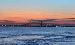 The Sidney Lanier Bridge over the Brunswick River | |
| Location | |
| Country | United States |
| Physical characteristics | |
| Source | |
| ⁃ location | Glynn County, Georgia |
| Mouth | |
⁃ coordinates | 31°07′13″N 81°25′35″W |
⁃ elevation | 0 m |
The Lanier Bridge crosses the Brunswick River, I-95 and Georgia State Route 303 cross the Turtle River, the Torres Causeway crosses St. Simons Sound, and the Jekyll Island Causeway crosses Jekyll Sound.
See also
References
- U.S. Geological Survey Geographic Names Information System: Brunswick River
- U.S. Geological Survey. National Hydrography Dataset high-resolution flowline data. The National Map Archived 2012-04-05 at WebCite, accessed April 21, 2011
- Brunswick West, GA, 7.5 Minute Topographic Quadrangle, USGS, 1956 (1976 rev.)
- Jekyll Island, GA, 7.5 Minute Topographic Quadrangle, USGS, 1957
- USGS Hydrologic Unit Map - State of Georgia (1974)
External links
- South Brunswick River boat ramp
- Georgia DNR Turtle River and South Brunswick River
- NOAA nautical chart
| Authority control |
|
|---|
This article is issued from Wikipedia. The text is licensed under Creative Commons - Attribution - Sharealike. Additional terms may apply for the media files.