Browning Township, Franklin County, Illinois
Browning Township is one of twelve townships in Franklin County, Illinois, USA. As of the 2010 census, its population was 2,450 and it contained 1,184 housing units.[2]
Browning Township | |
|---|---|
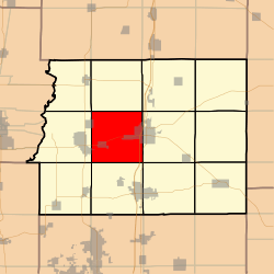 Location in Franklin County | |
 Franklin County's location in Illinois | |
| Coordinates: 37°59′25″N 88°58′58″W | |
| Country | United States |
| State | Illinois |
| County | Franklin |
| Established | November 4, 1884 |
| Area | |
| • Total | 36.48 sq mi (94.5 km2) |
| • Land | 35.79 sq mi (92.7 km2) |
| • Water | 0.69 sq mi (1.8 km2) 1.89% |
| Elevation | 381 ft (116 m) |
| Population (2010) | |
| • Estimate (2016)[1] | 2,396 |
| • Density | 68.5/sq mi (26.4/km2) |
| Time zone | UTC-6 (CST) |
| • Summer (DST) | UTC-5 (CDT) |
| ZIP codes | 62812, 62819, 62822, 62865, 62884, 62891 |
| FIPS code | 17-055-08940 |
Geography
According to the 2010 census, the township has a total area of 36.48 square miles (94.5 km2), of which 35.79 square miles (92.7 km2) (or 98.11%) is land and 0.69 square miles (1.8 km2) (or 1.89%) is water.[2]
Cities, towns, villages
- Benton (west quarter)
- Buckner
- Christopher (east edge)
- Valier (east quarter)
- West City
Unincorporated towns
Extinct towns
- Hickory Corners
Cemeteries
The township contains eleven cemeteries. These are: Browning, Grammer, Harrison, Hickory Corners, Knight, Moser, Mount Pleasant, Saint Joseph, Saint Marys, Smith and Wayman.
Major highways
Airports and landing strips
- Benton Municipal Airport
Landmarks
- Benton City Park
School districts
- Christopher Community Unit School District 99
- Sesser-Valier Community Unit School District 196
Political districts
- Illinois' 12th congressional district
- State House District 117
- State Senate District 59
References
- "Browning Township, Franklin County, Illinois". Geographic Names Information System. United States Geological Survey. Retrieved 2010-01-16.
- United States Census Bureau 2007 TIGER/Line Shapefiles
- United States National Atlas
- "Population and Housing Unit Estimates". Retrieved June 9, 2017.
- "Population, Housing Units, Area, and Density: 2010 - County -- County Subdivision and Place -- 2010 Census Summary File 1". United States Census. Archived from the original on 2020-02-12. Retrieved 2013-05-28.
- "Census of Population and Housing". Census.gov. Retrieved June 4, 2016.
External links
Places adjacent to Browning Township, Franklin County, Illinois | |
|---|---|
Municipalities and communities of Franklin County, Illinois, United States | ||
|---|---|---|
| Cities | Map of Illinois highlighting Franklin County | |
| Villages | ||
| Townships | ||
| CDP | ||
| Other unincorporated communities | ||
| Footnotes | ‡This populated place also has portions in an adjacent county or counties | |
This article is issued from Wikipedia. The text is licensed under Creative Commons - Attribution - Sharealike. Additional terms may apply for the media files.