Bridgewater, South Dakota
Bridgewater is a city in southwestern McCook County, South Dakota, United States. The population was 492 at the 2010 census.
Bridgewater, South Dakota | |
|---|---|
 Bridgewater Main Street, November 2014 | |
 Location in McCook County and the state of South Dakota | |
| Coordinates: 43°33′1″N 97°30′1″W | |
| Country | United States |
| State | South Dakota |
| County | McCook |
| Incorporated | 1889[1] |
| Government | |
| • Mayor | Michael Damm |
| Area | |
| • Total | 1.13 sq mi (2.91 km2) |
| • Land | 1.13 sq mi (2.91 km2) |
| • Water | 0.00 sq mi (0.00 km2) |
| Elevation | 1,417 ft (432 m) |
| Population | |
| • Total | 492 |
| • Estimate (2018)[4] | 461 |
| • Density | 409.78/sq mi (158.19/km2) |
| Time zone | UTC-6 (Central (CST)) |
| • Summer (DST) | UTC-5 (CDT) |
| ZIP code | 57319 |
| Area code(s) | 605 |
| FIPS code | 46-07180 |
| GNIS feature ID | 1254060[5] |
| Website | bridgewatersd |
History
Originally named Nation, the present name recalls an episode when water had to be carried to the town site for the railroad.[6] A post office called Nation was established in 1880, and the name was changed that same year to Bridgewater.[7]
Geography
Bridgewater is located at 43°33′1″N 97°30′1″W (43.550192, -97.500319).[8]
According to the United States Census Bureau, the city has a total area of 1.13 square miles (2.93 km2), all land.[9]
Bridgewater has been assigned the ZIP code 57319, and the FIPS place code 07180.
Demographics
| Historical population | |||
|---|---|---|---|
| Census | Pop. | %± | |
| 1890 | 410 | — | |
| 1900 | 691 | 68.5% | |
| 1910 | 934 | 35.2% | |
| 1920 | 976 | 4.5% | |
| 1930 | 762 | −21.9% | |
| 1940 | 790 | 3.7% | |
| 1950 | 748 | −5.3% | |
| 1960 | 694 | −7.2% | |
| 1970 | 633 | −8.8% | |
| 1980 | 653 | 3.2% | |
| 1990 | 533 | −18.4% | |
| 2000 | 607 | 13.9% | |
| 2010 | 492 | −18.9% | |
| Est. 2018 | 461 | [4] | −6.3% |
| U.S. Decennial Census[10] | |||
2010 census
As of the census[3] of 2010, there were 492 people, 204 households, and 133 families residing in the city. The population density was 435.4 inhabitants per square mile (168.1/km2). There were 254 housing units at an average density of 224.8 per square mile (86.8/km2). The racial makeup of the city was 98.4% White, 0.4% Native American, 0.6% Asian, 0.4% from other races, and 0.2% from two or more races. Hispanic or Latino of any race were 2.0% of the population.
There were 204 households, of which 28.9% had children under the age of 18 living with them, 48.5% were married couples living together, 11.8% had a female householder with no husband present, 4.9% had a male householder with no wife present, and 34.8% were non-families. 33.3% of all households were made up of individuals, and 21.1% had someone living alone who was 65 years of age or older. The average household size was 2.24 and the average family size was 2.77.
The median age in the city was 48.4 years. 23.8% of residents were under the age of 18; 2.6% were between the ages of 18 and 24; 19% were from 25 to 44; 25.6% were from 45 to 64; and 29.1% were 65 years of age or older. The gender makeup of the city was 45.3% male and 54.7% female.
2000 census
As of the census of 2000, there were 607 people, 245 households, and 147 families residing in the city. The population density was 541.4 people per square mile (209.3/km2). There were 266 housing units at an average density of 237.3 per square mile (91.7/km2). The racial makeup of the city was 98.35% White, 0.33% Native American, 0.33% Asian, 0.33% from other races, and 0.66% from two or more races. Hispanic or Latino of any race were 1.81% of the population.
There were 245 households, out of which 27.3% had children under the age of 18 living with them, 50.6% were married couples living together, 6.5% had a female householder with no husband present, and 39.6% were non-families. 35.5% of all households were made up of individuals, and 25.3% had someone living alone who was 65 years of age or older. The average household size was 2.31 and the average family size was 3.07.
In the city, the population was spread out, with 25.4% under the age of 18, 4.9% from 18 to 24, 21.7% from 25 to 44, 19.6% from 45 to 64, and 28.3% who were 65 years of age or older. The median age was 43 years. For every 100 females, there were 87.9 males. For every 100 females age 18 and over, there were 82.7 males.
The median income for a household in the city was $31,765, and the median income for a family was $39,375. Males had a median income of $28,611 versus $21,458 for females. The per capita income for the city was $15,855. About 5.5% of families and 9.5% of the population were below the poverty line, including 13.0% of those under age 18 and 10.4% of those age 65 or over.
Climate

Humid continental climate is a climatic region typified by large seasonal temperature differences, with warm to hot (and often humid) summers and cold (sometimes severely cold) winters. Precipitation is relatively well distributed year-round in many areas with this climate. The Köppen Climate Classification subtype for this climate is "Dfa" (Hot Summer Continental Climate).[11]
Notable person
- Sparky Anderson, Hall of Fame baseball manager; born in Bridgewater.[12] He is the namesake of Bridgewater's Sparky Anderson Park.[13]
See also
References
- "SD Towns" (PDF). South Dakota State Historical Society. Archived from the original (PDF) on 2010-02-10. Retrieved 2010-02-11.
- "2018 U.S. Gazetteer Files". United States Census Bureau. Retrieved February 22, 2020.
- "U.S. Census website". United States Census Bureau. Retrieved 2012-06-21.
- "Population and Housing Unit Estimates". United States Census Bureau. June 27, 2019. Retrieved June 4, 2019.
- "US Board on Geographic Names". United States Geological Survey. 2007-10-25. Retrieved 2008-01-31.
- Federal Writers' Project (1940). South Dakota place-names, v.1-3. University of South Dakota. p. 28.
- "McCook County". Jim Forte Postal History. Retrieved 27 January 2015.
- "US Gazetteer files: 2010, 2000, and 1990". United States Census Bureau. 2011-02-12. Retrieved 2011-04-23.
- "US Gazetteer files 2010". United States Census Bureau. Archived from the original on 2012-01-25. Retrieved 2012-06-21.
- United States Census Bureau. "Census of Population and Housing". Retrieved September 23, 2013.
- Climate Summary for Bridgewater
- "Sparky Anderson Stats". Baseball Almanac. Retrieved October 19, 2012.
- Brush, Carl and Jan (July 26, 2016). "Pedaling South Dakota: Day Two". South Dakota Magazine. Retrieved July 26, 2016.
External links
| Wikimedia Commons has media related to Bridgewater, South Dakota. |
Municipalities and communities of McCook County, South Dakota, United States | ||
|---|---|---|
| Cities | 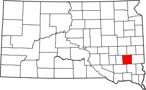 | |
| Unincorporated community | ||