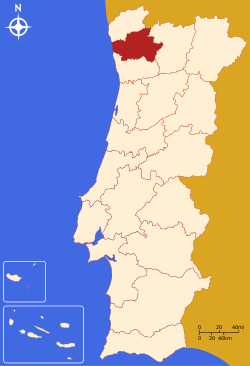
Braga District
The district of Braga (Portuguese: Distrito de Braga [ˈbɾaɣɐ] (![]()
Braga | |
|---|---|
 Coat of arms | |
 | |
| Country | Portugal |
| Region | Norte |
| Historical province | Minho |
| No. of municipalities | 14 |
| No. of parishes | 515 |
| Capital | Braga |
| Area | |
| • Total | 2,673 km2 (1,032 sq mi) |
| Population | |
| • Total | 831,368 |
| • Density | 310/km2 (810/sq mi) |
| ISO 3166 code | PT-03 |
| No. of parliamentary representatives | 19 |
Municipalities
The district comprises 14 municipalities:
- Amares
- Barcelos
- Braga
- Cabeceiras de Basto
- Celorico de Basto
- Esposende
- Fafe
- Guimarães
- Póvoa de Lanhoso
- Terras de Bouro
- Vieira do Minho
- Vila Nova de Famalicão
- Vila Verde
- Vizela
Summary of votes and seats won 1976-2019
Summary of election results from Braga district, 1976-2019
| Parties | % | S | % | S | % | S | % | S | % | S | % | S | % | S | % | S | % | S | % | S | % | S | % | S | % | S | % | S | % | S |
|---|---|---|---|---|---|---|---|---|---|---|---|---|---|---|---|---|---|---|---|---|---|---|---|---|---|---|---|---|---|---|
| 1976 | 1979 | 1980 | 1983 | 1985 | 1987 | 1991 | 1995 | 1999 | 2002 | 2005 | 2009 | 2011 | 2015 | 2019 | ||||||||||||||||
| PS | 32.3 | 6 | 30.2 | 5 | 29.3 | 5 | 39.7 | 7 | 21.8 | 4 | 25.9 | 5 | 31.5 | 5 | 42.9 | 8 | 44.3 | 8 | 37.4 | 8 | 45.4 | 9 | 41.7 | 9 | 32.9 | 7 | 30.9 | 7 | 36.4 | 8 |
| PSD | 28.6 | 5 | In AD | 27.0 | 5 | 32.8 | 6 | 53.4 | 10 | 53.6 | 10 | 38.2 | 7 | 36.7 | 7 | 44.4 | 9 | 32.9 | 7 | 30.8 | 6 | 40.1 | 9 | In PàF | 34.1 | 8 | ||||
| CDS-PP | 25.2 | 4 | 18.3 | 3 | 14.0 | 2 | 5.9 | 1 | 5.6 | 1 | 10.7 | 1 | 8.9 | 1 | 9.3 | 1 | 7.8 | 1 | 9.7 | 2 | 10.4 | 2 | 4.1 | 1 | ||||||
| PCP/APU/CDU | 4.2 | 10.0 | 1 | 8.4 | 1 | 8.8 | 1 | 8.5 | 1 | 6.1 | 1 | 4.6 | 4.5 | 5.4 | 1 | 4.4 | 4.8 | 1 | 4.6 | 1 | 4.9 | 1 | 5.2 | 1 | 4.0 | |||||
| AD | 51.9 | 9 | 54.9 | 9 | ||||||||||||||||||||||||||
| PRD | 16.8 | 3 | 3.3 | |||||||||||||||||||||||||||
| BE | 1.2 | 1.7 | 4.6 | 7.8 | 1 | 4.2 | 8.8 | 1 | 8.9 | 2 | ||||||||||||||||||||
| PàF | 45.6 | 10 | ||||||||||||||||||||||||||||
| Total seats | 15 | 16 | 17 | 16 | 17 | 18 | 19 | |||||||||||||||||||||||
| Source: Comissão Nacional de Eleições | ||||||||||||||||||||||||||||||
External links
| Municipalities | |
|---|---|
| Museums |
|
| |
This article is issued from Wikipedia. The text is licensed under Creative Commons - Attribution - Sharealike. Additional terms may apply for the media files.