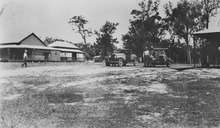
Bororen
Bororen is a town and locality in the Gladstone Region, Queensland, Australia.[2][3] In the 2016 census, Bororen had a population of 398 people.[1]
| Bororen Queensland | |||||||||||||||
|---|---|---|---|---|---|---|---|---|---|---|---|---|---|---|---|
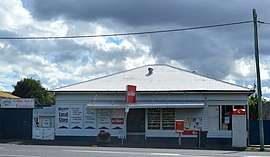 Local store and post office agency on the Bruce Highway | |||||||||||||||
 Bororen | |||||||||||||||
| Coordinates | 24.2444°S 151.4952°E | ||||||||||||||
| Population | 398 (2016 census)[1] | ||||||||||||||
| • Density | 1.2028/km2 (3.115/sq mi) | ||||||||||||||
| Postcode(s) | 4678 | ||||||||||||||
| Area | 330.9 km2 (127.8 sq mi) | ||||||||||||||
| Time zone | AEST (UTC+10:00) | ||||||||||||||
| LGA(s) | Gladstone Region | ||||||||||||||
| State electorate(s) | Burnett | ||||||||||||||
| Federal Division(s) | Flynn | ||||||||||||||
| |||||||||||||||
Geography
The Bruce Highway passes through both the town and the locality.
History
Bororen Post Office opened 2 June 1898; a receiving office had been open since about October 1897.[4]
Bororen Provisional School opened on 22 January 1900. It became a State School in 1909.[5][6]
Turkey Road State School opened on 1921 and closed on 24 May 1931.[7]
In about 1995, a war memorial was unveiled on the Bruce Highway, Bororen (24.243016°S 151.496029°E). It commemorates those servicemen and women who served in World War I and World War II.[8]
In the 2011 census, Bororen had a population of 417 people.[9]
In the 2016 census, Bororen had a population of 398 people.[1]
Education
Bororen State School is a government primary (Prep-6) school for boys and girls at 1 Kent Street (24.2443°S 151.4919°E).[10][11] In 2017, the school had an enrolment of 37 students with 4 teachers (3 full-time equivalent) and 5 non-teaching staff (2 full-time equivalent).[12]
References
- Australian Bureau of Statistics (27 June 2017). "Bororen (SSC)". 2016 Census QuickStats. Retrieved 20 October 2018.

- "Bororen - town in Gladstone Region (entry 3898)". Queensland Place Names. Queensland Government. Retrieved 28 September 2017.
- "Bororen - locality in Gladstone Region (entry 49131)". Queensland Place Names. Queensland Government. Retrieved 28 September 2017.
- Premier Postal History. "Post Office List". Premier Postal Auctions. Retrieved 2 July 2014.
- "Opening and closing dates of Queensland Schools". Queensland Government. Retrieved 2 July 2014.
- "Agency ID4996, Bororen State School". Queensland State Archives. Retrieved 3 July 2014.
- Queensland Family History Society (2010), Queensland schools past and present (Version 1.01 ed.), Queensland Family History Society, ISBN 978-1-921171-26-0
- "Bororen War Memorial". Monument Australia. Retrieved 3 July 2014.
- Australian Bureau of Statistics (31 October 2012). "Bororen (SSC)". 2011 Census QuickStats. Retrieved 2 July 2014.
- "State and non-state school details". Queensland Government. 9 July 2018. Archived from the original on 21 November 2018. Retrieved 21 November 2018.
- "Bororen State School". Retrieved 21 November 2018.
- "ACARA School Profile 2017". Archived from the original on 22 November 2018. Retrieved 22 November 2018.
Further reading
- Bororen State School (2000), Bororen State School centenary 1900-2000 : including Bororen, Iveragh, Boondilla and Turkey Road Schools, The School
External links
![]()
- "Miriam Vale and Miriam Vale Shire". Queensland Places. Centre for the Government of Queensland, University of Queensland. —includes Bororen
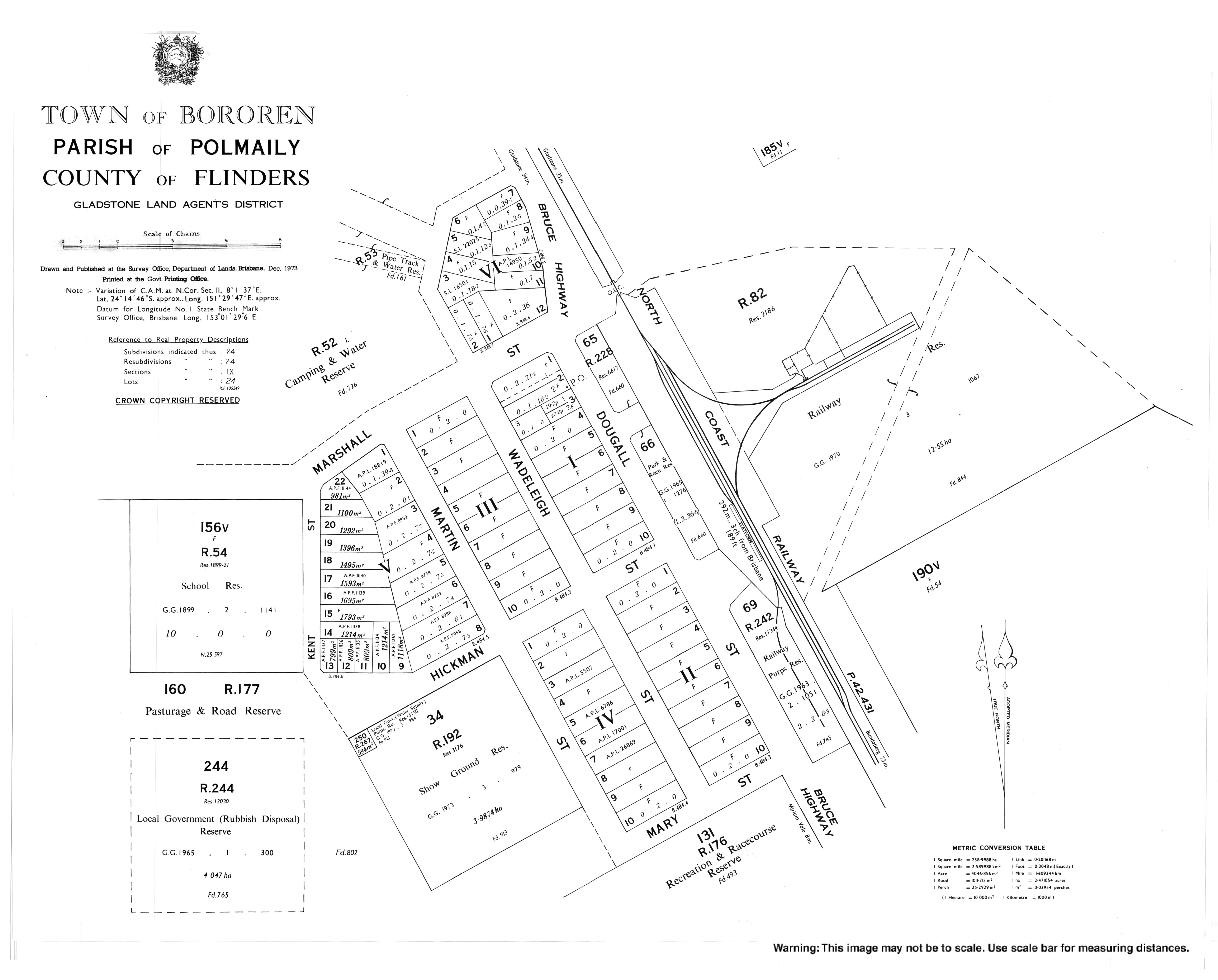
- "Town map of Bororen". Queensland Government. 1973.