Bolinda, Victoria
Bolinda /bəˈlɪndə/ is a small town and locality north of Melbourne, Australia on the Melbourne-Lancefield Road. It is 6 km. south of Romsey, within the Shire of Macedon Ranges.
| Bolinda Victoria | |||||||||||||||
|---|---|---|---|---|---|---|---|---|---|---|---|---|---|---|---|
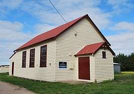 The Bolinda community hall | |||||||||||||||
 Bolinda | |||||||||||||||
| Coordinates | 37°26′S 144°45′E | ||||||||||||||
| Postcode(s) | 3432 | ||||||||||||||
| Elevation | 385 m (1,263 ft) | ||||||||||||||
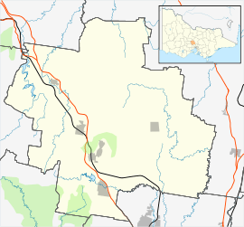
| Location | |||||||||||||||
| LGA(s) | Shire of Macedon Ranges | ||||||||||||||
| State electorate(s) | Macedon | ||||||||||||||
| Federal Division(s) | McEwen | ||||||||||||||
| |||||||||||||||
John Brock, one of the first British settlers in the Bolinda district, named his station Bullando Vale.[1] However, it is not clear whether this is connected in any way to the present name.
Bolinda Post Office opened on 12 June 1879 and closed in 1980.[2]
The community today is centred on the primary school (established 1870), community hall and recreation reserve.
Bolinda was an intermediate stopping point on the Clarkefield-Lancefield railway which operated between 1881 and 1956.
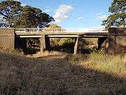
The Bolinda Bridge, between Bolinda and Clarkefield
References
| Wikimedia Commons has media related to Bolinda, Victoria. |
- Mitchell, Peter; Alan Jackson; Carol Moore; Gavin Smith (2004). Romsey: A Veritable Garden of Eden. Romsey: West Bourke Books Inc. ISBN 0-646-43570-1.
- Premier Postal History. "Post Office List". Retrieved 11 April 2008.
This article is issued from Wikipedia. The text is licensed under Creative Commons - Attribution - Sharealike. Additional terms may apply for the media files.