Blanca, Colorado
The Town of Blanca is a Statutory Town in Costilla County, Colorado, United States. The town population was 385 at the 2010 census.[8]
Town of Blanca, Colorado | |
|---|---|
 Main Street, looking west | |
 Location of Blanca in Costilla County, Colorado. | |
| Coordinates: 37°26′21″N 105°30′49″W[1] | |
| Country | |
| State | |
| County | Costilla County[2] |
| Incorporated (town) | September 07, 1909[3] |
| Government | |
| • Type | Statutory Town[2] |
| Area | |
| • Total | 1.79 sq mi (4.62 km2) |
| • Land | 1.79 sq mi (4.62 km2) |
| • Water | 0.00 sq mi (0.00 km2) |
| Elevation | 7,756 ft (2,364 m) |
| Population (2010) | |
| • Total | 385 |
| • Estimate (2018)[6] | 397 |
| • Density | 220.60/sq mi (85.19/km2) |
| Time zone | UTC-7 (MST) |
| • Summer (DST) | UTC-6 (MDT) |
| ZIP code | 81123[7] |
| Area code(s) | 719 |
| FIPS code | 08-07190 |
| GNIS feature ID | 0203627 |
History
The town, named for Blanca Peak,[9] was founded in August 1908 from a land lottery in the San Luis Valley of south central Colorado. It was incorporated in 1909.[10]
In the mid-1990s Polish settlers set up shop at the Red Rocks General Store selling liquor, beer, polish sausages, and other eastern European goods. Blanca is the region's main supplier of bilberry syrup.[11] Blanca is known for elk hunting and alpine trout fishing.
Geography
Blanca is at 37°26′26″N 105°30′36″W (37.440569, -105.509901)[12] in the east of the San Luis Valley and northern Costilla County. The United States Census Bureau reports that the town has an area of 1.8 square miles (4.6 km2), all of it land.[8]
The town lies along U.S. Route 160, 20 miles (32 km) east of Alamosa and 52 miles (84 km) west of Walsenburg.
The region has a cool, dry climate, with 107 frost-free days each year. Temperatures range from −30 °F (−34 °C) to 85 °F (29 °C). Annual rainfall is about 7 inches (180 mm).
In areas not irrigated, dunes carry sparse vegetation such as greasewood, rubber rabbitbrush, salt grass, sandhill muhly and sand dropseed. The dunes are intermingled with depressions and basins of historical playas. The Blanca Wetlands, an Area of Critical Environmental Concern, lies northwest of the town. The wetlands receive groundwater for irrigation from the Closed Basin Project, which delivers groundwater to the Rio Grande.[13]
Demographics
| Historical population | |||
|---|---|---|---|
| Census | Pop. | %± | |
| 1920 | 380 | — | |
| 1930 | 252 | −33.7% | |
| 1940 | 407 | 61.5% | |
| 1950 | 376 | −7.6% | |
| 1960 | 233 | −38.0% | |
| 1970 | 212 | −9.0% | |
| 1980 | 252 | 18.9% | |
| 1990 | 272 | 7.9% | |
| 2000 | 391 | 43.8% | |
| 2010 | 385 | −1.5% | |
| Est. 2018 | 397 | [6] | 3.1% |
| U.S. Decennial Census[14] | |||
As of the census[15] of 2000, there were 391 people, 142 households, and 105 families in the town. The population density was 219.6 people per square mile (84.8/km²). There were 183 housing units at an average density of 102.8 per square mile (39.7/km²). The racial makeup was 53.45% White, 0.77% African American, 1.28% Native American, 2.81% Asian, 39.64% from other races, and 2.05% from two or more races. Hispanic or Latino of any race were 67.01%.
There were 142 households, of which 35.2% had children under 1, 63.4% were married couples living together, 7.7% a female householder with no husband present, and 25.4% were non-families. 21.1% of households were of individuals and 9.9% had someone living alone who was 65 or older. The average household size was 2.75 and the average family size 3.26.
In the town, the population was 27.9% under 18, 8.2% from 18 to 24, 27.9% from 25 to 44, 21.7% from 45 to 64, and 14.3% 65 or older. The median age was 37. For every 100 females, there were 106.9 males. For every 100 females 18 and over, there were 102.9 males.
The median income for a household in the town was $22,875, and the median income for a family $22,411. Males had a median income of $20,125 versus $15,833 for females. The per capita income for the town was $10,200. About 19.5% of families and 21.6% of the population were below the poverty line, including 29.1% of those under 18 and 11.3% of those 65 or over.
See also
- Town of Blanca CO official website
- Outline of Colorado
- State of Colorado
- Colorado cities and towns
- Colorado municipalities
- Colorado counties
- Colorado cities and towns
- Blanca Peak
- San Luis Valley
References
- "2014 U.S. Gazetteer Files: Places". United States Census Bureau. July 1, 2014. Retrieved January 5, 2015.
- "Active Colorado Municipalities". State of Colorado, Department of Local Affairs. Archived from the original on 2009-12-12. Retrieved 2007-09-01.
- "Colorado Municipal Incorporations". State of Colorado, Department of Personnel & Administration, Colorado State Archives. 2004-12-01. Retrieved 2007-09-02.
- "2016 U.S. Gazetteer Files". United States Census Bureau. Retrieved Jul 25, 2017.
- "US Board on Geographic Names". United States Geological Survey. 2007-10-25. Retrieved 2008-01-31.
- "Population and Housing Unit Estimates". Retrieved March 21, 2020.
- "ZIP Code Lookup". United States Postal Service. Archived from the original (JavaScript/HTML) on September 3, 2007. Retrieved September 4, 2007.
- "Geographic Identifiers: 2010 Demographic Profile Data (G001): Blanca town, Colorado". U.S. Census Bureau, American Factfinder. Archived from the original on February 12, 2020. Retrieved June 24, 2014.
- Dawson, John Frank (1954). Place names in Colorado: why 700 communities were so named, 150 of Spanish or Indian origin. Denver, CO: The J. Frank Dawson Publishing Co. p. 10.
- "Town of Blanca, Colorado". Town of Blanca, Colorado. Retrieved 2012-05-07.
- "Profile for Blanca, Colorado, CO". Town of Blanca, Colorado. Retrieved 2012-09-07.
- "US Gazetteer files: 2010, 2000, and 1990". United States Census Bureau. 2011-02-12. Retrieved 2011-04-23.
- Wetlands Focus Area Committee (September 2000). "THE SAN LUIS VALLEY COMMUNITY WETLANDS STRATEGY" (PDF). p. 24. Retrieved 2012-10-09.CS1 maint: ref=harv (link)
- "Census of Population and Housing". Census.gov. Retrieved June 4, 2015.
- "U.S. Census website". United States Census Bureau. Retrieved 2008-01-31.
External links
| Wikimedia Commons has media related to Blanca, Colorado. |
Municipalities and communities of Costilla County, Colorado, United States | ||
|---|---|---|
| Towns | 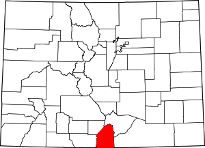 Map of Colorado highlighting Costilla County | |
| CDPs | ||
| Unincorporated communities | ||
| Ghost town | ||