Bilchar Dobani
Bilchar Dobani or Dobani Peak (Urdu: بلچھار دوبانی) is a 6,143-metre (20,154 ft) mountain peak located between Taisot, Haramosh and Bagrot valley, in Gilgit district of the autonomous territory of Gilgit-Baltistan, in Pakistan.[1]
| Dobani Peak بلچھار دوبانی | |
|---|---|
 | |
| Highest point | |
| Elevation | 6,143 m (20,154 ft) |
| Coordinates | 35°57′20.5″N 74°37′59.0″E |
| Naming | |
| Native name | Bilchar-Dobani |
| Geography | |
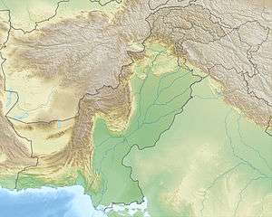 Dobani Peak بلچھار دوبانی Location in Pakistan  Dobani Peak بلچھار دوبانی Dobani Peak بلچھار دوبانی (Gilgit Baltistan) | |
| Location | Bagrot Valley, Gilgit–Baltistan, Pakistan |
| Parent range | Karakoram |
| Climbing | |
| First ascent | Isao Ikeuchi and Masaru Hashimoto on 9 June, 1979 |
Location
The mountain is located as an isolated subrange in southeast of Rakaposhi subrange and southwest of Haramosh Mountains. The western face of Dobani Peak is located in the Tesot valley, and to the north of it is the Bagrot valley. In the northwest of the mountain is found the Haramosh mountains range. The mountain is found at a distance of 29 km (18 mi) east of the city of Gilgit. The Bagrot Valley runs along the western flank of Bilchhar Dobani.[2][3]
First ascent
The Bilchhar Dobani was first climbed by two Japanese mountaineers Isao Ikeuchi and Masaru Hashimoto via the west face and northern ridge on 9 June 1979.[4]
See also
Gallery
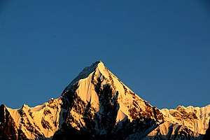
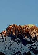 Sunset on Dubani
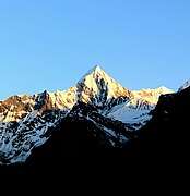 Sunset on Dubani from south side
External links
- Bilchar Dobani at Peakbagger.com
- Bilchhar Dobani at panoramio.com
- Bilchhar Dobani at flickr.com
- himalaya-info.org
References
- Singh, Sarina (2008). Pakistan & the Karakoram Highway. Lonely Planet. p. 426. ISBN 9781741045420.
- "Asia, Pakistan—Karakoram, Dobani - AAC Publications - Search The American Alpine Journal and Accidents". publications.americanalpineclub.org.
- Singh, Sarina (2008). Pakistan & the Karakoram Highway. Lonely Planet. ISBN 9781741045420.
- Masaru Hashimoto. "Asia, Pakistan—Karakoram, Dobani". American Alpine Journal, 1980, vol. 22.