Bayerbach bei Ergoldsbach
Bayerbach is a municipality in the district of Landshut in Bavaria in Germany.
Bayerbach bei Ergoldsbach | |
|---|---|
 Coat of arms | |
Location of Bayerbach bei Ergoldsbach within Landshut district 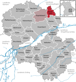 | |
 Bayerbach bei Ergoldsbach  Bayerbach bei Ergoldsbach | |
| Coordinates: 48°42′N 12°18′E | |
| Country | Germany |
| State | Bavaria |
| Admin. region | Niederbayern |
| District | Landshut |
| Municipal assoc. | Ergoldsbach |
| Government | |
| • Mayor | Josef Fuchs |
| Area | |
| • Total | 25.42 km2 (9.81 sq mi) |
| Elevation | 409 m (1,342 ft) |
| Population (2018-12-31)[1] | |
| • Total | 1,921 |
| • Density | 76/km2 (200/sq mi) |
| Time zone | CET/CEST (UTC+1/+2) |
| Postal codes | 84092 |
| Dialling codes | 08774 |
| Vehicle registration | LA |
| Website | www.vgem-ergoldsbach.de |
Geography
It is located on the Bayerbacher Bach, a stream which issues into the Kleine Laber.
Subdivisions
Bayerbach bei Ergoldsbach consists of 22 villages:[2]
|
|
|
Neighbouring communities
Main sights
- Castle Peuerbach (15th century, rebuilt 1892/93)
- Church of Mariä Himmelfahrt (Neogothic building 1865/67)
Sons and daughters of Bayerbach bei Ergoldsbach
- Karl Bickleder (1888–1958), German politician (BVP and CSU), member of the Landtag of Bavaria.
- Anna Katharina Schaffelhuber (born 1993), German para-alpine skier
References
- "Fortschreibung des Bevölkerungsstandes". Bayerisches Landesamt für Statistik und Datenverarbeitung (in German). July 2019.
- Bayerische Landesbibliothek: Suchergebnis Bayerbach. (bayerische-landesbibliothek.online.de)
This article is issued from Wikipedia. The text is licensed under Creative Commons - Attribution - Sharealike. Additional terms may apply for the media files.