Bata, Pazardzhik Province
Bata (Bulgarian: Бъта) is a village in the Panagyurishte municipality in western Bulgaria. It has 1 345 inhabitants.
Bata | |
|---|---|
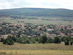 | |
 Bata Location of Bata | |
| Coordinates: 42°27′N 24°11′E | |
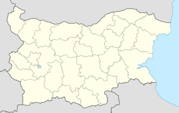
| Country | |
| Provinces (Oblast) | Pazardzhik Province |
| Government | |
| • Mayor | Georgi Aleksandrov (Ind.) |
| Area | |
| • Total | 47.704 km2 (18.419 sq mi) |
| Elevation | 431 m (1,414 ft) |
| Population (2007-01-01)[1] | |
| • Total | 1,305 |
| • Density | 27/km2 (71/sq mi) |
| Time zone | UTC+2 (EET) |
| • Summer (DST) | UTC+3 (EEST) |
| Postal Code | 4527 |
Geography
Bata is located in a mountainous region. The village lies in the Sredna Gora mountain, in the Bata-Banya valley. The river Banska Luda Yana runs through the village and flows in the Panagyurska Luda Yana slightly downstream. There are gold sands in the river between Bata and Popintsi which is at 9 km to the south. There are two micro dams in the land of the village suitable for fishing. A mineral spring exists in the locality Toplika.
The nearest settlements are the town of Panagyurishte at 8 km to the north and the village of Banya at 4 km to the east.
Culture and landmarks
There are ruins of a medieval fortress in the vicinity called by the locals Krasen or Kaleto. Golden and silver jewels and coins dating from different periods have been found during excavations.
Some authentic traditions have been preserved. The village has an amateur group called Iglika (cowslip) famous for the presentation of typical traditions, songs and dances with many awards from different fairs.
Events
- Kukeri - at Zagovezni
- Fair at St George's Day
People
- Anelia Ralenkova - rhythmic gymnast with 4 gold medals from World and European Championships
- Dimitar Naydenov Dimitrov - sambo
- Ivan Shopov - sambo coach
External links
| Wikimedia Commons has media related to Bata, Bulgaria. |
Notes
- "Bulgaria Guide, Bata". Retrieved 11 January 2009.
Capital: Panagyurishte | ||
| Villages |  | |
| Landmarks | ||
| Culture | ||
| Notable people |
| |