Bastress Township, Lycoming County, Pennsylvania
Bastress Township is a township in Lycoming County, Pennsylvania, United States. The population was 574 at the 2000 census. It is part of the Williamsport, Pennsylvania Metropolitan Statistical Area.
Bastress Township, Pennsylvania | |
|---|---|
 Immaculate Conception Church on Jacks Hollow Road | |
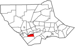 Map of Lycoming County, Pennsylvania highlighting Bastress Township | |
 Map of Lycoming County, Pennsylvania | |
| Coordinates: 41°11′40″N 77°7′33″W | |
| Country | United States |
| State | Pennsylvania |
| County | Lycoming |
| Settled | 1837 |
| Formed | 1854 |
| Area | |
| • Total | 9.42 sq mi (24.41 km2) |
| • Land | 9.42 sq mi (24.39 km2) |
| • Water | 0.01 sq mi (0.02 km2) |
| Elevation | 1,722 ft (525 m) |
| Population (2010) | |
| • Total | 546 |
| • Estimate (2016)[2] | 557 |
| • Density | 59.15/sq mi (22.84/km2) |
| Time zone | UTC-5 (Eastern Time Zone (North America)) |
| • Summer (DST) | UTC-4 (EDT) |
| ZIP code | 17702 |
| Area code(s) | 570 |
| FIPS code | 42-081-04424 |
| GNIS feature ID | 1216740[3] |
History
Bastress Township was formed from part of Susquehanna Township on December 13, 1854 by the Pennsylvania General Assembly. The township is named in honor of Solomon Bastress, of Jersey Shore, who was a former member of the legislature and an associate judge.[4]
The first settlers were German Roman Catholic farmers. They migrated to the area beginning in 1837 under the leadership of the Jesuit missionary, Father Nicholas Steinbacher. Together they built the first Church of the Immaculate Conception in 1838. The current stone church building was erected in 1860.[4] The parish also established a cemetery and Catholic school soon after the settlement of Bastress. Immaculate Conception parish and school stand today as a reminder of the German Catholic heritage of the residents of Bastress Township.
Bastress has changed very little since its founding. The community is largely rural and many of the residents are descendants of the first settlers. Since the 1890 census it has grown from a population of 236 to just 574.
Geography
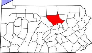
Bastress Township is bordered by Susquehanna Township to the north, Armstrong Township to the east, Limestone Township to the south, and Nippenose Township to the west. As the crow flies, Lycoming County is about 130 miles (209 km) northwest of Philadelphia and 165 miles (266 km) east-northeast of Pittsburgh.[5]
According to the United States Census Bureau, the township has a total area of 8.6 square miles (22 km2), all of it land.
Demographics
| Historical population | |||
|---|---|---|---|
| Census | Pop. | %± | |
| 2010 | 546 | — | |
| Est. 2016 | 557 | [2] | 2.0% |
| U.S. Decennial Census[6] | |||
As of the census[7] of 2000, there were 574 people, 188 households, and 150 families residing in the township. The population density was 66.3 people per square mile (25.6/km2). There were 201 housing units at an average density of 23.2/sq mi (9.0/km2). The racial makeup of the township was 99.13% White, and 0.87% from two or more races. Hispanic or Latino of any race were 0.87% of the population.
There were 188 households, out of which 40.4% had children under the age of 18 living with them, 74.5% were married couples living together, 4.3% had a female householder with no husband present, and 19.7% were non-families. 17.6% of all households were made up of individuals, and 8.0% had someone living alone who was 65 years of age or older. The average household size was 3.05 and the average family size was 3.50.
In the township the population was spread out, with 31.7% under the age of 18, 6.6% from 18 to 24, 28.6% from 25 to 44, 22.6% from 45 to 64, and 10.5% who were 65 years of age or older. The median age was 37 years. For every 100 females there were 102.1 males. For every 100 females age 18 and over, there were 101.0 males.
The median income for a household in the township was $50,125, and the median income for a family was $54,844. Males had a median income of $34,306 versus $20,250 for females. The per capita income for the township was $17,880. About 2.6% of families and 4.0% of the population were below the poverty line, including 5.8% of those under age 18 and none of those age 65 or over.
See also
References
- "2016 U.S. Gazetteer Files". United States Census Bureau. Retrieved Aug 14, 2017.
- "Population and Housing Unit Estimates". Retrieved June 9, 2017.
- "US Board on Geographic Names". United States Geological Survey. 2007-10-25. Retrieved 2008-01-31.
- Meginness, John Franklin (1892). "Nippenose, Limestone, Susquehanna, and Bastress". History of Lycoming County, Pennsylvania: including its aboriginal history; the colonial and revolutionary periods; early settlement and subsequent growth; organization and civil administration; the legal and medical professions; internal improvement; past and present history of Williamsport; manufacturing and lumber interests; religious, educational, and social development; geology and agriculture; military record; sketches of boroughs, townships, and villages; portraits and biographies of pioneers and representative citizens, etc. etc (1st ed.). Chicago: Brown, Runk & Co. ISBN 0-7884-0428-8. Archived from the original on 1 March 2007. Retrieved 2007-02-20.
(Note: ISBN refers to Heritage Books July 1996 reprint. URL is to a scan of the 1892 version with some OCR typos).
- "2007 General Highway Map Lycoming County Pennsylvania" (PDF) (Map). 1:65,000. Pennsylvania Department of Transportation, Bureau of Planning and Research, Geographic Information Division. Retrieved 2009-12-24.
- "Census of Population and Housing". Census.gov. Retrieved June 4, 2016.
- "U.S. Census website". United States Census Bureau. Retrieved 2008-01-31.
Municipalities and communities of Lycoming County, Pennsylvania, United States | ||
|---|---|---|
| City | | |
| Boroughs | ||
| Townships |
| |
| CDPs | ||
| Unincorporated communities | ||
| Ghost town | ||
| Footnotes | ‡This populated place also has portions in an adjacent county | |