Barton River (Vermont)
The Barton River is a tributary of Lake Memphremagog, over 22 miles (35 km) long, in northern Vermont in the United States.
| Barton River | |
|---|---|
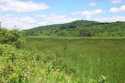 Barton River Marsh | |
| Location | |
| Country | United States |
| State | Vermont |
| Region | Northeast Kingdom |
| City | Newport, Vermont |
| Physical characteristics | |
| Source | Crystal Lake (Vermont) |
| ⁃ location | Orleans County, Vermont, United States |
| ⁃ coordinates | 44°43′55″N 72°9′4″W |
| ⁃ elevation | 968 ft (295 m) |
| Mouth | Lake Memphremagog |
⁃ location | Newport (city), Vermont, Orleans County, Vermont, United States |
⁃ coordinates | 44°56′39″N 72°12′16″W |
⁃ elevation | 682 ft (208 m) |
| Length | 22 mi (35 km) |
| Basin size | 174 sq mi (450 km2) |
| Discharge | |
| ⁃ location | Newport, Vermont |
| Basin features | |
| Tributaries | |
| ⁃ right | Crystal Lake (Vermont), Willoughby River |
It runs north from Glover through Barton, Brownington, Coventry and drains through Newport into Lake Memphremagog's South Bay.
Course
The Barton River arises from the fountains of the former Runaway Pond in Glover.
The Vermont Route 16 north of Glover to Lake Memphremagog stretch of the river is 21.5 miles (34.6 km) long and is rated by American Whitewater as a class I-III section.[1] Glover is 20 miles (32 km) distant from Memphremagog.
Roaring Brook empties Parker Pond into the river in southern Barton near route 16.
One of the head branches is the drain from Crystal Lake in the village of Barton.[2]
After leaving Barton village, the routes of US Route 5, Interstate 91 and the railroad, all follow the course of the Barton River valley and the river, north to Newport.
The Willoughby River flows from Lake Willoughby into the Barton River in Orleans and provides considerable volume. Orleans was once called "Barton Landing" and was the place where, historically, craft could be safely loaded for transport north.
After leaving Orleans, it flows through eastern Irasburg, through Coventry and then into Lake Memphremagog.
The following areas are in the Barton River watershed: Derby, Coventry, Brownington, Irasburg, Barton, Westmore, Lake Willoughby, Crystal Lake, Shadow Lake, Parker Pond, and Brownington Pond. [3]
References
- Vermont Whitewater accessed January 12, 2008
- History of Vermont: Natural, Civil, and Statistical 1853 accessed January 13, 2008
- Public invited to meetings about Memphremagog watershed. the Chronicle. August 5, 2007.
External links

- Vermont Agency of Natural Resources retrieved July 17, 2008
| Authority control |
|
|---|