Bargate (ward)
Bargate Ward is an Electoral Ward in the Unitary Authority of Southampton, England. It covers Southampton City Centre, and stretches as far as Ocean Village and St Mary's to the east, and West Quay and The Polygon to the west. Bargate Ward had 18,762 residents in the 2011 Census, which had risen to an estimated 20,926 in mid 2015.[1][2]
| Bargate Ward | |
|---|---|
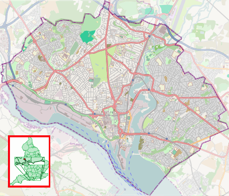 Bargate Ward Location within Southampton | |
| Area | 3.7 km2 (1.4 sq mi) |
| Population | 20,926 [1][2] |
| • Density | 5,656/km2 (14,650/sq mi) |
| Unitary authority | |
| Ceremonial county | |
| Region | |
| Country | England |
| Sovereign state | United Kingdom |
| Post town | SOUTHAMPTON |
| Postcode district | SO14 |
| Dialling code | 023 |
| Police | Hampshire |
| Fire | Hampshire |
| Ambulance | South Central |
| UK Parliament | |
The ward takes its name from the Bargate, the northern gate of the old City Walls which still stands today, and is bounded by (clockwise from West) Freemantle Ward, Bevois Ward, Peartree Ward and Woolston Ward.
Boundary Changes
Under the Boundary Committee Review recommendations, implemented in 2002, Bargate Ward was reduced in size to deal with rapid population growth. In 1999 there had been 12,714 registered voters, and this figure was expected to rise to 14,025 by 2004. The boundary changes resulted in almost a quarter of its electorate being shifted to Bevois and Freemantle wards, making the adjusted electorate 9,746 in 1999, with a projected 10,801 in 2004.[3]
As part of the size reduction, Southampton City Council had proposed that the ward be renamed Town Ward. The Labour Party suggested that “the name Bargate may be more appropriate", and with support from the Conservative Party, the original name stood.[3]
References
- "Bargate (Ward) — Key Figures for 2011 Census: Key Statistics". Office for National Statistics. 2001. Retrieved 29 June 2015.
- "Archived copy". Archived from the original on 6 January 2016. Retrieved 11 July 2015.CS1 maint: archived copy as title (link)
- "Final recommendations for future electoral arrangements in Southampton". Boundary Committee for England. July 2000. Retrieved 4 July 2008.
External links
Areas and suburbs of Southampton | |||||||
|---|---|---|---|---|---|---|---|
| |||||||
| Southampton Itchen |
| ||||||
| Southampton Test | |||||||
| Romsey and Southampton North | |||||||
| |||||||
| |||||||