Bansur
Bansur is a Town and tehsil in Alwar district in Rajasthan, India. Bansur Tehsil's headquarters is Bansur town. It belongs to Jaipur Division. It is located 46 km west of the district headquarters Alwar and 117 km south of the state capital Jaipur.[1] Bansur tehsil is a part of the Gurjar-Ahirwal Cultural Region. It is main educational hub of the area. Many famous colleges and schools are situated here.
Bansur | |
|---|---|
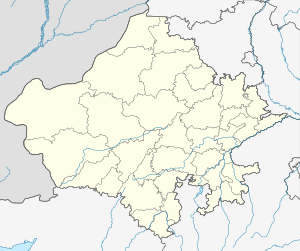 Bansur Location in Rajasthan, India  Bansur Bansur (India) | |
| Coordinates: 27.685°N 76.351°E | |
| Country | |
| State | Rajasthan |
| District | Alwar |
| Tehsil | Bansur |
| Languages | |
| • Official | Hindi हिंदी |
| • Spoken | Ahirwati,Gujari गुर्जरी |
| PIN | 301402 |
| Vehicle registration | RJ-02 |
| Lok Sabha constituency | Jaipur Rural |
| Vidhan Sabha constituency | Bansur |
| Assembly MLA | Shakuntala Rawat |
Bansur Tehsil is bounded by Kotputli Tehsil to the west, Behror Tehsil to the north, Umren Tehsil to the east and Alwar Tehsil to the south. Alwar, Neem-Ka-Thana, Narnaul, and Bawal are the nearest cities to Bansur.
It is at an elevation of 289 m.
Alwar, Sariska, Narnaul, Samode (Samode Bagh) and Nuh are nearby tourist destinations.
Language
gurjarwati(the language of gurjar also Langage of [[]]), is spoken in Ahirwal region. Here dundhadi Jaipur region language is also reflects. Mix of dundhadi and ahirwati language is commonly used. Some influence of haryanvi is also here.
Rewari, Mahendergarh, Narnaul, Gurgaon, Kotkasim, Kotputli, Bansur, Behror and Mundawar may be considered as the centre of Ahirwati speaking area.
Transport
The nearest major railway station is in Alwar, 52 km away. The second nearest major railway station is in Khairthal 37 km away. Bansur is well connected to Delhi and Jaipur via Kotputli by NH -8. Kotputli is 16 km away of Bansur. Roadways bus service for Kotputli is available from 6:00 am to 8:15 pm. The entry of heavey vehicles is restricted from 6 am to 8 pm in the rown.
Bansur Fort
The fort of Bansur is situated in the middle of the city. It can be seen from almost any place in the city. Anyone can visit the fort anytime without any fee. An amazing and outstanding view of the city can be seen from the fort. It has many "Burz". A bawadi can also be seen in the middle of the fort having many stairs to go down, not in use now. It resembles some of the finest water conservation models used by our ancestors in past, collecting all the water from the fort and collecting it in the Bawadi for future use. The fort has many cannon stands. Walls of the fort are almost 6 to 7 feet wide. Earlier the fort was unpainted and was coloured pink later. A famous durga mata temple is also on the fort. About 300 stairs are here to climb on the fort.
References
- "Bansur". India Mappedaccessdate=2013-08-17."The Ahirwal Region : A Historical Unique Identity" (PDF). Ijccr.com. Retrieved 17 August 2013.
Villages of Alwar | ||
|---|---|---|
| Behror Block of Alwar (90 Villages) | Tehsil Behror
1 Ajmeripur 2 Antpura 3 Balpura 4 Banesinghpura 5 Banhad 6 Bardod 7 Basai 8 Beeghana 9 Bhagwari Kalan 10 Bhagwari Khurd 11 Bheeteda 12 Bhoopseda 13 Bijorawas 14 Boodhwal 15 Chak Muradpur 16 Chandi Chana 17 Dahmi 18 Dawani 19 Dhidhor 20 Dhis 21 Dhoondhariya 22 Dooghera 23 Gadoj 24 Gandala 25 Gokalpura 26 Golawas 27 Googdiya 28 Goonti 29 Gujarwas 30 Guwana 31 Hameedpur 32 Hamjapur 33 Islampur 34 Jaguwas 35 Jainpurbas 36 Jaisinghpura 37 Jakhrana Kalan 38 Jakhrana Khurd 39 Jalalpur 40 Jamalpur 41 Jat Gaonra 42 Jharoda 43 Kaliya Hoda 44 Kalyanpura 45 Kankarchhaja 46 Kankardopa 47 Karoda 48 Khapariya 49 Kharkhara 50 Khatan Khera 51 Kherki 52 Khohar 53 Khohri 54 Kiratsinghpura 55 Kohrana 56 Krishan Nagar 57 Kureli 58 Laksiwas 59 Mahrajawas 60 Manchal 61 Mawri 62 Milakpur 63 Mohammadpur 64 Mohammadpur Nangliya 65 Momanpur 66 Mosampur @ Kankara 67 Mundiya Khera 68 Nagal Khodiya 69 Nagli Jageer 70 Naglisadh 71 Nalota 72 Nalpur 73 Nangla Rudh 74 Nareda Kalan 75 Nasarpur 76 Nibhor 77 Pahari 78 Ramsinghpura 79 Riwali 80 Sagli 81 Sarbilandpura 82 Shahzadpur Nangaliya 83 Sherpur 84 Shimla 85 Shyampur 86 Shyodansinghpura 87 Sorwa 88 Talwar 89 Taseeng 90 Untoli | |
| Neemrana Block of Alwar (87 Villages) | Tehsil Behror
CD Block : Nimrana (0037) Tehsil : Behror (Part) 1 Adeend 2 Akleempur 3 Anandpur 4 Balahir 5 Bani Jonaycha 6 Banthala 7 Bantkhani 8 Basai Bhopalsingh 9 Batana 10 Bawari 11 Beeghana Jat 12 Beenjhpur 13 Belni 14 Bheemsinghpura 15 Bichpuri 16 Biranwas 17 Chak Ramdas 18 Chaubara 19 Chawandi 20 Dabadwas 21 Daulatsinghpura 22 Dausod 23 Dheekwar 24 Dhodhakari 25 Doomroli 26 Fatehpura 27 Fauladpur 28 Gheeloth 29 Giglana 30 Googal Kota 31 Heeragarh 32 Hudiya Kalan 33 Hudiya Khurd 34 Ishwarisinghpura 35 Jaitpur 36 Janaksinghpura 37 Jonaycha Kalan 38 Jonaycha Khurd 39 Kalipahari 40 Kanhawas 41 Kankar 42 Kathuwas 43 Kayasa 44 Khatiwas 45 Khundroth 46 Kolila Joga 47 Kolila Rabad 48 Kolila Sanga 49 Kundansinghpura 50 Kuteena 51 Madhosinghpura 52 Mahtawas 53 Majarakath 54 Majari Kalan 55 Majari Khurd 56 Majra 57 Mandhan 58 Mangalpur 59 Mohaladiyan 60 Mukandsinghpura 61 Naghori 62 Nanagwas 63 Nangal Mehta 64 Nangli Balai 65 Nareda Khurd 66 Naysarana 67 Nihalpura 68 Partapur 69 Peepali 70 Porula 71 Pratapsinghpura 72 Pratapur Chak No. 1 73 Pratapur Chak No. 2 74 Pratapur Chak No. 3 75 Raghunathpura 76 Raisarana 77 Raiwana 78 Ramchandrapura 79 Rodwal 80 Salarpur 81 Sansedi 82 Santo 83 Shriyani 84 Talwana 85 Umraogarh 86 Vijaynagar 87 Vijaysinghpura | |
| Mandawar Block of Alwar (146 Villages) | Tehsil Mandawar
1 Agwani 2 Ajarka 3 Alipur 4 Amoth 5 Azizpur 6 Badheen 7 Badli 8 Balloowas 9 Bapdoli 10 Bari 11 Basni 12 Bawad 13 Beejwad Chauhan 14 Beerod 15 Behroj 16 Behror Jat 17 Bhagola Aheer 18 Bhagolajat 19 Bhajanawas 20 Bhanot 21 Bheekhawas 22 Bheenwada 23 Bhojpuri 24 Bhoongara Aheer 25 Bhoongara Thethar 26 Birsangwas 27 Birtoli 28 Chakoliya 29 Chandpur 30 Cheeruni 31 Chhabriwas 32 Chhapur 33 Choodla 34 Dadhiya 35 Dantla 36 Darbarpur 37 Dhailawas 38 Dhokal Nagar 39 Doonwas 40 Gadli 41 Gadoowas 42 Gandhi Nagar 43 Garhi 44 Gola Hera 45 Gopipura 46 Hada Heri 47 Hatoondi 48 Hulmana Kalan 49 Hulmana Khurd 50 Ikrotiya 51 Jagiwara 52 Jalawas 53 Jalpiwas 54 Jasai 55 Jeendoli 56 Jeevan Singhpura 57 Jhajharpur 58 Jogawad 59 Kadar Nagar 60 Kali Pahari 61 Kalooka 62 Karni Kot 63 Khanpur Mewan 64 Khanpuraheer 65 Khareta 66 Khohri 67 Khushalwas 68 Kokawas 69 Lakheempur 70 Lamachpur 71 Majra 72 Majri Bhanda 73 Majri Khola 74 Mandha 75 Manethi 76 Manka 77 Mator 78 Mau 79 Menpur 80 Mirzapur 81 Mohammadpur 82 Molawas 83 Mundanwara Kalan 84 Mundanwara Khurd 85 Mundawar 86 Mundiya Khera 87 Munpur 88 Nahar Khera 89 Nangal Baola 90 Nangal Raniya 91 Nangal Santokara 92 Nangal Singal 93 Nangal Siya 94 Nangal Udiya 95 Nangali Ojha 96 Naredi 97 Padmara Kalan 98 Padmara Khurd 99 Palawa 100 Peepli 101 Pehal 102 Phusa Pur 103 Qyara 104 Radwa 105 Raipur 106 Rajwara 107 Rambas 108 Ramsinghpura 109 Ranoth 110 Rasgan 111 Renagiri 112 Rundh 113 Sabalgarh 114 Sanchod 115 Sanoli 116 Sarai Kalan 117 Seel Gaon 118 Seel Gaon Khurd 119 Shahjadpur 120 Shahpur 121 Shamda 122 Shekhawas 123 Shital Pur 124 Shreekrishan Nagar 125 Shyopur 126 Sihali Kalan 127 Sihali Khurd 128 Sirod Kalan 129 Sirod Khurd 130 Siya Khoh 131 Sodawas 132 Sorkha Kalan 133 Sorkha Khurd 134 Suheta 135 Sukhman Heri 136 Sundarwari 137 Surajpura 138 Swaroop Sarai 139 Tatarpur 140 Tehadka 141 Tehadki 142 Tejpura 143 Tinkiruri 144 Todarpur 145 Ulaheri 146 Vijay Nagar | |
| Kotkasim Block of Alwar (117 Villages) | Tehsil Kotkasim
1 Aheer Basna 2 Akoli 3 Alampur 4 Anaka 5 Badsara 6 Baghana 7 Bagheri Khurd 8 Bairaheri 9 Beelaheri 10 Beeliyawas 11 Beeranwas 12 Begampur 13 Berawas Kalan 14 Berawas Khurd 15 Bhamoowas 16 Bhojpur 17 Bhojrajka 18 Bhonkar 19 Burhi Bawal 20 Chachiyawas 21 Chandpura 22 Chawandi 23 Chowki 24 Daika 25 Daika 26 Dalawas 27 Daulat Nagar Majra 28 Deengli 29 Deoseeka 30 Dheerdhoka 31 Doomhera 32 Gangapuri 33 Gheekaka 34 Girwas 35 Gokulpur 36 Goojriwas 37 Gunsar 38 Gurgachka 39 Hajipur 40 Hajnaka 41 Hanspur Kalan 42 Hanspur Khurd 43 Harsoli 44 Ikrotiya 45 Jahanpuri 46 Jakopur 47 Jalaka 48 Jamalpur 49 Jatiyana 50 Jatoowas 51 Jharka 0 52 Jhiryana 53 Jokhawas 54 Jonal 55 Joriya 56 Kadaiya 57 Kairwa 58 Kanharka 59 Kani 60 Kaririwas 61 Karwar 62 Kasimpur 63 Kayampura Jokhawas 64 Khairal 65 Khanpur Aheer 66 Kharola 67 Kheri 68 Khohra Thakran 69 Kirwari 70 Koompur 71 Kotkasim 72 Kutubpur 73 Ladpur 74 Lahdod 75 Lalpur 76 Lisani 77 Madhoopur 78 Magha Ka Majra 79 Majri 80 Makdawa 81 Maswasi @ Madhopuri 82 Matalwas 83 Meerpur 84 Menawas 85 Meoli 86 Mirzapur 87 Moonpur Mewan 88 Moonpur Thakran 89 Nangal Saliya 90 Nangli Jatan 91 Narooki 92 Narwas 93 Nasopur 94 Neemlaka 95 Paharwas 96 Palpur 97 Pataliya 98 Patan Aheer 99 Pur 100 Raipur Jatan 101 Ramnagar 102 Rampur 103 Raniyawas 104 Roneeja 105 Sadhooka 106 Salkhar 107 Sanoda 108 Shahjadpur 109 Shahpur 110 Sherpur 111 Silpata 112 Sokha 113 Teuwas 114 Thathka 115 Thethar Basna 116 Turkwas 117 Ujoli | |
| Tijara Block of Alwar (191 Villages) | Tehsil Tijara
1 Abhanpur 072304 00807500 2 Adeepur 072291 00806200 3 Ahamlaka 072384 00815500 4 Alapur Jatt 072397 00816800 5 Alapur Meo 072331 00810200 6 Alawalpur 072376 00814700 7 Ameer Nagar 072309 00808000 8 Andhaka 072404 00817500 9 Arandka 072351 00812200 10 Asleempur 072348 00811900 11 Baghor 072389 00816000 12 Bahadari 072217 00798800 13 Bai 072400 00817100 14 Baijalhera 072383 00815400 15 Baliyawas 072333 00810400 16 Baloj 072354 00812500 17 Baman Thedi 072318 00808900 18 Banban 072223 00799400 19 Banbeerpur 072229 00800000 20 Bandapur 072237 00800800 21 Bandra 072342 00811300 22 Banjhra 072268 00804000 23 Barhera 072401 00817200 24 Basai 072278 00805000 25 Began Heri 072385 00815600 26 Berla 072398 00816900 27 Bhalesar 072269 00804100 28 Bhamraka 072286 00805800 29 Bhatkol 072305 00807600 30 Bhindoosi 072380 00815100 31 Bhojawas 072315 00808600 32 Bhoodki 072346 00811700 33 Bhoodli 072220 00799100 34 Bibipur 072230 00800100 35 Bichhala 072300 00807100 36 Bichpuri 072381 00815200 37 Bilaspur 072363 00813400 38 Binoliya 072298 00806900 39 Bub Ka Hera 072273 00804500 40 Burera 072258 00802900 41 Chaupanki 072236 00800700 42 Chawandi Kalan 072399 00817000 43 Chawandi Khurd 072296 00806700 44 Chhapar 072231 00800200 45 Chooharpur 072246 00801700 46 Dabhera 072297 00806800 47 Daganheri 072256 00802700 48 Daika 072357 00812800 49 Damdama 072326 00809700 50 Dhaki 072341 00811200 51 Dhakpuri 072327 00809800 52 Dhamawas 072262 00803300 53 Dheeriyawas 072281 00805300 54 Dholi Pahari 072271 00804300 55 Dotana 072396 00816700 56 Elaka 072360 00813100 57 Fakaruddinka 072234 00800500 58 Gadpur 072215 00798600 59 Gahankhar 072374 00814500 60 Gandhola 072251 00802200 61 Gandwa 072248 00801900 62 Gelpur 072285 00805700 63 Gol 072392 00816300 64 Gothra 072378 00814900 65 Gotoli 072292 00806300 66 Guwalda 072252 00802300 67 Hameeraka 072324 00809500 68 Hasanpur 072284 00805600 69 Hasanpur Mafi 072361 00813200 70 Heengwahera 072335 00810600 71 Husaipur 072238 00800900 72 Husaipur 072359 00813000 73 Huseengpur 072228 00799900 74 Ibrahimpur @ Virampur 072349 00812000 75 Ibrahimpur Mafi 072365 00813600 76 Indor 072249 00802000 77 Ishroda 072314 00808500 78 Jagmal Heri 072294 00806500 79 Jairoli 072403 00817400 80 Jakhopur 072272 00804400 81 Jalalpur 072337 00810800 82 Jhiwana 072222 00799300 83 Jhundpuri 072277 00804900 84 Jojaka 072312 00808300 85 Joriya 072221 00799200 86 Kakrali 072377 00814800 87 Kalaka 072226 00799700 88 Kalgaon 072338 00810900 89 Kamalpur 072280 00805200 90 Karampur 072257 00802800 91 Karenda 072218 00798900 92 Karendi 072216 00798700 93 Karmsiwas 072263 00803400 94 Karoli 072265 00803600 95 Khalilpuri 072364 00813500 96 Kharkhara 072323 00809400 97 Kharkhari 072240 00801100 98 Khatiwas 072232 00800300 99 Kheri 072239 00801000 100 Khidarpur 072293 00806400 101 Khohri Kalan 072253 00802400 102 Khohri Khurd 072233 00800400 103 Khuskhera 072264 00803500 104 Kulawat 072245 00801600 105 Kultajpur 072328 00809900 106 Labedar 072290 00806100 107 Ladamka 072279 00805100 108 Ladhawara 072358 00812900 109 Ladiya 072255 00802600 110 Ladpuri 072247 00801800 111 Lapala 072355 00812600 112 Luhadera 072334 00810500 113 Mahandika 072243 00801400 114 Maharajpura 072366 00813700 115 Mahesara 072261 00803200 116 Mainaki 072344 00811500 117 Majra Mahaniya 072369 00814000 118 Majra Peepli 072317 00808800 119 Majri Goojar 072339 00811000 120 Maliyar Gurjar 072388 00815900 121 Maliyar Jatt 072362 00813300 122 Mandha 072373 00814400 123 Maseet 072283 00805500 124 Matawas 072295 00806600 125 Mayapur 072254 00802500 126 Meethiyawas 072274 00804600 127 Milakpur Turk 072289 00806100 128 Milakpuri 072321 00809200 129 Mirchooni 072276 00804800 130 Mosampur 072375 00814600 131 Mundana 072336 00810700 132 Muradwas 072350 00812100 133 Musari 072275 00804700 134 Musepur 072395 00816600 135 Nabi Nagar 072311 00808200 136 Nakhnol 072266 00803800 137 Nanagheri 072301 00807200 138 Nangal 072329 00810000 139 Naugawan 072282 00805400 140 Naugawan 072382 00815300 141 Naurangabad 072368 00813900 142 Neemli 072390 00816100 143 Nibaheri 072267 00803900 144 Pahar Samlat @ Rundh Baghor 072391 00816200 145 Pahar Samlat@Roondh Roopbas 072325 00809600 146 Palasali 072356 00812700 147 Palpur 072332 00810300 148 Patan Kalan 072287 00805900 149 Patan Khurd 072288 00806000 150 Pathredi 072235 00800600 151 Pavti 072303 00807400 152 Peeplana 072310 00808100 153 Phalsa 072219 00799000 154 Phullabas 072393 00816400 155 Rabadka 072260 00803100 156 Rabhana 072302 00807300 157 Rahmatnagar 072353 00812400 158 Rai Khera 072371 00814200 159 Raipur 072386 00815700 160 Rajdhoki 072347 00811800 161 Ram Nagar 072379 00815000 162 Rambas Jhonpri 072319 00809000 163 Roopbas 072330 00810100 164 Rundh Gol 072387 00815800 165 Rundh Indor 072250 00802100 166 Salahera 072299 00807000 167 Salarpur 072259 00803000 168 Salarpur 072320 00809100 169 Sare Kalan 072241 00801200 170 Sare Khurd 072242 00801300 171 Sarhheta 072352 00812300 172 Sarkanpur 072316 00808700 173 Seethal 072214 00797100 174 Shadipur 072307 00807800 175 Shahbad 072343 00811400 176 Shahmat Nagar 072370 00814100 177 Shahpur 072227 00799800 178 Shekhpur Aheer 072313 00808400 179 Shekhpur Jatt 072394 00816500 180 Siroli Kalan 072306 00807700 181 Siroli Khurd 072308 00807900 182 Soorawas 072367 00813800 183 Tajalka 072322 00809300 184 Tatarpur 072224 00799500 185 Teehli 072372 00814300 186 Thara 072225 00799600 187 Thons 072402 00817300 188 Tohra 072345 00811600 189 Ubaraka 072270 00804200 190 Udaipur 072340 00811100 191 Udhanwas 072244 00801500 | |
| Kishangarh Bas Block of Alwar (141 Villages) | Tehsil Kishangarh Bas
1 Alamdeeka 2 Bagheri Kalan 3 Baghor 4 Baghora 5 Bagthala 6 Bajhot 7 Ballabhgram 8 Bambora 9 Bas Kripalnagar 10 Basai Balan 11 Basai Beerthal 12 Basai Jagta 13 Basai Kalan 14 Beda Ka Bas 15 Bhadook 16 Bhatkol 17 Bidarka 18 Bolni 19 Brisangpur 20 Chachaka 21 Chamroda 22 Chaundawata 23 Cheet Ghana 24 Chhatarpur 25 Chor Basai 26 Dadarhera 27 Dayalpur 28 Deota 29 Dhamookar 30 Dohra 31 Dongra 32 Faizpur 33 Fatiyabad 34 Ganj 35 Ghasoli 36 Googal Heri 37 Gothari 38 Husepur 39 Ichchhaka 40 Isepur 41 Ismailpur 42 Jaistika 43 Jatka 44 Jeelota 45 Jhamoowas 46 Jharjheela 47 Jhirandiya 48 Kankra 49 Kaushalpur 50 Khanpur Mewan 51 Khera 52 Kherla 53 Khoha 54 Khohra Peepli 55 Khojaka 56 Khudeena 57 Kolgaon 58 Kultajpur 59 Kutiyapur 60 Lalpuri 61 Langarwas 62 Lisana 63 Machh Roli 64 Mahond 65 Mahrampur 66 Mancha 67 Mandwapur 68 Manothadi 69 Meerka 70 Mirzapur 71 Moosa Khera 72 Mothooka 73 Nagliya 74 Nangal Maujiya 75 Nangal Mohammadpur 76 Nangla Doongar 77 Nangli Janardan 78 Nangli Khaleel 79 Nangli Mewan 80 Nangli Pathan 81 Naya Gaon 82 Nimbhera 83 Noor Nagar 84 Nyana 85 Odra 86 Padasala 87 Pahar Samlat 88 Patan Mewan 89 Poondraka 90 Raipur Mewan 91 Ranoli 92 Raoka 93 Rata Kalan 94 Rata Khurd 95 Rundh Gidawara 96 Rundh Ismailpur 97 Rundh Jhamoowas 98 Sahoowas 99 Santhalka 100 Sarpur 101 Seokhera 102 Shekhpur 103 Shyamaka 104 Siwana 105 Tahnoli 106 Tanka Heri 107 Tarwala 108 Teetarka 109 Tehatra 110 Thana Ghora 111 Tohri 112 Bahadurpur Patti Joriya 113 Bahadurpur Patti Kanugo 114 Bahadurpur Patti Katla 115 Bahadurpur Patti Meeran 116 Bahadurpur Patti Pahar 117 Baldeobas 118 Bhajera 119 Chandooki 120 Chikani 121 Chirkhana 122 Gajeeka 123 Jahar Khera 124 Jajor 125 Kajakpur 126 Karoli 127 Kithoor 128 Milakpur 129 Mundiya Khera 130 Nagla Samawadi 131 Naharpur Kalan 132 Nangal Heera 133 Nangal Jheera 134 Pahara 135 Peelwa 136 Raisees 137 Rani Khera 138 Rayabka 139 Senthli 140 Sirmoli 141 Sotka | |
| Lachhmangarh Block of Alwar (195 Villages) | Tehsil Ramgarh
1 Barwada 072688 00844600 2 Chidwai 072689 00844700 3 Govindpura 072686 00844400 4 Hasanpur 072678 00843600 5 Indpur 072681 00843900 6 Jahanpur 072682 00844000 7 Khanpur Khurd 072680 00843800 8 Lodhpuri 072693 00986500 9 Malpur 072685 00844300 10 Sahajpur 072684 00844200 11 Singraka 072683 00844100 12 Sirmaur 072687 00844500 13 Tilwar 072679 00843700 14 Agaraki 073485 00920300 15 Ahmadbas 073579 00929100 16 Albks Ka Bas 073575 00928800 17 Alghana 073492 00921000 18 Amarpur 073679 00938500 19 Antapara 073670 00937800 20 Asaka 073498 00921600 21 Badh Goojar Khohra 073577 00928900 22 Badka 073563 00927700 23 Badwara 073503 00922100 24 Baharpuri 073599 00931100 25 Bai Ka Bas 073572 00928600 26 Bajheri 073511 00922900 27 Bandheri 073513 00923100 28 Bandka 073545 00926200 29 Baorika 073532 00924900 30 Barawas 073568 00928200 31 Baroda Meo 073528 00924500 32 Baroli 073493 00921100 33 Baroli 073588 00930000 34 Bas Dhekda 073617 00932900 35 Bas Dongri 073505 00922300 36 Baseri 073663 00937100 37 Bedha 073536 00925300 38 Beedooka 073519 00923700 39 Berla 073612 00932400 40 Bhagwatpura 073667 00937500 41 Bhainsrawat 073512 00923000 42 Bhayari 073526 00924300 43 Bheekhaheri 073681 00938700 44 Bheekhaheri Khurd 073682 00938700 45 Bhoor Pahari 073665 00937300 46 Bhoot Ka Bas 073554 00926900 47 Bichgaon 073651 00936100 48 Bidarka 073676 00938300 49 Boolaheri 073510 00922800 50 Boontoli 073573 00928700 51 Butyana 073534 00925100 52 Chak Bhayari 073527 00924400 53 Chamarwara 073484 00920200 54 Chhangalki 073542 00925900 55 Chhatarpur 073497 00921500 56 Chhila Chhoh 073614 00932600 57 Chimanpura 073531 00924800 58 Chimrawali God 073616 00932800 59 Chimrawali Sikh 073615 00932700 60 Dabri 073502 00922000 61 Daulatpura 073584 00929600 62 Deenar 073567 00928100 63 Deewli 073637 00934800 64 Deorajpura 073650 00936000 65 Dhand 073541 00925800 66 Dhara Ka Bas 073558 00927200 67 Diwli Pahar 073638 00934800 68 Dongri 073504 00922200 69 Doroli 073488 00920600 70 Dusrahera 073543 00926000 71 Dwarkpur 073609 00932100 72 Fatehpur Tarf Khudiyana 073551 00926700 73 Fatehpur Tarf Malawali 073643 00935300 74 Gandeeka 073494 00921200 75 Gandoora 073582 00929400 76 Gaonri 073556 00927100 77 Ghat 073571 00928500 78 Goojar Khohra 073607 00931900 79 Gopalpura 073592 00930400 80 Gor Pahari 073603 00931500 81 Gothra 073674 00938200 82 Gothra Khurd 073675 00938200 83 Gothri Guru 073611 00932300 84 Gothri Purohitan 073608 00932000 85 Hadarhera 073569 00928300 86 Hajipur 073550 00926600 87 Harsana 073634 00934500 88 Harsoli 073479 00919800 89 Hasanpur 073622 00933400 90 Hingota 073583 00929500 91 Imlali 073530 00924700 92 Irniya 073549 00926500 93 Itera 073547 00926400 94 Itka 073521 00923900 95 Jaisinghpura 073523 00924100 96 Jamalpur 073578 00929000 97 Jawli 073557 00927200 98 Jhalatala 073672 00938000 99 Jhareda 073509 00922700 100 Jodhpura 073645 00935500 101 Johri Ka Bas 073576 00928800 102 Jona Khera Bhai 073636 00934700 103 Jona Khera Pahar 073635 00934600 104 Kachawa 073644 00935400 105 Kachroti 073499 00921700 106 Kafanwara 073585 00929700 107 Kaimasa 073490 00920800 108 Kajota 073641 00935100 109 Kali Pahari 073668 00937600 110 Kanwara 073590 00930200 111 Kareeriya 073560 00927400 112 Khadaniya 073548 00926400 113 Kharsanki 073518 00923600 114 Kharsanki 073586 00929800 115 Khera Ka Bas 073481 00919900 116 Khera Mahmood 073480 00919900 117 Khera Mangal Singh 073677 00938400 118 Kherla 073533 00925000 119 Kherli Bahadar 073482 00920000 120 Kherli Chandrawat 073562 00927600 121 Kherli Lodha 073619 00933100 122 Kherli Mahlak 073605 00931700 123 Kherli Veeran 073540 00925700 124 Khohra 073642 00935200 125 Khorpuri 073535 00925200 126 Khudiyana 073553 00926900 127 Laxmangarh 073601 00931300 128 Lilee 073591 00930300 129 Mahlakpur 073538 00925500 130 Mahrana 073559 00927300 131 Malawali 073640 00935000 132 Malla Ka Bas 073555 00927000 133 Manjapta 073621 00933300 134 Marakpur 073522 00924000 135 Mastpur 073500 00921800 136 Melkheri 073565 00927900 137 Mojpur 073618 00933000 138 Mokalheri 073564 00927800 139 Moliya 073546 00926300 140 Moondiya 073678 00938400 141 Moondiya Khera 073639 00934900 142 Mukundpura 073671 00937900 143 Mundjori 073633 00934400 144 Mundpuri Kalan 073478 00919700 145 Mundpuri Khurd 073517 00923500 146 Nangal Khanjadi 073587 00929900 147 Nangli Tarf Bayra 073552 00926800 148 Narnol Kalan 073673 00938100 149 Narnol Khurd 073662 00937000 150 Naswari 073477 00919600 151 Nenapur 073570 00928400 152 Nibhera 073544 00926100 153 Nizamnagar 073524 00924200 154 Nyana 073486 00920400 155 Pagseri 073489 00920700 156 Pahrawati 073680 00938600 157 Palan Khera 073495 00921300 158 Partya Ka Bas 073525 00924200 159 Pathroda 073514 00923200 160 Peepal Khera 073529 00924600 161 Phahri 073520 00923800 162 Raghunath Bas 073581 00929300 163 Raipur 073598 00931000 164 Ramwas 073501 00921900 165 Rasoolpur 073647 00935700 166 Ratawali 073561 00927500 167 Ratnaki 073506 00922400 168 Resti 073566 00928000 169 Roneeja Pahar 073606 00931800 170 Roneejajat 073604 00931600 171 Ronpur 073539 00925600 172 Rundh Maujpur 073613 00932500 173 Sahadka 073574 00928800 174 Saidampur 073487 00920500 175 Sajanpuri 073600 00931200 176 Salarpur 073507 00922500 177 Salimpur 073649 00935900 178 Seetal 073537 00925400 179 Sehra 073666 00937400 180 Semla 073620 00933200 181 Semla Khurd 073508 00922600 182 Semli Dilawar 073515 00923300 183 Shahpur 073483 00920100 184 Shakipura 073491 00920900 185 Shekhpur 073648 00935800 186 Soorajgarh 073602 00931400 187 Sorai 073580 00929200 188 Sunari 073669 00937700 189 Talra 073516 00923400 190 Teekri 073496 00921400 191 Thumrela 073610 00932200 192 Tilakpur 073652 00936200 193 Todanagar 073646 00935600 194 Todarbas 073589 00930100 195 Uchhar 073664 00937200 | |
| Ramgarh Block of Alwar (184 Villages) | Tehsil Ramgarh
1 Adee Naka 072552 00831800 2 Agyara 072578 00834200 3 Akleempur 072546 00831200 4 Alampur 072615 00837700 5 Alawal Pur 072621 00838300 6 Alawara 072676 00843500 7 Badi Pokhar 072561 00832500 8 Bagar Meo 072581 00834500 9 Bagar Rajput 072651 00841200 10 Baghori 072592 00835600 11 Bahala 072580 00834400 12 Bahripur 072616 00837800 13 Bakayanka 072626 00838700 14 Balrampur 072533 00829900 15 Balwandka 072569 00833300 16 Bamboli 072654 00841500 17 Bamni Khera 072649 00841000 18 Bandholi 072550 00831600 19 Baramda 072605 00836800 20 Bardod 072593 00835700 21 Bas Harnath Singh 072692 00844900 22 Bas Thokdar 072608 00837000 23 Batesara 072571 00833500 24 Beejwa 072599 00836300 25 Bera Was 072586 00835000 26 Bere 072587 00835100 27 Bilaspur 072673 00843200 28 Boojaka 072527 00829400 29 Chak Meenapura 072576 00834000 30 Chandigarh 072596 00836000 31 Chaprada 072568 00833200 32 Chauma 072632 00839300 33 Cheerwa 072617 00837900 34 Choroti Istmurar 072663 00842300 35 Choroti Pahar 072563 00832700 36 Chowki 072588 00835200 37 Dahar Ka Bas 072565 00832900 38 Danwari 072606 00836900 39 Dhadholi 072573 00833700 40 Dhan Khera 072657 00841700 41 Dhaneta 072525 00829200 42 Dohli 072594 00835800 43 Doli 072644 00840600 44 Esan Ka Bas 072531 00829700 45 Garhi 072524 00829100 46 Goha 072589 00835300 47 Goleta 072572 00833600 48 Golki 072619 00838100 49 Goojar Bas 072658 00841800 50 Goojarpur Kalan 072549 00831500 51 Goojarpur Khurd 072638 00839900 52 Gugdod 072650 00841100 53 Hajipur 072611 00837300 54 Jadoli 072690 00844800 55 Jakopur 072635 00839600 56 Jatpur 072656 00841700 57 Jugrawar 072667 00842700 58 Kala Ghata 072535 00830100 59 Kalsawara 072536 00830200 60 Kamalpur 072574 00833800 61 Kanor 072669 00842800 62 Kareeriya 072558 00832200 63 Karoli Jageer 072634 00839500 64 Karoli Khalsa 072636 00839700 65 Keshav Nagar 072645 00840600 66 Kesroli 072570 00833400 67 Khalsa Nagar 072554 00831900 68 Khanpur Kalan 072646 00840700 69 Kharkhara 072543 00830900 70 Kharkhari 072523 00829000 71 Khedli Jhanda 072620 00838200 72 Kheri 072643 00840500 73 Kherthala 072625 00838600 74 Khilora 072553 00831900 75 Khoh 072519 00828600 76 Khohar 072610 00837200 77 Khohra Karmali 072530 00829700 78 Khojaka 072598 00836200 79 Khunteta Kalan 072659 00841900 80 Khunteta Khurd 072660 00842000 81 Khushpuri 072628 00838900 82 Kota Kalan 072526 00829300 83 Kota Khurd 072557 00832100 84 Ladpur 072670 00842900 85 Lalawandi 072641 00840200 86 Lalpuri 072655 00841600 87 Loharwari 072562 00832600 88 Mandapur 072602 00836500 89 Mandla Kalan 072639 00840000 90 Mandla Khurd 072640 00840100 91 Mandu Ka Bas 072566 00833000 92 Mangleshpur 072691 00844900 93 Manki 072637 00839800 94 Mansheerpur 072630 00839100 95 Masta Bad 072647 00840800 96 Meenapura 072577 00834100 97 Meghawas 072603 00836600 98 Meo Khera 072648 00840900 99 Milakpur 072675 00843400 100 Mohammadpur 072612 00837400 101 Moonpur 072665 00842500 102 Mubarikpur 072607 00837000 103 Mukandwas 072556 00832000 104 Mundpuri 072653 00841400 105 Munpur Karmala 072623 00838400 106 Nagla Balaiya 072590 00835400 107 Nagla Bhooriya 072694 00986600 108 Nagli Megha 072652 00841300 109 Nagliwal 072609 00837100 110 Naharpur Khurd 072614 00837600 111 Nakachpur 072559 00832300 112 Nakhnol 072529 00829600 113 Nangal Alaf 072674 00843300 114 Nangal Nangali 072551 00831700 115 Nangal Tappa 072661 00842100 116 Nangla Banjeerka 072585 00834900 117 Nangla Chirawanda 072538 00830400 118 Nangli 072677 00843500 119 Nangli Mubarikpur 072541 00830700 120 Narka 072582 00834600 121 Nasopur 072664 00842400 122 Naugawan 072613 00837500 123 Naya Bas 072671 00843000 124 Neekach 072528 00829500 125 Newada 072547 00831300 126 Newadi 072545 00831100 127 Niwali 072597 00836100 128 Odaka 072532 00829800 129 Odela 072633 00839400 130 Pali 072662 00842200 131 Parawada 072544 00831000 132 Pata 072539 00830500 133 Patan Bhan 072534 00830000 134 Peeproli 072583 00834700 135 Pipli Ka Bas 072668 00842700 136 Podipur 072604 00836700 137 Poothi 072642 00840300 138 Rabbaka 072629 00839000 139 Raghunathgarh 072537 00830300 140 Ranveer Bas 072601 00836400 141 Rasgan 072624 00838500 142 Rasoolpur 072522 00828900 143 Raswada 072542 00830800 144 Roopbas 072540 00830600 145 Rundh Dhooninath 072575 00833900 146 Sadan Ka Bas 072584 00834800 147 Sahajpur 072666 00842600 148 Sahdoli 072567 00833100 149 Sammanpur 072548 00831400 150 Sankhala 072579 00834300 151 Sarheta 072591 00835500 152 Sekambas 072622 00838300 153 Senthli 072672 00843100 154 Shekhpur 072600 00836400 155 Sherpur 072618 00838000 156 Sonagarh 072595 00835900 157 Sunhera 072627 00838800 158 Teekri 072631 00839200 159 Thegi Ka Bas 072564 00832800 160 Tismar 072521 00828800 161 Todli 072518 00828500 162 Untwal 072560 00832400 163 Warispur 072520 00828700 164 Yadav Nagar 072555 00831900 Tehsil : Alwar (Part) 165 Bhajeet 072781 00854400 166 Bhoowaka 072749 00850300 167 Dada 072812 00857300 168 Doomera 072808 00856900 169 Ghegholi 072778 00854000 170 Goojooki 072804 00856500 171 Goondpur 072780 00854300 172 Jhareda 072807 00856800 173 Kakrali 072748 00850200 174 Kakrali Jat 072813 00857400 175 Kemala 072777 00853900 176 Kerwa Jat 072814 00857500 177 Khanpur Jat 072806 00856700 178 Kherli Saiyad 072809 00857000 179 Madanpuri 072782 00854400 180 Mojdeeka 072750 00850400 181 Nagli Rajawat 072811 00857200 182 Naharpur 072779 00854200 183 Salpuri 072783 00854500 184 Siraska 072728 00848200 | |
| Umren Block of Alwar (147 Villages) | Tehsil Alwar
| |
| Bansur Block of Alwar (147 Villages) | Tehsil Bansur
1 Alampur 072987 00873400 2 Alanpur 072912 00866800 3 Anat Pura 072995 00874200 4 Auspur 072949 00870100 5 Babariya 072904 00866100 6 Babera 072957 00870700 7 Baberi 072902 00866000 8 Bahram Ka Bas 072996 00874300 9 Balawas 072966 00871500 10 Balba Ka Bas 072975 00872200 11 Bamanwas 072920 00867600 12 Bandhka 073034 00877700 13 Bara Gaon 073044 00878700 14 Barh Bhaosingh 072981 00872800 15 Barh Dhoondhala 072982 00872900 16 Barh Purohit 072980 00872700 17 Barh Thegoowas 072992 00873900 18 Bas Dayal 073013 00875900 19 Bas Gordhan 073036 00877900 20 Bas Karnawat 073014 00876000 21 Bas Narbad 073035 00877800 22 Bas Shekhawat 073021 00876700 23 Basai Chauhan 072900 00865800 24 Basai Narooka 072913 00866900 25 Basdi 073032 00877600 26 Basna 073016 00876200 27 Basra 072930 00868400 28 Bawali Ka Bas 072924 00867900 29 Beelath 073017 00876300 30 Bhaggoo Ka Bas 072908 00866400 31 Bheriwas 072898 00865600 32 Bhoopsera 072946 00869800 33 Bhoori Doongri 072959 00870900 34 Bhooriyawas 072917 00867300 35 Bilali 073041 00878400 36 Bisalwa 073004 00875100 37 Boochiyawas 072965 00871400 38 Burja 073030 00877400 39 Buteri 072985 00873200 40 Chainpura 073027 00877100 41 Chatarpura 073018 00876400 42 Chaudhani 072956 00870600 43 Chechiyan Ka Bas 072941 00869400 44 Chhabriwas 072906 00866200 45 Chheend 072972 00872000 46 Chhipari 072916 00867200 47 Choola 072944 00869600 48 Dabariya 072963 00871200 49 Dangiwas 072899 00865700 50 Deo Nagar 072905 00866100 51 Deosan 072907 00866300 52 Dhakla 072951 00870200 53 Dhamla Ka Bas 072974 00872100 54 Dhani Kanoongo Wali Swamiyan 073006 00875200 55 Dheerpur 072925 00868000 56 Fatehpur 072947 00869900 57 Ghat 072977 00872400 58 Giroodi 072993 00874000 59 Goonta 072933 00868700 60 Gurha Bhankharwala 072998 00874500 61 Guwara 072938 00869200 62 Gyanpura 073031 00877500 63 Hajipur 072970 00871900 64 Hameerpur 072940 00869400 65 Harsora 072921 00867700 66 Holawas 073005 00875200 67 Indrada 073007 00875300 68 Isra Ka Bas 072928 00868300 69 Jaggoowas 072911 00866700 70 Jai Singhpura 072973 00872000 71 Jaitpur 073040 00878300 72 Jhagdet Kalan 073020 00876600 73 Jhajharpura 072988 00873500 74 Jheera 072903 00866000 75 Kali Pahari 072997 00874400 76 Kalyan Nagar 072936 00869000 77 Kalyanpura 072999 00874600 78 Kanjipura 072969 00871800 79 Kankariya 072986 00873300 80 Kasba Bansur 072979 00872600 81 Katariya Ka Bas 072943 00869500 82 Kauthal 072984 00873100 83 Keharpura 072958 00870800 84 Kharkhara 073009 00875500 85 Kharkhari Khurd 073037 00878000 86 Kharwa 073039 00878200 87 Khatauti 072926 00868100 88 Kheewaheri 073012 00875800 89 Khera 072989 00873600 90 Khohri 073015 00876100 91 Kishorpura 072918 00867400 92 Kool 073038 00878100 93 Kothiya 072954 00870500 94 Kundli 073029 00877300 95 Ladpur 072915 00867100 96 Lalpura 073026 00877000 97 Lekri 073003 00875000 98 Loyati 072961 00871100 99 Mahanpur 072950 00870200 100 Majra Aheer 072914 00867000 101 Majra Dhakoda 072901 00865900 102 Majra Rawat 072964 00871300 103 Malloobas 072910 00866600 104 Manchi 072931 00868500 105 Mandeeja Basai 072991 00873800 106 Mandha 072937 00869100 107 Mandli 073023 00876800 108 Mangalwa 072976 00872300 109 Meerapur 072932 00868600 110 Milakpur 073011 00875700 111 Moondli 072968 00871700 112 Morodi 072929 00868400 113 Mothooka 072935 00868900 114 Mugalpur 072927 00868200 115 Mukandpura 072945 00869700 116 Nangal Bhaosingh 072960 00871000 117 Nangal Lakha 072953 00870400 118 Narol 072923 00867800 119 Narsingh Pura 073022 00876700 120 Nathoosar 073002 00874900 121 Nawalpura 073008 00875400 122 Naya Bas 073028 00877200 123 Naya Nagar 073024 00876800 124 Neemoochana 073019 00876500 125 Pali 073042 00878500 126 Paparda 072971 00871900 127 Parsa Ka Bas 072952 00870300 128 Prithvipura 073033 00877700 129 Raghunathpura 072939 00869300 130 Ram Nagar 072948 00870000 131 Rampur 073000 00874700 132 Rasnali 073010 00875600 133 Ratanpura 072967 00871600 134 Ratanpura @ Karana 073043 00878600 135 Rathoron Ka Bas 072942 00869400 136 Rayli 072909 00866500 137 Santhalpur 072983 00873000 138 Shahpur 072934 00868800 139 Shiv Nagar 072922 00867700 140 Shyampura 072990 00873700 141 Talwas 072919 00867500 142 Teekli Ka Bas 073001 00874700 143 Todiya Ka Bas 072994 00874100 144 Toorana 073025 00876900 145 Udho Ka Bas 072978 00872500 146 Ukhalhera 072955 00870600 147 Unchhpur 072962 00871200 | |
| Thanagazi Block of Alwar (175 Villages) | Tehsil Thanagazi
1 Aamala 073100 00883400 2 Agar 073133 00886600 3 Ajabgarh 073210 00893700 4 Ajabpura 073052 00879400 5 Ambedkar Bas 073089 00882500 6 Amka 073135 00886800 7 Amra Ka Bas 073107 00884100 8 Angari 073116 00885000 9 Badhana Ka Bas 073137 00886900 10 Bairawas 073065 00880500 11 Bakhatpura 073080 00881800 12 Balaiyon Ki Dhani 073177 00890600 13 Balloowas 073184 00891100 14 Bamanwas Chaugan 073148 00888000 15 Bamanwas Kankar 073062 00880300 16 Banchhri 073150 00888200 17 Bandrol 073079 00881700 18 Barh Doli 073085 00882300 19 Barh Goojran 073088 00882500 20 Bas Beesa 073084 00882200 21 Bas Booriya 073053 00879500 22 Basai Abhairam 073093 00882800 23 Basai Jogiyan 073070 00880900 24 Bhadach 073134 00886700 25 Bhadana Ki Bal 073069 00880800 26 Bhangdoli 073110 00884400 27 Bhanwata 073142 00887400 28 Bheekampura 073153 00888500 29 Bhoodiyawas 073090 00882600 30 Bhooriyawas 073141 00887300 31 Biharisar 073096 00883100 32 Chaha Ka Bas 073168 00889800 33 Chandpura 073159 00889000 34 Chandpuri 073047 00878900 35 Chosla 073139 00887100 36 Churani 073118 00885200 37 Dahra 073078 00881600 38 Daulatpura 073154 00888600 39 Dera 073146 00887800 40 Dhaital 073111 00884500 41 Dhigariya 073097 00883200 42 Doomeda 073131 00886400 43 Doomoli 073158 00888900 44 Doonga Ka Bas 073050 00879200 45 Duhar Chaugan 073092 00882700 46 Duharmala 073067 00880700 47 Dwarapur 073094 00882900 48 Ganeshpura With Rundh Kali Ghati 073106 00884000 49 Garh Basai 073114 00884800 50 Garhi 073045 00878800 51 Goloara Naidoli 073189 00891600 52 Goojron Ka Guwara 073162 00889200 53 Gopalpura 073152 00888400 54 Govindpura 073185 00891200 55 Gowari 073113 00884700 56 Gurha 073119 00885300 57 Gurha Kishordas 073120 00885400 58 Guwara Bandipul 073213 00894000 59 Guwara Bhagwan 073203 00893000 60 Guwara Bhooriyawali 073195 00892200 61 Guwara Bhopala 073099 00883400 62 Guwara Birkari 073209 00893600 63 Guwara Dabar 073196 00892300 64 Guwara Dhasi 073198 00892500 65 Guwara Dulawa 073212 00893900 66 Guwara Gugli 073214 00894100 67 Guwara Hanuman 073200 00892700 68 Guwara Har 073205 00893200 69 Guwara Jamadar 073207 00893400 70 Guwara Janawat 073204 00893100 71 Guwara Kalot 073202 00892900 72 Guwara Kalyan 073190 00891700 73 Guwara Kundal 073194 00892100 74 Guwara Lala Bhaiya 073199 00892600 75 Guwara Leswa 073216 00894300 76 Guwara Nirbha 073217 00894400 77 Guwara Pakhal 073191 00891800 78 Guwara Radi 073215 00894200 79 Guwara Ramji 073218 00894500 80 Guwara Sadaram 073188 00891500 81 Guwara Sahiba 073201 00892800 82 Guwara Seeli Baori 073193 00892000 83 Guwara Seera 073197 00892400 84 Guwara Soti 073208 00893500 85 Guwara Vyas 073206 00893300 86 Hameerpur 073174 00890400 87 Harner 073109 00884300 88 Heensla 073081 00881900 89 Hodayli 073149 00888100 90 Jagannathpura 073181 00890900 91 Jaisinghpura 073130 00886300 92 Jaitpur Brahmnan 073186 00891300 93 Jaitpur Goojran 073175 00890500 94 Jhankri 073117 00885100 95 Jhiri 073157 00888900 96 Jodhawas 073123 00885600 97 Jodhpura 073061 00880200 98 Kabli Garh 073145 00887700 99 Kala Khora 073091 00882600 100 Kalalanka 073147 00887900 101 Kalapara 073183 00891000 102 Kaler 073178 00890700 103 Kanpura ( Loj ) 073056 00879800 104 Karna Ka Bas 073105 00883900 105 Khariya Ki Dhani 073063 00880300 106 Kharkhari Kalan 073055 00879700 107 Kharrika 073126 00885900 108 Kheda 073122 00885500 109 Kishori 073151 00888300 110 Kola Ka Bas 073086 00882400 111 Kolahera 073059 00880100 112 Kothya 073046 00878800 113 Kripalwadi 073060 00880100 114 Kundalka 073104 00883800 115 Kundla 073187 00891400 116 Kyara 073155 00888700 117 Ladoowas 073054 00879600 118 Laha Ka Bas 073108 00884200 119 Lalpura 073163 00889300 120 Lila Marha 073071 00881000 121 Lothawas 073170 00890000 122 Madhogarh 073166 00889600 123 Malootana 073077 00881500 124 Manawas 073057 00879900 125 Mankot 073082 00882000 126 Mejod 073129 00886200 127 Mordi Ki Dhani 073074 00881200 128 Mundawara 073058 00880000 129 Mundiyawas 073121 00885500 130 Nagel 073167 00889700 131 Nangal Bani 073115 00884900 132 Nangalheri 073066 00880600 133 Narayanpur 073073 00881200 134 Narhat 073136 00886900 135 Nathoosar 073101 00883500 136 Nitata 073176 00890600 137 Pachpadi 073165 00889500 138 Padak Chhapli 073138 00887000 139 Palasana 073161 00889100 140 Piplai 073182 00891000 141 Pratapgarh 073160 00889100 142 Prempura 073051 00879300 143 Rah Ka Mala 073064 00880400 144 Raipura 073127 00886000 145 Rajpura Jageer 073095 00883000 146 Rajpura Sikh 073048 00879000 147 Roopu Ka Bas 073112 00884600 148 Rundh 073211 00893800 149 Rundh Agar 073132 00886500 150 Rundh Hameerpur 073173 00890300 151 Rundh Jhiri 073143 00887500 152 Rundh Lalpura 073169 00889900 153 Rundh Lothawas 073171 00890100 154 Rundh Narayanpur 073076 00881400 155 Rundh Pachpadi 073164 00889400 156 Rundh Pratapgarh 073172 00890200 157 Rundh Seeli Baori 073219 00894600 158 Saleta 073098 00883300 159 Samra 073179 00890800 160 Sanwatsar 073144 00887600 161 Seeli Baori 073192 00891900 162 Shyampura 073128 00886100 163 Shyampura Jageer 073049 00879100 164 Siraska 073103 00883700 165 Suratgarh 073156 00888800 166 Surjanpur 073083 00882100 167 Thanagazi 073102 00883600 168 Tibara 073087 00882400 169 Tigariya 073180 00890800 170 Toda 073140 00887200 171 Todi Luharan 073124 00885700 172 Todi Neejran 073125 00885800 173 Tolawas 073068 00880800 174 Turkiyawas 073072 00881100 175 Vijaypura 073075 00881300 | |
| Rajgarh Block of Alwar (147 Villages) | Tehsil Rajgarh
1 Alei 073303 00902900 2 Anawara 073255 00898200 3 Bahali 073263 00899000 4 Baldeogarh 073356 00908200 5 Balloopura 073389 00911500 6 Bandh Ramsagar 073363 00908900 7 Baori 073261 00898800 8 Barh Digawara 073259 00898600 9 Barla 073313 00903900 10 Barwa Doongri 073353 00907900 11 Beeghota 073359 00908500 12 Berli 073323 00904900 13 Bhajeda 073308 00903400 14 Bhangarh 073334 00906000 15 Bhankhari 073301 00902700 16 Birkari 073342 00906800 17 Chandupura 073258 00898500 18 Chawa Ka Bas 073231 00895800 19 Cheetos 073309 00903500 20 Dabkan 073236 00896300 21 Dabla Meena 073293 00901900 22 Dabla Meo 073292 00901800 23 Damodar Ka Bas 073340 00906600 24 Dangarwara 073316 00904200 25 Daulatpura 073314 00904000 26 Deoti 073362 00908800 27 Dhamred 073310 00903600 28 Dheeroda 073329 00905500 29 Dholan 073318 00904400 30 Digawara 073260 00898700 31 Doondpuri 073326 00905200 32 Dubbi 073257 00898400 33 Firozpur Jageer 073288 00901400 34 Firozpur Khalsa 073287 00901300 35 Garh 073237 00896400 36 Ghatra 073357 00908300 37 Ghewar 073232 00895900 38 Gola Ka Bas 073335 00906100 39 Gorakhpura 073295 00902100 40 Gordhanpura 073245 00897200 41 Goth 073382 00910800 42 Govindpura 073306 00903200 43 Gur Ka Khera 073346 00907200 44 Guwara Ghesli 073376 00910200 45 Hodaheli 073262 00898900 46 Indrapura 073307 00903300 47 Jirawali 073297 00902300 48 Joneta 073367 00909300 49 Kakrali Rampura 073322 00904800 50 Kala Deewala 073350 00907600 51 Kali Pahari 073312 00903800 52 Kalwar 073238 00896500 53 Kalyanpura 073296 00902200 54 Kandoli 073300 00902600 55 Kaniyawas 073222 00894900 56 Kaniyawas 073343 00906900 57 Kankwari 073221 00894800 58 Karoth ( Rural ) 073304 00903000 59 Keetla 073339 00906500 60 Khariyawas 073247 00897400 61 Kharkhara 073379 00910500 62 Kherli 073361 00908700 63 Khirat Ka Bas 073331 00905700 64 Khoh 073327 00905300 65 Kooncha 073319 00904500 66 Koondla 073320 00904600 67 Kootooki 073345 00907100 68 Kothi Narayanpur 073299 00902500 69 Kotri Rampura 073241 00896800 70 Kundroli 073317 00904300 71 Lakhawas 073349 00907500 72 Lanki 073364 00909000 73 Losal 073250 00897700 74 Madhogarh 073289 00901500 75 Mallana 073242 00896900 76 Mandawari 073371 00909700 77 Mitrawat 073223 00895000 78 Moonpur 073302 00902800 79 Motiwara 073377 00910300 80 Murlipura 073230 00895700 81 Murlipura 073298 00902400 82 Murrata 073373 00909900 83 Nadoo 073229 00895600 84 Naidoli 073234 00896100 85 Namdarpura 073338 00906400 86 Nangal Ataldas 073390 00911600 87 Nangal Chandel 073351 00907700 88 Nangal Dasa 073347 00907300 89 Nangal Dharmoo 073388 00911400 90 Nangal Karna 073354 00908000 91 Narayanpur 073366 00909200 92 Narwas 073372 00909800 93 Nathalwara 073365 00909100 94 Nayabas Haveli (Rural) 073381 00910700 95 Nayagaon Bolka 073311 00903700 96 Neemla 073384 00911000 97 Palpur 073244 00897100 98 Palwa 073294 00902000 99 Paota 073352 00907800 100 Patti Beena 073336 00906200 101 Pemawala 073341 00906700 102 Pratappura 073253 00898000 103 Prempura 073344 00907000 104 Prempura 073385 00911100 105 Rajdoli 073248 00897500 106 Rajgarh (Rural) 073391 00911700 107 Rajor 073226 00895300 108 Rajpur Bara 073374 00910000 109 Ramsinghpura 073321 00904700 110 Ratanpura 073383 00910900 111 Ratna Ka Bas 073333 00905900 112 Roopbas 073249 00897600 113 Roopbas 073256 00898300 114 Rundh Beegota 073358 00908400 115 Rundh Bhangarh 073332 00905800 116 Rundh Dabkan 073235 00896200 117 Rundh Daulatpura 073378 00910400 118 Rundh Haripura 073225 00895200 119 Rundh Kankwari 073220 00894700 120 Rundh Nadoo 073228 00895500 121 Rundh Narayani 073328 00905400 122 Rundh Rajor 073224 00895100 123 Rundh Tahla 073227 00895400 124 Rundh Umri Deori 073252 00897900 125 Sakat 073370 00909600 126 Shiv Nagri 073355 00908100 127 Shobhapura 073369 00909500 128 Shreenagar 073380 00910600 129 Shri Chandpura 073315 00904100 130 Sitapura 073337 00906300 131 Sitawat 073240 00896700 132 Surer 073387 00911300 133 Syaluta 073348 00907400 134 Tahla 073233 00896000 135 Talab 073246 00897300 136 Thamawali 073368 00909400 137 Thana 073305 00903100 138 Thana 073325 00905100 139 Thonsra 073254 00898100 140 Tilwar 073243 00897000 141 Tilwari 073239 00896600 142 Toda Jaisinghpura 073324 00905000 143 Todi 073375 00910100 144 Todi Ka Bas 073330 00905600 145 Umri Deori 073251 00897800 146 Veerpur 073360 00908600 147 Vijainagar 073386 00911200 | |
| Reni Block of Alwar (110 Villages) | Tehsil : Rajgarh
1 Adooka 073280 00900700 2 Ahmadpur 073437 00916200 3 Akhoda Meena 073475 00919400 4 Akoda 073473 00919300 5 Amala 073460 00918300 6 Amarpura 073445 00917000 7 Ambedkar Nagar 073468 00918800 8 Andwari 073396 00912200 9 Bahadko Kalan 073459 00918300 10 Bahado Khurd 073462 00918400 11 Bahadurpur 073470 00919000 12 Bajoli 073444 00916900 13 Barer 073409 00913500 14 Barh Bileta 073285 00901100 15 Barh Doroli 073399 00912500 16 Barh Makroda 073416 00914200 17 Berawanda 073407 00913300 18 Bhajera 073446 00917100 19 Bhedoli 073404 00913000 20 Bheetoli 073450 00917500 21 Bhooda 073474 00919400 22 Bhuleri 073428 00915400 23 Bileta 073284 00901000 24 Binjari 073274 00900100 25 Boore Kalan 073267 00899400 26 Boore Khurd 073268 00899500 27 Buchpuri 073418 00914400 28 Chandpur 073464 00918600 29 Cheemapura 073443 00916800 30 Chhilodi 073269 00899600 31 Choondala 073461 00918300 32 Dagdaga 073434 00915900 33 Dalalpura 073394 00912000 34 Danpur 073469 00918900 35 Dera 073426 00915200 36 Dholera 073422 00914800 37 Doroli 073398 00912400 38 Gaonri 073279 00900600 39 Garh 073270 00899700 40 Garhi Sawairam 073463 00918500 41 Ghatwari 073401 00912700 42 Googrod 073286 00901200 43 Guriya 073408 00913400 44 Hatoj 073438 00916300 45 Hirnoti 073411 00913700 46 Ishwana 073392 00911800 47 Itoli 073452 00917700 48 Jagmalpura 073427 00915300 49 Jaisinghpura 073448 00917300 50 Jamdoli 073429 00915500 51 Jhankra 073403 00912900 52 Kalyanpura 073447 00917200 53 Kaneti 073405 00913100 54 Karanpura 073449 00917400 55 Keelpur 073436 00916100 56 Kharagpur 073439 00916400 57 Kharkhara 073291 00901700 58 Kharkhari Chawandsingh 073265 00899200 59 Kharkhari Rana 073420 00914600 60 Khera Mirzapur 073435 00916000 61 Khirni Khohra 073277 00900400 62 Khohra Chauhan 073456 00918000 63 Khurd 073421 00914700 64 Kodiya 073471 00919100 65 Ladiya 073431 00915600 66 Lalka 073275 00900200 67 Lapala 073412 00913800 68 Machari 073393 00911900 69 Makroda 073415 00914100 70 Manaka 073397 00912300 71 Manpura 073283 00900900 72 Moondiya 073442 00916700 73 Morod Kalan 073266 00899300 74 Morod Khurd 073264 00899100 75 Mukundpura 073423 00914900 76 Nagal Bas 073454 00917800 77 Nangal Dhanna 073271 00899800 78 Nangal Gangaguroo 073400 00912600 79 Nangal Sanna 073272 00899900 80 Nangal Sohan 073406 00913200 81 Nayagaon Machari 073395 00912100 82 Nayla Nagar 073465 00918600 83 Nibola 073440 00916500 84 Odpur 073290 00901600 85 Pada 073413 00913900 86 Padli 073455 00917900 87 Pali 073458 00918200 88 Pande Roopbas 073457 00918100 89 Parbaini 073467 00918800 90 Patan 073281 00900800 91 Patanbas 073282 00900800 92 Peepal Hera 073441 00916600 93 Pinan 073402 00912800 94 Pragpura 073432 00915700 95 Pundaraka 073278 00900500 96 Rahcholi 073424 00915000 97 Rajpur Chhota 073273 00900000 98 Ram Nagar 073430 00915500 99 Rampura 073451 00917600 100 Ramsinghpura 073466 00918700 101 Reni 073453 00917800 102 Sahibabad 073410 00913600 103 Sainthal 073433 00915800 104 Saloli 073419 00914500 105 Tahtara 073417 00914300 106 Thonsri 073425 00915100 107 Thoomra 073472 00919200 108 Toda Gyan Singh 073276 00900300 109 Ukeri 073476 00919500 110 Vabeli 073414 00914000 | |
| Kathumar Block of Alwar (177 Villages) | Tehsil : Lachhmangarh
1 Adoli 2 Bhaupara 3 Dhandavas 4 Hanuman Bas 5 Haripura 6 Jagru 7 Jatwara 8 Kemla 9 Khera Laganpur 10 Khera Sarangpuri 11 Khoh 12 Makreta 13 Manakpur 14 Nahar Khohra 15 Nangal Roopa 16 Nangla Bas Guman 17 Napapara 18 Nithari 19 Patakpur 20 Roopbas Thekri 21 Santokpur 22 Teentpur 23 Toda 24 Uksi 25 Agraya 26 Ajeetpura 27 Arruwa 28 Badangarhi 29 Badika 30 Badka 31 Badla 32 Badsu 33 Bahrampur 34 Bahtoo Kalan 35 Bahtoo Khurd 36 Baldeopura 37 Balloopura Ramgarh 38 Bamanpura 39 Bangan Ka Nagla 40 Barada 41 Barodakan 42 Baseth 43 Bayra 44 Beejla 45 Berka 46 Bhadeera 47 Bhairoowas 48 Bhanokhar 49 Bhanwar 50 Bharithal 51 Bhattwas 52 Bhojpura 53 Bisli 54 Boolaheri 55 Chain Pura 56 Chainpura 57 Chak Tapsi 58 Chandpur 59 Chohari Ka Nangla 60 Chokuti 61 Dahari Dantwar 62 Dantiya 63 Daroda 64 Daulat Pura 65 Dayalpura 66 Dayothana 67 Dhankroli 68 Dhanokhara 69 Doroli 70 Dudheri 71 Dughati 72 Gahalawata 73 Gala Khera 74 Ganjpur 75 Garoo 76 Gheewri 77 Ghosrana 78 Govind Pura 79 Gundbas 80 Haneepur 81 Hanumanta 82 Hulyana 83 Imarti Ka Was 84 Indra Colony 85 Indrawali 86 Ishrota 87 Ishroti 88 Itola 89 Jadla 90 Jahadoo 91 Jodhpura 92 Kalwari 93 Kalyanpura 94 Kanchan Pura 95 Kaneti 96 Kankroli 97 Kantwari 98 Karoli 99 Katehada 100 Kathoomar 101 Khatipura 102 Khera Kalyanpur 103 Khera Meda 104 Khera Tarf Bahtoo 105 Kherli Rel (Rural) 106 Kherli Tarf Nooniya 107 Kherli Tarf Rela 108 Khonkhar 109 Kuttin Sawdas 110 Lathki 111 Lidpuri 112 Magarakha 113 Maithna 114 Makkhan Ka Nagla 115 Mangolaki 116 Mankhera 117 Manpur 118 Manya Ka Bas 119 Masari 120 Mathura Hera 121 Medpura 122 Mohanwas 123 Moodiya 124 Moti Ka Nagla 125 Nagla Dhansingh 126 Nagla Matuwa 127 Nangla Jadoo 128 Nangla Keshariya 129 Nangla Khooba 130 Nangla Madhopur 131 Nangla Rampura 132 Nangla Sitaram 133 Nangli Bhawana 134 Nangli Tarf Toda 135 Natoj 136 Nooniya 137 Noorpur 138 Pahari 139 Paota 140 Peepal Khera 141 Pisai 142 Preetampura 143 Rajpur 144 Ram Nagar 145 Rampura 146 Rampura Patan 147 Ranoli 148 Ranota 149 Reengas Pura 150 Reenjhwas 151 Rela 152 Reta 153 Reti 154 Roneeja Than 155 Rundh Maithana 156 Rundh Sonkhari 157 Sahajpura (Rural) 158 Sahari 159 Sajanpara 160 Salempur 161 Salwari 162 Samoli 163 Samoochi 164 Sedooka Nangla 165 Shahpur 166 Shekhpura 167 Sitaheda 168 Sonkh 169 Sonkhar (Rural) 170 Sonkhari 171 Sundana 172 Tasai 173 Teekri 174 Tigariya 175 Titpuri 176 Tusari 177 Udaipura | |
| ||