Bangholme, Victoria
Bangholme is a suburb in Melbourne, Victoria, Australia, 31 km south-east of Melbourne's central business district and adjacent to the urban area. Its local government area is the City of Greater Dandenong. At the 2016 census, Bangholme had a population of 784,[1] most of who live in the Willow Lodge Village, a mobile home development on Frankston-Dandenong Rd.
| Bangholme Melbourne, Victoria | |||||||||||||||
|---|---|---|---|---|---|---|---|---|---|---|---|---|---|---|---|
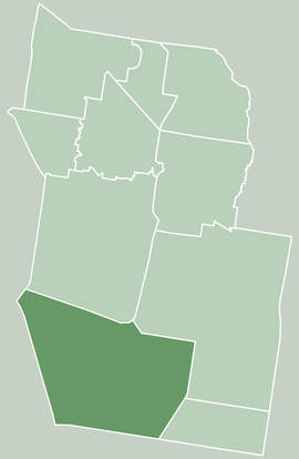 Map of City of Greater Dandenong showing Bangholme | |||||||||||||||
| Coordinates | 38°02′56″S 145°09′58″E | ||||||||||||||
| Population | 784 (2016 census)[1] | ||||||||||||||
| • Density | 26/km2 (68/sq mi) | ||||||||||||||
| Established | 1925 | ||||||||||||||
| Postcode(s) | 3175 | ||||||||||||||
| Area | 30 km2 (11.6 sq mi) | ||||||||||||||
| Location | |||||||||||||||
| LGA(s) | City of Greater Dandenong | ||||||||||||||
| State electorate(s) | |||||||||||||||
| Federal Division(s) | Isaacs | ||||||||||||||
| |||||||||||||||
The area is semi-rural and is part of Melbourne's South East Green Wedge, with a significant part of the land used by the Melbourne Water Eastern Sewage Treatment Plant,[2] and the remainder being mostly small land holdings, with some used for horse acreage.
The EastLink tollway passes through the area.
History
Bangholme Post Office opened on 15 June 1925, and closed in 1943.[3]
Demographics
Bangholme has a SEIFA score of 744, indicating a high level of disadvantage — it is in the bottom percentile nationally and has the lowest score of any Melbourne suburb.[4]
Sport
The National Water Sports Centre is located in Bangholme adjacent to the Patterson River.[5]
Golfers play at the course of the Eastern Sward Golf Club on Thompson Road, Bangholme.[6]
Horse riding lessons are conducted at BlinkBonnie Equestrian Centre on Pillars Road.
Horse agistment (paddocks for hire) is also available at various properties on and near Pillars Road.
See also
- City of Springvale - the former local government area of which Bangholme was a part
References
- Australian Bureau of Statistics (27 June 2017). "Bangholme (State Suburb)". 2016 Census QuickStats. Retrieved 3 December 2017.

- "Melbourne Water : Sewerage : Eastern Treatment Plant". Archived from the original on 25 May 2011. Retrieved 4 May 2008.
- Premier Postal History, Post Office List, retrieved 11 April 2008
- Australian Bureau of Statistics (25 March 2009). "2033.0.55.001 - Census of Population and Housing: Socio-Economic Indexes for Areas (SEIFA), Australia - Data only, 2006". Archived from the original on 29 June 2011. Retrieved 4 July 2011.
- "Sport & Recreation Victoria". Archived from the original on 26 July 2008. Retrieved 4 May 2008.
- Golf Select, Eastern Sward, retrieved 11 May 2009