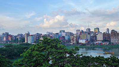
Badda Thana
Badda (Bengali: বাড্ডা) is a Thana of Dhaka District in the Division of Dhaka, Bangladesh. It was formed from parts in December 1998 from parts of Cantonment Thana and Gulshan Thana.[2] Badda is adjacent to Rampura, Gulshan and Baridhara Thana.
Badda বাড্ডা | |
|---|---|
Thana | |
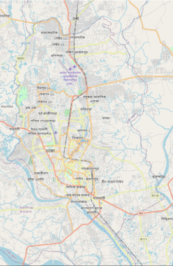 Badda Location in Dhaka | |
| Coordinates: 23°47.2′N 90°25.5′E | |
| Country | |
| Division | Dhaka Division |
| District | Dhaka District |
| Area | |
| • Total | 16.78 km2 (6.48 sq mi) |
| Elevation | 23 m (75 ft) |
| Population (1991) | |
| • Total | 157,924 |
| • Density | 9,411/km2 (24,370/sq mi) |
| Time zone | UTC+6 (BST) |
| Website | Official Map of the Badda Thana |
Geography
Badda is located at 23.786111°N 90.425°E. Its total area is 16.78 km²
Demographics
This Badda has a population of 157925. Males constitute 55.68% of the population, and females 44.32%. Badda has an average literacy rate of 58.5%, and the national average of 32.4% literate.
Administration
Badda has 2+4 Unions/Wards, 16+14 Mauzas/Mahallas, and 0 villages.
Suburbs That Falls under Badda Thana
- Banasree
- North Badda
- Middle Badda
- South Badda
- Merul Badda
- Badda DIT Project
- Aftabnagar
- Satarkul & Barid
 jamuna future park on kuril biswa road
Education
According to Banglapedia, Badda Alatunnessa Higher Secondary School, Satarkul High school, and Cambrian School and College, founded 2004, are notable higher secondary schools.[2] Badda thana has dozens of private kinder garden schools, few law schools, and several government primary schools.
See also
- Upazilas of Bangladesh
- Districts of Bangladesh
- Divisions of Bangladesh
References
- "Geographic coordinates of Dhaka, Bangladesh". DATEANDTIME.INFO. Retrieved 7 July 2016.
- Molla, Md Tuhin (2012). "Badda Thana". In Islam, Sirajul; Jamal, Ahmed A. (eds.). Banglapedia: National Encyclopedia of Bangladesh (Second ed.). Asiatic Society of Bangladesh.