Asiru Phat'jata
Asiru Phat'jata (Aymara asiru snake, phat'jaña to split in half,[2] -ta a suffix to indicate the participle, "split snake") is a hill in Peru, situated at a height of about 3,895 metres (12,779 ft). It is located in the Puno Region, Yunguyo Province, Yunguyo District.[3] Asiru Phat'jata lies near Lake Titicaca at the road which connects Yunguyo and Puno, south of the village Asiru Phat'jata (Acero Patjata) and north of the mountain Qhapiya.
| Asiru Phat'jata | |
|---|---|
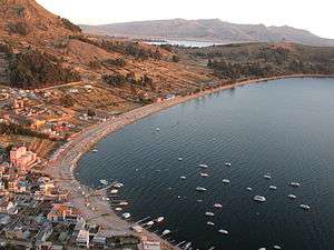 View of Copacabana with Asiru Phat'jata in the background (on the right) | |
| Highest point | |
| Elevation | 3,895 m (12,779 ft) [1] |
| Coordinates | 16°16′03″S 69°08′39″W |
| Geography | |
 Asiru Phat'jata Peru | |
| Location | Peru, Puno Region |
On the hill there is an archaeological area. It was declared a National Cultural Heritage (Patrimonio Cultural) of Peru by the National Institute of Culture.[3]
Gallery
 Satellite view of Wiñaymarka Lake, the southern sub-basin of Lake Titicaca, and the extinct volcano Qhapiya (on the left). Asiru Phat'jata is visible north of Qhapiya.
References
- mapcarta.com Elevation for "Vilqui Patja" (near Asiru Phat'jata), retrieved on January 29, 2014
- Ludovico Bertonio, Aymara-Spanish dictionary (transcription)
- mincetur.gob.pe Archived February 4, 2014, at the Wayback Machine "Cerro Asiru Phatjata", retrieved on January 29, 2014
This article is issued from Wikipedia. The text is licensed under Creative Commons - Attribution - Sharealike. Additional terms may apply for the media files.