Aripuanã
Aripuanã is a municipality in the state of Mato Grosso in the Central-West Region of Brazil. It is located on the banks of the Aripuanã River.
Aripuanã | |
|---|---|
Municipality | |
 Flag  Seal | |
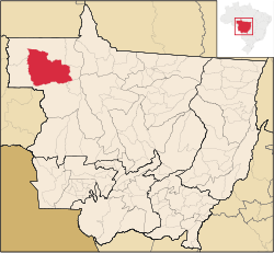 Location in Mato Grosso | |
| Country | |
| Region | Center-West |
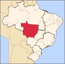
| State | Mato Grosso |
| Mesoregion | Norte Mato-Grossense |
| Established | 1943 |
| Area | |
| • Total | 96.714 sq mi (250.489 km2) |
| Elevation | 344 ft (105 m) |
| Population | |
| • Total | 18,581 |
| • Density | 190/sq mi (74/km2) |
| Time zone | UTC -3 |
The city is served by Aripuanã Airport.
The municipality contains the 8,517 hectares (21,050 acres) Rio Flor do Prado Ecological Station, a fully protected environmental unit created in 2003.[3] It also holds part of the 164,224 hectares (405,810 acres) Guariba-Roosevelt Extractive Reserve, a sustainable use unit created in 1996.[4]
References
- IBGE (10 Oct 2002). "Área territorial oficial" (in Spanish). Resolução da Presidência do IBGE de n° 5 (R.PR-5/02). Retrieved 5 Dec 2010.
- "Censo Populacional 2010". Censo Populacional 2010 (in Spanish). Instituto Brasileiro de Geografia e Estatística (IBGE). 29 Nov 2010. Archived from the original on 2011-02-20. Retrieved 11 Dec 2010.
- Blairo Borges Maggi (9 December 2003), Decreto 2.124 de 09 de Dezembro de 2003 (in Portuguese), retrieved 2016-06-05
- RESEX Guariba-Roosevelt (in Portuguese), ISA: Instituto Socioambiental, retrieved 2016-06-07
Capital: Cuiabá | |||||||||||||||||
| Centro-Sul Mato-Grossense |
|  | |||||||||||||||
| Nordeste Mato-Grossense |
| ||||||||||||||||
| Norte Mato-Grossense |
| ||||||||||||||||
| Sudeste Mato-Grossense |
| ||||||||||||||||
| Sudoeste Mato-Grossense |
| ||||||||||||||||
This article is issued from Wikipedia. The text is licensed under Creative Commons - Attribution - Sharealike. Additional terms may apply for the media files.