Ansina
Ansina is a town in the Tacuarembó Department of northern-central Uruguay.
Ansina Villa Ansina | |
|---|---|
Town | |
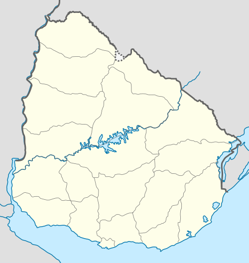 Ansina Location in Uruguay | |
| Coordinates: 31°52′40″S 55°27′55″W | |
| Country | |
| Department | Tacuarembó Department |
| Population (2011) | |
| • Total | 2,712 |
| Time zone | UTC -3 |
| Postal code | 45006 |
| Dial plan | +598 46 (+6 digits) |
Location
The town is located on the junction of Route 26 with Route 44, on the east bank of Tacuarembó River.
History
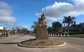
Ansina monument at the entrance to the town.
On 5 October 1950, the populated nucleus known as "Paso de Borracho" was renamed to "Ansina" and its status was elevated to "Pueblo" (village) by the Act of Ley Nº 11.530,[1] and then on 3 May 1984, to "Villa" (town) by the Act of Ley Nº 15.539.[2]
Population
In 2011 Ansina had a population of 2,712.[3]
| Year | Population |
|---|---|
| 1963 | 989 |
| 1975 | 1,056 |
| 1985 | 1,637 |
| 1996 | 1,930 |
| 2004 | 2,790 |
| 2011 | 2,712 |
Source: Instituto Nacional de Estadística de Uruguay[4]
Places of worship
- Our Lady of Itatí Parish Church, a Roman Catholic pilgrimage sanctuary[5]
References
- "LEY N° 11.530". República Oriental del Uruguay, Poder Legislativo. 1950. Archived from the original on 4 March 2016. Retrieved 6 September 2012.
- "LEY N° 15.539". República Oriental del Uruguay, Poder Legislativo. 1984. Archived from the original on 6 March 2016. Retrieved 6 September 2012.
- "Censos 2011 Cuadros Tacuarembó". INE. 2012. Retrieved 25 August 2012.
- "Statistics of urban localities (1963–2004)". INE. 2012. Archived from the original (PDF) on 23 March 2015. Retrieved 6 September 2012.
- Itatí Sanctuary
External links
Capital: Tacuarembó | ||
| Towns and villages | 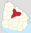 | |
| Sights | ||
This article is issued from Wikipedia. The text is licensed under Creative Commons - Attribution - Sharealike. Additional terms may apply for the media files.