Andimeshk
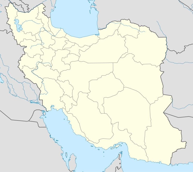
Andimeshk (Persian: اندیمشک, also Romanized as Āndīmeshḵ) is a city and capital of Andimeshk County, Khuzestan Province, Iran.
Andimeshk اندیمشک | |
|---|---|
City | |
 andimeshk | |
| Nicknames: اندیمشک', 'اری ترین لور,اردریکا | |
 Andimeshk | |
| Coordinates: 32°27′36″N 48°21′33″E | |
| Country | |
| Province | Khuzestan |
| County | Andimeshk |
| Bakhsh | Central |
| Elevation | 176 m (577 ft) |
| Population (2016 Census) | |
| • Urban | 135,116 [1] |
| Time zone | UTC+3:30 (IRST) |
| • Summer (DST) | UTC+4:30 (IRDT) |
| Website | www.andimeshk.ir |
Andimeshk is located about 34 kilometres (21 mi) north of Shush, on the main road and the rail line between Tehran and Ahvaz.
The name first appears in cuneiform tablets from Mesopotamia from the Ur III period (21st to 20th century BCE) in the form "Adamshakh", with a probable meaning "Crocodile (Town)". Later it was called "Andamaska" or "Andimaska", meaning "plenty of butter"; local villages like Gheel-AB and Lour and two fortresses were added to it.[2] The city was en route to Ilam and Anshan and subsequently to Lorestan, which made it strategically important until the late Sassanid era. [2]
History
During the Pahlavi dynasty era, Andimeshk received a great deal of modern development projects because of its location and resources. These included a railway, the Dokoohe military depot and an aluminum factory-silo, as well as many other industrial developments. The city had been connected along the Trans-Iranian Railway in 1929. During World War II a pipeline was also laid from Abadan, then the location of the world's largest refinery, to Andimeshk; from there the fuel was re-loaded onto trucks and transported to the Soviet Union. In 1955 the pipeline was extended from Andimeshk to Tehran. [3] According to Tarikh-e-Tabari most of the people in this city are of Khuzi origin.
Archaeology
North Khuzestan was home to some of the oldest civilizations in the world. The Choghamish hills have more than 8,000 years of treasures from different periods, and archaeologists have called on the city of dawn.[3] Susa's Zanbil temple symbolizes the knowledge of the people who lived in this area over 3,000 years ago.[3] Apadana palace is a symbol of the greatness of the Iranians. Shushtar waterfalls are a symbol of Iranian engineering and technology. Dezful's Old Bridge is a symbol of Persian authority. Cole Farah Izeh and Lure area in the west of Andimeshk County.[3]
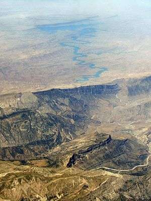
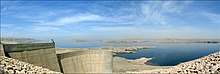
Karkheh Dam
This dam was a mistake and an environmental crime among many other so called dams that IRGC made.[very biased and poor wording, should be removed] the information is ambiguous as after revolution no American stayed or worked in Iran. The dam is not 127 m high rather 48 m and River Dez has the dam with 127m high and build by American multinational company. The karkhe dam damaged wild life down stream up to Shoush some 30 km south.[Please remove the false info down here!] The dam is on the Karkheh River in the north-western province of Khuzestan, the closest city being Andimeshk to the east. It is 127 metres high and has a reservoir capacity of 5.9 billion cubic meters. The Karkheh Dam is designed to irrigate 320,000 hectares of land, produce 520 MW of hydro-electricity and prevent downstream floods. In 1956, studies began on the Karkheh Dam by the American company Development and Resources Corporation, which was headed by David E. Lilienthal, the former Chairman of the TVA. In 1990, the final studies were completed by Mahab Ghods Consulting Engineers. The engineering division of the Islamic Revolutionary Guards Corps (IRGC) started construction on the Karkheh Dam in 1992 and the dam was complete in 2001. During construction, 120 contractual and over eight consultative companies worked on the dam. 5,000 workers constructed the dam and 40 died in the process.[4]
It is also possible to visit the powerhouse which is located at the east side of the dam in the mountains. The powerhouse has eight vertical Francis turbines.
The dam's current problem is the annual loss of reservoir capacity due to the erosion of soil in upstream areas.
Geography
Andimeshk sits close to the foothills of the Zagros Mountains on the main north-south highway from Tehran to Ahvaz, the provincial capital of Khuzestan. The main rail line from Tehran to the Persian Gulf is 15 km (9 mi) from Andimeshk.. Persian Gulf is at least 200 km south.
Climate
Andimeshk has a hot semi-arid climate (Köppen climate classification BSh) with extremely hot summers and mild winters. Rainfall is higher than most of southern Iran, but is almost exclusively confined to the period from November to April, though on occasions it can exceed 250 millimetres (9.8 in) per month or 600 millimetres (24 in) per year.[5]
| Climate data for Andimeshk | |||||||||||||
|---|---|---|---|---|---|---|---|---|---|---|---|---|---|
| Month | Jan | Feb | Mar | Apr | May | Jun | Jul | Aug | Sep | Oct | Nov | Dec | Year |
| Record high °C (°F) | 28.0 (82.4) |
29.0 (84.2) |
36.0 (96.8) |
40.5 (104.9) |
46.5 (115.7) |
50.0 (122.0) |
53.6 (128.5) |
52.0 (125.6) |
48.0 (118.4) |
43.0 (109.4) |
35.0 (95.0) |
29.0 (84.2) |
53.6 (128.5) |
| Average high °C (°F) | 17.2 (63.0) |
19.6 (67.3) |
24.1 (75.4) |
30.0 (86.0) |
37.5 (99.5) |
43.7 (110.7) |
46.0 (114.8) |
44.9 (112.8) |
41.7 (107.1) |
34.8 (94.6) |
26.2 (79.2) |
19.3 (66.7) |
32.1 (89.8) |
| Daily mean °C (°F) | 10.8 (51.4) |
13.2 (55.8) |
17.3 (63.1) |
22.8 (73.0) |
29.9 (85.8) |
35.1 (95.2) |
37.0 (98.6) |
35.8 (96.4) |
32.0 (89.6) |
25.6 (78.1) |
17.9 (64.2) |
12.5 (54.5) |
24.2 (75.5) |
| Average low °C (°F) | 5.3 (41.5) |
6.8 (44.2) |
10.0 (50.0) |
14.7 (58.5) |
20.5 (68.9) |
23.8 (74.8) |
26.2 (79.2) |
25.5 (77.9) |
21.1 (70.0) |
16.2 (61.2) |
10.8 (51.4) |
6.8 (44.2) |
15.6 (60.2) |
| Record low °C (°F) | −9 (16) |
−4.0 (24.8) |
−2 (28) |
3.0 (37.4) |
10.0 (50.0) |
16.0 (60.8) |
19.0 (66.2) |
16.5 (61.7) |
10.0 (50.0) |
6.0 (42.8) |
1.0 (33.8) |
−2 (28) |
−9 (16) |
| Average rainfall mm (inches) | 100.6 (3.96) |
60.0 (2.36) |
50.2 (1.98) |
34.5 (1.36) |
9.2 (0.36) |
0.0 (0.0) |
0.2 (0.01) |
0.0 (0.0) |
0.0 (0.0) |
7.4 (0.29) |
39.1 (1.54) |
83.2 (3.28) |
384.4 (15.14) |
| Average rainy days | 9.9 | 8.1 | 8.1 | 6.5 | 3.0 | 0.0 | 0.1 | 0.0 | 0.0 | 2.1 | 6.2 | 8.0 | 52 |
| Average relative humidity (%) | 75 | 68 | 59 | 49 | 32 | 22 | 24 | 28 | 29 | 40 | 59 | 73 | 47 |
| Mean monthly sunshine hours | 131.6 | 158.4 | 192.3 | 217.7 | 272.5 | 325.6 | 322.7 | 317.0 | 291.3 | 234.8 | 158.2 | 121.9 | 2,744 |
| Source: NOAA (1961-1990)[6] | |||||||||||||
Economy
Andimeshk Because Railway Station is the primary commercial center for northern Khuzestan and one of the main producers of agricultural products in Iran . Andimeshk is also a market for the agricultural products of Lorestan province. The city also contains a large cotton textile mill and many small- and medium-scale industries.
Notable persons
- Qadam Kheyr of Qalâvand,[7][8] Lurish woman warrior
- Saeid Abdevali, national wrestling athlete
- Habibollah Akhlaghi, national wrestling athlete
Andimeshk City Pictures
.jpg)

References
- https://www.amar.org.ir/english
- Iranica
- Encyclopaedia Iranica
- http://www.industcards.com/hydro-iran.htm Archived 2012-09-08 at Archive.today Hydroelectric Power Plants in Iran
- Andimeshk rainfall
- "Andimeshk Climate Normals 1961-1990". National Oceanic and Atmospheric Administration. Retrieved December 28, 2012.
- تاریخ جغرافیایی و اجتماعی لرستان، حمید ایزدپناه،۱۳۷۶، تهران، انجمن آثار و مفاخر فرهنگی
- موسیقی در فرهنگ لرستان، اسکندرامان الهی بهاروند، ۱۳۸۴، نشر افکار
| Capital | 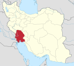 | |
|---|---|---|
| Counties and cities | ||
| Sights |
| |
| populated places | ||