Amajari
Amajari is a municipality located in the northwest of the state of Roraima in Brazil. Its population is 7,980 and its area is 28,472 km². It is the westernmost municipality in Roraima.
Amajari | |
|---|---|
| The Municipality of Amajari | |
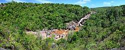 Cachoeira do Paiva | |
 Flag  Seal | |
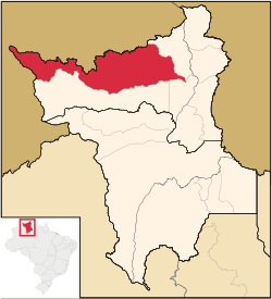 Location of Amajari in the State of Roraima | |
| Coordinates: 03°39′07″N 61°22′15″W | |
| Country | |
| Region | North |
| State | |
| Founded | October 17, 1995 |
| Government | |
| • Mayor | Vera Lúcia (PSC) |
| Area | |
| • Total | 28,472 km2 (10,993 sq mi) |
| Elevation | 100 m (300 ft) |
| Population (2008) | |
| • Total | 7,980 |
| • Density | 0.21/km2 (0.5/sq mi) |
| [1] | |
| Time zone | UTC-4 |
| HDI (2000) | 0.654 – medium[2] |
| Website | www.amajari.rr.gov.br |
The municipality of Amajari is a region of 8 indigenous segments with a total of 19 indigenous communities living there. The present ethnic groups are the Macuxi, Wapichana, Sapará and Taurepang people. The 8 indigenous segments: TI Araçá, TI Ouro, TI Anaro, TI Ponta da Serra, TI Aningal, TI Garagem, TI Santa Inês and TI Ananás. The indigenous communities that are located in the region are: Araçá, Mutamba, Mangueira, Três Corações, Guariba, Anaro, Ponta da Serra, Urucuri, Juraci, Nova União, Ouro, San Francisco, Cajueiro, Garagem, Ananás, Leão de Ouro, Santa Inês, Aningal and Vida Nova.
References
- 2008 IBGE statistics
- "Archived copy". Archived from the original on 2009-10-03. Retrieved 2009-12-17.CS1 maint: archived copy as title (link) - UNDP
- http://www.ibge.gov.br/home/ bestatistica/populacao/censo2010/default.shtm Dados com base em levantamentos utilizando os resultados do Censo 2010 do IBGE. Accessed at 7 fev 2012.
Capital: Boa Vista | ||
| Boa Vista | 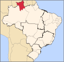 | |
| Nordeste de Roraima | ||
| Caracarai | ||
| Sudeste de Roraima | ||