Alta, Utah
Alta is a town in eastern Salt Lake County, Utah, United States. It is part of the Salt Lake City, Utah Metropolitan Statistical Area. The population was 383 at the 2010 census, a slight increase from the 2000 figure of 370.
Alta, Utah | |
|---|---|
Town | |
 Alta Ski Area, February 2011 | |
 Location in Salt Lake County and the state of Utah. | |
 Location of Utah in the United States | |
| Coordinates: 40°34′51″N 111°38′14″W | |
| Country | United States |
| State | Utah |
| County | Salt Lake |
| Settled | 1865 |
| Incorporated | 1970 |
| Named for | Spanish for 'high' |
| Area | |
| • Total | 4.55 sq mi (11.80 km2) |
| • Land | 4.55 sq mi (11.78 km2) |
| • Water | 0.01 sq mi (0.02 km2) |
| Elevation | 8,560 ft (2,610 m) |
| Population (2010) | |
| • Total | 383 |
| • Estimate (2018)[2] | 383 |
| • Density | 84.21/sq mi (32.51/km2) |
| Time zone | UTC-7 (MST) |
| • Summer (DST) | UTC-6 (MDT) |
| ZIP code | 84092 |
| Area code(s) | 385, 801 |
| FIPS code | 49-00650[3] |
| GNIS feature ID | 1437483[4] |
| Website | www.townofalta.com |
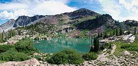
Alta is also the location of Alta Ski Area, a ski resort that has 500,000 visitors a year. It is known for its powder skiing and its decision to not allow snowboarding.
History
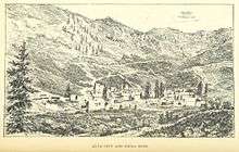
Alta has been important to the development of skiing in Utah. Alta was founded about 1865 to house miners from the Emma mine, the Flagstaff mine, and other silver mines in Little Cottonwood Canyon. Sensationally rich silver ore in the Emma mine enabled its owners to sell the mine at an inflated price to British investors in 1871.[5] The subsequent exhaustion of the Emma ore body led to the recall of the American ambassador to Great Britain, who was a director of the company, and Congressional hearings in Washington.[6]
An incident that occurred in the town in 1873 was adapted by Rod Serling for the episode entitled "Mr. Garrity and the Graves" of his television series The Twilight Zone.
An 1878 fire and an 1885 avalanche destroyed most of the original mining town, though some mining activity persisted into the 20th century. By the 1930s, only one resident, George Watson, remained in the town. Facing back taxes on mining claims he owned, Watson donated much of the land in Alta to the U.S. Forest Service. Watson stipulated that the Forest Service use the land to construct a ski area. In 1935, Norwegian skiing legend Alf Engen was hired to help develop the area, and Alta opened its first ski lift in 1938.
Today, Alta is a small town, centered around the Alta Ski Area.
Geography
According to the United States Census Bureau, the town has a total area of 4.1 square miles (10.5 km2), of which, 4.1 square miles (10.5 km2) of it is land and 0.25% is water.
At 8,950 feet (2,730 m), Alta is one of the highest cities in Utah, and one of the highest in America.
Demographics
As of the census of 2010, there were 386 people in 156 households in the town. The racial makeup of the town was 93 percent white and 4 percent Hispanic or Latino.
The population was 67 percent male and 33 percent female. The population was 4.7 percent under the age of 18 and 2.6 percent was 65 or older.
Climate
Alta experiences a high altitude humid continental climate (Köppen Dfb), which borders on a subalpine climate (Dfc), due to its high elevation. Due to its proximity to the Great Salt Lake, the town receives very heavy snows, averaging over 507 inches (12.9 m) per year. During the very wet season of 1982/1983, Alta received as much as 900 inches (23 m) of snow, leading to record flooding of Wasatch streams as the snow melted during May and June that year.[10] Alta's total precipitation of 108.54 inches (2,756.9 mm) during 1983 is a record for a calendar year in any state of the Mountain West;[11] strangely Villanueva only 675 miles (1,086 km) away recorded only 0.91 inches (23.1 mm), which is a record low for New Mexico,[11] in that same year.
| Climate data for Alta, Utah (Elevation 8,730ft) | |||||||||||||
|---|---|---|---|---|---|---|---|---|---|---|---|---|---|
| Month | Jan | Feb | Mar | Apr | May | Jun | Jul | Aug | Sep | Oct | Nov | Dec | Year |
| Record high °F (°C) | 57 (14) |
57 (14) |
65 (18) |
69 (21) |
76 (24) |
82 (28) |
86 (30) |
84 (29) |
79 (26) |
72 (22) |
64 (18) |
59 (15) |
86 (30) |
| Average high °F (°C) | 30.2 (−1.0) |
31.2 (−0.4) |
34.7 (1.5) |
41.3 (5.2) |
51.9 (11.1) |
63.4 (17.4) |
72.2 (22.3) |
70.5 (21.4) |
61.5 (16.4) |
49.0 (9.4) |
36.6 (2.6) |
31.1 (−0.5) |
47.8 (8.8) |
| Daily mean °F (°C) | 21.6 (−5.8) |
22.7 (−5.2) |
26.0 (−3.3) |
32.6 (0.3) |
42.3 (5.7) |
52.3 (11.3) |
60.9 (16.1) |
59.5 (15.3) |
50.7 (10.4) |
39.6 (4.2) |
28.1 (−2.2) |
22.7 (−5.2) |
38.3 (3.5) |
| Average low °F (°C) | 13.0 (−10.6) |
14.1 (−9.9) |
17.2 (−8.2) |
23.8 (−4.6) |
32.6 (0.3) |
41.2 (5.1) |
49.6 (9.8) |
48.5 (9.2) |
39.9 (4.4) |
30.1 (−1.1) |
19.5 (−6.9) |
14.2 (−9.9) |
28.6 (−1.9) |
| Record low °F (°C) | −26 (−32) |
−19 (−28) |
−8 (−22) |
1 (−17) |
10 (−12) |
20 (−7) |
31 (−1) |
30 (−1) |
16 (−9) |
−4 (−20) |
−16 (−27) |
−25 (−32) |
−26 (−32) |
| Average precipitation inches (mm) | 7.07 (180) |
6.26 (159) |
6.70 (170) |
5.59 (142) |
3.86 (98) |
2.02 (51) |
1.62 (41) |
1.98 (50) |
2.59 (66) |
4.11 (104) |
5.47 (139) |
6.71 (170) |
53.98 (1,370) |
| Average snowfall inches (cm) | 82.7 (210) |
75.3 (191) |
80.1 (203) |
60.4 (153) |
26.8 (68) |
4.8 (12) |
0.0 (0.0) |
0 (0) |
4.3 (11) |
30.6 (78) |
62.8 (160) |
80.0 (203) |
507.8 (1,289) |
| Average precipitation days (≥ 0.01 inch) | 13 | 13 | 13 | 11 | 9 | 6 | 7 | 8 | 8 | 9 | 11 | 13 | 121 |
| Source: Western Regional Climate Center[12] | |||||||||||||
See also
- List of cities and towns in Utah
- Twister (tree) – located near Alta
References
- "2018 U.S. Gazetteer Files". United States Census Bureau. Retrieved Feb 16, 2020.
- "Population and Housing Unit Estimates". Retrieved June 4, 2019.
- "U.S. Census website". United States Census Bureau. Retrieved 2008-01-31.
- "US Board on Geographic Names". United States Geological Survey. 2007-10-25. Retrieved 2008-01-31.
- "Emma Mine". mineswindles.com.
- Dan Plazak, A Hole in the Ground with a Liar at the Top, Salt Lake City: University of Utah Press, 2006, ISBN 978-0-87480-840-7, p.39-77.
- "Census of Population and Housing". Census.gov. Retrieved June 4, 2015.
- "U.S. Census website". United States Census Bureau. Retrieved 2013-09-17.
- "Archived copy" (PDF). Archived from the original (PDF) on 2018-10-03. Retrieved 2014-03-15.CS1 maint: archived copy as title (link)
- "Utah Battles Floods, Mud"; in Pittsburgh Post-Gazette; June 3, 1983; p. 30
- "Weather Extremes"
- "Seasonal Temperature and Precipitation Information". Western Regional Climate Center. Retrieved April 6, 2013.
External links
| Wikimedia Commons has media related to Alta, Utah. |
| Wikivoyage has a travel guide for Alta, Utah. |
- Official website
- Alta Ski Area Official Website
- Alta Community Enrichment, the Alta Arts Council
- Wild old Bunch
- AltaCam Ski Forum
- Alta Visitors Bureau
Places adjacent to Alta, Utah | |
|---|---|
Municipalities and communities of Salt Lake County, Utah, United States | ||
|---|---|---|
| Cities |  Map of Utah highlighting Salt Lake County | |
| Towns | ||
| Metro Townships | ||
| CDPs | ||
| Unincorporated communities | ||
| Ghost towns |
| |
| Footnotes | ‡This populated place also has portions in an adjacent county or counties | |