Alta, Illinois
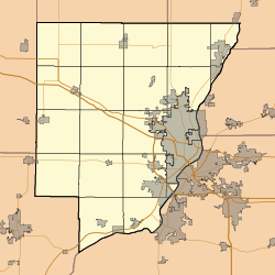
Alta is an unincorporated community on the northwest border of Peoria in Peoria County, Illinois, United States. Alta is 8 miles (13 km) north-northwest of downtown Peoria. The decommissioned Illinois State Route 174 runs through Alta, and the Rock Island Trail begins in Alta.
Alta, Illinois | |
|---|---|
Unincorporated community | |
 Alta, Illinois | |
| Coordinates: 40°48′39″N 89°38′03″W | |
| Country | United States |
| State | Illinois |
| County | Peoria |
| Elevation | 751 ft (229 m) |
| Time zone | UTC-6 (Central (CST)) |
| • Summer (DST) | UTC-5 (CDT) |
| Area code(s) | 309 |
| GNIS feature ID | 403461[1] |
History
Alta was laid out in 1873 when the railroad was extended to that point.[2] The community was so named on account of its lofty elevation.[2] A post office was established at Alta in 1873, and remained in operation until the 1970s[3]
References
- "US Board on Geographic Names". United States Geological Survey. 2007-10-25. Retrieved 2008-01-31.
- Callary, Edward (29 September 2008). Place Names of Illinois. University of Illinois Press. p. 7. ISBN 978-0-252-09070-7.
- "Peoria County". Jim Forte Postal History. Retrieved 27 November 2015.
Municipalities and communities of Peoria County, Illinois, United States | ||
|---|---|---|
| Cities | Map of Illinois highlighting Peoria County | |
| Villages | ||
| Townships | ||
| CDPs | ||
| Other unincorporated communities |
| |
| Footnotes | ‡This populated place also has portions in an adjacent county or counties | |
This article is issued from Wikipedia. The text is licensed under Creative Commons - Attribution - Sharealike. Additional terms may apply for the media files.