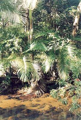
Alligator Creek, Queensland (Townsville)
Alligator Creek is a rural locality in the City of Townsville, Queensland, Australia.[1]
| Alligator Creek Queensland | |||||||||||||||
|---|---|---|---|---|---|---|---|---|---|---|---|---|---|---|---|
 Alligator Creek | |||||||||||||||
 Alligator Creek | |||||||||||||||
| Coordinates | 19.4241°S 146.9458°E | ||||||||||||||
| Postcode(s) | 4816 | ||||||||||||||
| Area | 49.4 km2 (19.1 sq mi) | ||||||||||||||
| LGA(s) | City of Townsville | ||||||||||||||
| State electorate(s) | Burdekin | ||||||||||||||
| Federal Division(s) | |||||||||||||||
| |||||||||||||||
Geography
Alligator Creek is approx 20 kilometres (12 mi) south-east of Townsville. It is bounded on the north by the Bruce Highway. Bowling Green Bay National Park is to the immediate south-east.
Amenities
The Townsville City Council operate a mobile library service which visits Parkland Road at Alligator Creek every second Wednesday morning.[2]
The Gator Girls branch of the Queensland Country Women's Association meets at the Alligator Creek Community & Sports Club at 10 Parklane Road.[3]
References
- "Alligator Creek - locality in City of Townsville (entry 44564)". Queensland Place Names. Queensland Government. Retrieved 28 December 2017.
- "Mobile Library Service" (PDF). Townsville City Council. Archived from the original (PDF) on 29 January 2018. Retrieved 29 January 2018.
- "Branch Locations". Queensland Country Women's Association. Retrieved 26 December 2018.
External links
- "Alligator Creek (near Townsville)". Queensland Places. Centre for the Government of Queensland, University of Queensland.
This article is issued from Wikipedia. The text is licensed under Creative Commons - Attribution - Sharealike. Additional terms may apply for the media files.