Aliartos
Aliartos (Greek: Αλίαρτος) is a small town and municipality in the Boeotia regional unit, Greece, at 109 kilometres from Athens. The 2011 census recorded 10,887 residents in the municipality, 6,094 residents in the municipal unit and 4,847 in the community of Aliartos.[1] Its name comes from the ancient city of Haliartus.
Aliartos Αλίαρτος | |
|---|---|
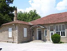 The Copais company building in Aliartos | |
 Aliartos Location within the region  | |
| Coordinates: 38°22.3′N 23°06.3′E | |
| Country | Greece |
| Administrative region | Central Greece |
| Regional unit | Boeotia |
| Municipality | Aliartos |
| Municipal unit | Aliartos |
| Government | |
| • Mayor | Georgios Dasiotis |
| Area | |
| • Municipality | 256.507 km2 (99.038 sq mi) |
| • Municipal unit | 148.355 km2 (57.280 sq mi) |
| Highest elevation | 195 m (640 ft) |
| Lowest elevation | 100 m (300 ft) |
| Population (2011)[1] | |
| • Municipality | 10,887 |
| • Municipality density | 42/km2 (110/sq mi) |
| • Municipal unit | 6,094 |
| • Municipal unit density | 41/km2 (110/sq mi) |
| Community | |
| • Population | 4,847 (2011) |
| • Area (km2) | 66.077 |
| Time zone | UTC+2 (EET) |
| • Summer (DST) | UTC+3 (EEST) |
| Postal code | 320 01 |
| Area code(s) | +30-2368-xxx-xxx |
| Vehicle registration | ΒΙ |
| Website | http://www.aliartos.gov.gr/ |
Geography
Aliartos lies in the center of the Kopais (Kωπαΐδα) plain. The municipality of Aliartos covers an area of 256.507 km2, the municipal unit of Aliartos 148.355 km2 and the community 66.077 km2.[2]
Climate
Under the Köppen climate classification, Aliartos has a hot-summer Mediterranean climate (Csa), with wet, cool winters and dry, hot summers.
| Climate data for Aliartos (1967–1997) | |||||||||||||
|---|---|---|---|---|---|---|---|---|---|---|---|---|---|
| Month | Jan | Feb | Mar | Apr | May | Jun | Jul | Aug | Sep | Oct | Nov | Dec | Year |
| Average high °C (°F) | 11.5 (52.7) |
12.7 (54.9) |
15.4 (59.7) |
20.2 (68.4) |
25.8 (78.4) |
30.8 (87.4) |
32.2 (90.0) |
31.7 (89.1) |
28.5 (83.3) |
22.3 (72.1) |
17.1 (62.8) |
12.9 (55.2) |
21.8 (71.2) |
| Daily mean °C (°F) | 7.1 (44.8) |
8.2 (46.8) |
10.6 (51.1) |
15.2 (59.4) |
20.6 (69.1) |
25.7 (78.3) |
27.2 (81.0) |
26.2 (79.2) |
22.6 (72.7) |
16.9 (62.4) |
12.0 (53.6) |
8.6 (47.5) |
16.7 (62.2) |
| Average low °C (°F) | 3.2 (37.8) |
3.6 (38.5) |
4.9 (40.8) |
7.9 (46.2) |
12.1 (53.8) |
15.9 (60.6) |
17.8 (64.0) |
17.3 (63.1) |
14.4 (57.9) |
10.9 (51.6) |
7.1 (44.8) |
4.3 (39.7) |
10.0 (49.9) |
| Average precipitation mm (inches) | 80.5 (3.17) |
75.2 (2.96) |
62.4 (2.46) |
41.8 (1.65) |
28.6 (1.13) |
14.3 (0.56) |
7.0 (0.28) |
15.4 (0.61) |
16.7 (0.66) |
68.3 (2.69) |
73.0 (2.87) |
99.3 (3.91) |
582.5 (22.95) |
| Average precipitation days (≥ 1 mm) | 12.4 | 12.1 | 11.2 | 8.3 | 6.2 | 3.5 | 2.2 | 2.4 | 3.3 | 8.4 | 9.4 | 12.4 | 91.8 |
| Source: Hellenic National Meteorological Service[3] | |||||||||||||
History
The modern town of Aliartos is a recent creation. In the early 19th century, the site was occupied by two small agricultural settlements, Moulki (Μούλκι) and Krimpas (Κριμπάς). In 1835, the name of ancient Haliartus was revived for the newly established municipality which encompassed these settlements. Krimpas was renamed to Aliartos in June 1919,[4] but in 1951 the settlement was disbanded and the name was transferred in July 1953 to Moulki.[5] The names of Moulki and Krimpas survive as quarters of the new town.
Municipality
The municipality Aliartos was formed at the 2011 local government reform by the merger of the following 2 former municipalities, that became municipal units:[6]
- Aliartos
- Thespies
References
- "Απογραφή Πληθυσμού - Κατοικιών 2011. ΜΟΝΙΜΟΣ Πληθυσμός" (in Greek). Hellenic Statistical Authority.
- "Population & housing census 2001 (incl. area and average elevation)" (PDF) (in Greek). National Statistical Service of Greece. Archived from the original (PDF) on 2015-09-21.
- "Climatological Information for Aliartos, Greece". HNMS. Archived from the original on 16 September 2016. Retrieved 2 July 2016.
- Name changes of settlements in Greece, Krimpas-Aliartos
- Name changes of settlements in Greece, Moulki-Aliartos
- Kallikratis law Greece Ministry of Interior (in Greek)
Administrative division of the Central Greece Region | ||
|---|---|---|
| Regional unit of Boeotia | 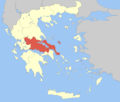 | |
| Regional unit of Euboea | ||
| Regional unit of Evrytania | ||
| Regional unit of Phocis | ||
| Regional unit of Phthiotis | ||
| ||