Alabama State Route 179
State Route 179 (SR 179) is a 10.434-mile (16.792 km) state highway that serves as a north-south connection between western Etowah County and Boaz. The southern terminus of SR 179 is at its intersection with US 278, and the northern terminus is at its intersection with SR 168 southwest of downtown Boaz.
| ||||
|---|---|---|---|---|
| Route information | ||||
| Maintained by ALDOT | ||||
| Length | 10.434 mi[1] (16.792 km) | |||
| Major junctions | ||||
| South end | ||||
| North end | ||||
| Location | ||||
| Counties | Etowah, Marshall | |||
| Highway system | ||||
| ||||

Route description
State Route 179 begins at its intersection with US-278 in Howelton.[2] From this point, the route travels in a northerly direction through its northern terminus at SR-168 southwest of Boaz.[3]
Major intersections
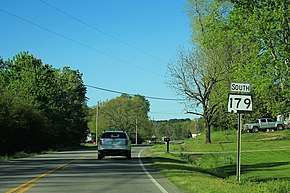
A sign denoting Alabama State Route 179, located near Boaz.
| County | Location | mi[1] | km | Destinations | Notes |
|---|---|---|---|---|---|
| Etowah | Howelton | 0.0 | 0.0 | Southern terminus | |
| Marshall | Boaz | 10.434 | 16.792 | Northern terminus | |
| 1.000 mi = 1.609 km; 1.000 km = 0.621 mi | |||||
References
- Milepost Map of Etowah & Marshall Counties (PDF) (Map). Cartography by ALDOT Bureau of Transportation Planning, Survey & Mapping Division. Alabama Department of Transportation. 1999. Archived from the original (PDF) on 2008-06-25.
- Google (May 1, 2010). "SR-179 southern terminus" (Map). Google Maps. Google. Retrieved May 1, 2010.
- Google (May 1, 2010). "SR-179 northern terminus" (Map). Google Maps. Google. Retrieved May 1, 2010.
This article is issued from Wikipedia. The text is licensed under Creative Commons - Attribution - Sharealike. Additional terms may apply for the media files.