Ait Ouallal, Zagora
Ait Ouallal (Berber languages: ⴰⵢⵜ ⵡⴰⵍⵍⴰⵍ, Arabic: آيت ولال, also known as Ait Ouzzine and Ajmou Amajgal) is a rural municipality in the Zagora Province, in the region of Draa Tafilalet, Morocco. It is located at approximately 30°51′51.858″N 5°53′20.412″W, near the village of N'Kob (3,1 km) and 27 kilometers from Tamsahelte (30°49′1.5″N 5°39′36″W) via R108. Based on the 2004 census, Ait Ouallal has 9649 inhabitants.
Ait Ouallal Ait Ouzzine / ⴰⵢⵜ ⵡⴰⵍⵍⴰⵍ آيت ولال | |
|---|---|
| Ait Ouallal | |
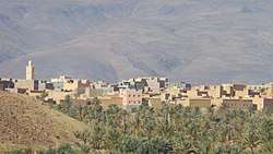 Oasis of palm trees in N'Kob, near the village of Ait Ouallal | |
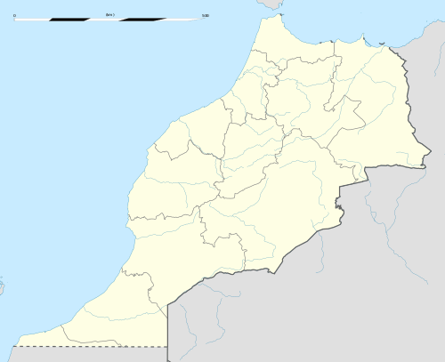 Ait Ouallal Location in Morocco | |
| Coordinates: 30°51′51.858″N 5°53′20.412″W | |
| Country | |
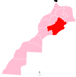
| Region | Drâa-Tafilalet |
| Province | Zagora Province |
| Community | Ait Ouallal |
| Government | |
| • President of the Urban Community of Ait Ouallal | Ahmed Ait Baha |
| Population (2004) | |
| • Total | 9,649 |
| Time zone | UTC+0 (WET) |
| • Summer (DST) | UTC+1 (WEST) |
| Area code(s) | +212 |
| Geocode | 587.03.07. |
Climate
Ait Ouallal, Zagora has a desert climate (Köppen climate classification BWh).
| Climate data for Ait Ouallal | |||||||||||||
|---|---|---|---|---|---|---|---|---|---|---|---|---|---|
| Month | Jan | Feb | Mar | Apr | May | Jun | Jul | Aug | Sep | Oct | Nov | Dec | Year |
| Average high °C (°F) | 17.6 (63.7) |
19.4 (66.9) |
22.8 (73.0) |
27.2 (81.0) |
31.6 (88.9) |
37 (99) |
41.2 (106.2) |
40 (104) |
33.6 (92.5) |
27.8 (82.0) |
21.8 (71.2) |
17.6 (63.7) |
28.1 (82.7) |
| Average low °C (°F) | 1.4 (34.5) |
3.3 (37.9) |
6.6 (43.9) |
9.7 (49.5) |
13.2 (55.8) |
17.5 (63.5) |
21 (70) |
21.2 (70.2) |
16.5 (61.7) |
12.1 (53.8) |
7.3 (45.1) |
2.9 (37.2) |
11.1 (51.9) |
| Average precipitation mm (inches) | 6 (0.2) |
5 (0.2) |
8 (0.3) |
4 (0.2) |
5 (0.2) |
1 (0.0) |
1 (0.0) |
4 (0.2) |
10 (0.4) |
19 (0.7) |
20 (0.8) |
10 (0.4) |
93 (3.6) |
| Source: Climate Data[1] | |||||||||||||
This article is issued from Wikipedia. The text is licensed under Creative Commons - Attribution - Sharealike. Additional terms may apply for the media files.