Airole
Airole (Ligurian: Airöe, locally Airöre) is a comune (municipality) in the Province of Imperia in the Italian region of Liguria, located about 130 kilometres (81 mi) southwest of Genoa and about 40 kilometres (25 mi) west of Imperia, on the border with France. As of 31 December 2004, it had a population of 461 and an area of 14.8 square kilometres (5.7 sq mi).[3]
Airole | |
|---|---|
| Comune di Airole | |
 Airole | |
 Coat of arms | |
Location of Airole 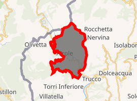
| |
 Airole Location of Airole in Italy 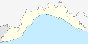 Airole Airole (Liguria) | |
| Coordinates: 43°52′N 7°33′E | |
| Country | Italy |
| Region | Liguria |
| Province | Province of Imperia (IM) |
| Frazioni | Collabassa, case Noceire, case Giauma |
| Area | |
| • Total | 14.8 km2 (5.7 sq mi) |
| Elevation | 149 m (489 ft) |
| Population (Dec. 2004)[2] | |
| • Total | 461 |
| • Density | 31/km2 (81/sq mi) |
| Demonym(s) | Airolesi |
| Time zone | UTC+1 (CET) |
| • Summer (DST) | UTC+2 (CEST) |
| Postal code | 18030 |
| Dialing code | 0184 |
| Website | Official website |
The municipality of Airole contains the frazioni (subdivisions, mainly villages and hamlets) Collabassa, case Noceire, and case Giauma.
Airole borders the following municipalities: Breil-sur-Roya (France), Dolceacqua, Olivetta San Michele, and Ventimiglia.
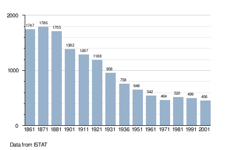
Demographic evolution
References
- "Superficie di Comuni Province e Regioni italiane al 9 ottobre 2011". Istat. Retrieved 16 March 2019.
- "Popolazione Residente al 1° Gennaio 2018". Istat. Retrieved 16 March 2019.
- All demographics and other statistics: Italian statistical institute Istat.
This article is issued from Wikipedia. The text is licensed under Creative Commons - Attribution - Sharealike. Additional terms may apply for the media files.