Ahtopol
Ahtopol (Bulgarian: Ахтопол) is a town and seaside resort on the southern Bulgarian Black Sea Coast. It is located on a headland in the southeastern part of Burgas Province and is close to the border with European Turkey. It is the southernmost town on the Bulgarian coast. Ahtopol lies within Strandzha Nature Park.
Ahtopol Ахтопол | |
|---|---|
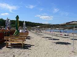 Ahtopol's beach | |
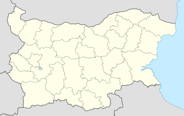 Ahtopol Location of Ahtopol | |
| Coordinates: 42°6′N 27°57′E | |
| Country | |
| Province | Burgas |
| Municipality | Tsarevo Municipality |
| Government | |
| • Mayor | Biser Kolev |
| Elevation | 0 m (0 ft) |
| Population (2005-09-13) | |
| • Total | 1,316 |
| Time zone | UTC+2 (EET) |
| • Summer (DST) | UTC+3 (EEST) |
| Postal Code | 8280 |
| Area code(s) | 0590 |
Ahtopol Peak in Antarctica is named after the town.
History
The town lies on the site of an ancient Thracian settlement, with the earliest traces of human settlement dating to the Neolithic. It was probably colonized by the Ancient Greeks around 440-430 BC. According to researchers the city was founded by Athenians.[1][2] The Romans called it Peronticus, while the Byzantine leader Agathon reconstructed the town after barbarian invasions and possibly gave it his own name, Agathopolis (Greek: Αγαθόπολις). According to other sources, it was named thus as early as 323 BC. Another name it bore anciently was Aulaiouteichos[3] or Alaeouteichos.[1]
| Year | Population |
|---|---|
| 1920 | 770 |
| 1934 | 972 |
| 1946 | 1,079 |
| 1956 | 1,058 |
| 1965 | 947 |
| 1975 | 945 |
| 1985 | 1,137 |
| 1992 | 1,204 |
| 2005 | 1,316 |
In the Middle Ages, the town frequently changed hands between the Byzantine Empire and the Bulgarian Empire. Medieval sources mention Ahtopol as a lively merchant port where many Byzantine, Italian and other ships arrived. With the invasion of the Ottoman troops at the end of the 14th century, the town was called Ahtenbolu. The town ultimately fell under Ottoman rule as late as 1453. An Ottoman tax register of 1498 lists 158 Christian families in Ahtopol, most of which have Greek names but others evidently Slavic (Bulgarian). In 1898, Ahtopol was a town of 410 houses, of which 300 Greek and 110 Bulgarian. In the 19th century, it was still a thriving centre of fishery and overseas trade, with many locals owning their own ships and selling goods all around the Black Sea and the Mediterranean. Viticulture was also well-developed.
Ahtopol has been burnt down and devastated by sea pirates (often the Caucasian Lazi) many times, with the most recent fire being in 1918, when the town was almost destroyed. Remains of the town's fortress (reaching up to 8 m in height and 3.5 m in width), the 12th-century monastery of St Yani and a fountain with a carved horseman are the only traces left from ancient times. Another landmark is the Church of the Ascension from 1796. Ahtopol was a kaza centre in Kırkkilise sanjak of Edirne Vilayet between 1878-1912 as "Ahtabolu"[4] (Ahtopol was referred as Agathoupolis in reference page). Also, Evliya Çelebi passed from here in 1663 and referred as "Ahtabolu" in 6th volume (English of "6. Cilt") of Seyahatname.[5]
After the Balkan Wars, when the area was ceded to Bulgaria by the Ottoman Empire, the town's predominantly Greek population gradually moved to Greece and was replaced by Bulgarian refugees, mostly from Eastern Thrace, specifically Bunarhisar (150 families). The Greek name of the town was Achtòpolis, Αχτοπολις or Agathùpolis, Αγαθουπολις.
Rocketry
From 1984 to 1990 28 soundings rockets of the Soviet type M-100 were launched near Ahtopol at 42°5'8"N 27°57'17"E.
Climate
Ahtopol has a humid subtropical climate (Köppen climate classification: Cfa) bordering with a mediterranean climate (Csa) with limited continental effects.
| Climate data for Ahtopol (2000-2014) | |||||||||||||
|---|---|---|---|---|---|---|---|---|---|---|---|---|---|
| Month | Jan | Feb | Mar | Apr | May | Jun | Jul | Aug | Sep | Oct | Nov | Dec | Year |
| Average high °C (°F) | 6.4 (43.5) |
7.6 (45.7) |
10.7 (51.3) |
16.1 (61.0) |
21.1 (70.0) |
25.6 (78.1) |
27.6 (81.7) |
27.3 (81.1) |
24.5 (76.1) |
19.2 (66.6) |
13.7 (56.7) |
8.7 (47.7) |
17.4 (63.3) |
| Daily mean °C (°F) | 2.7 (36.9) |
3.7 (38.7) |
6.5 (43.7) |
11.3 (52.3) |
16.2 (61.2) |
20.4 (68.7) |
22.6 (72.7) |
21.9 (71.4) |
19.2 (66.6) |
15.4 (59.7) |
9.5 (49.1) |
5.2 (41.4) |
12.9 (55.2) |
| Average low °C (°F) | −0.3 (31.5) |
0.5 (32.9) |
2.9 (37.2) |
7.2 (45.0) |
11.9 (53.4) |
15.9 (60.6) |
17.9 (64.2) |
17.2 (63.0) |
14.6 (58.3) |
12.2 (54.0) |
6.0 (42.8) |
2.4 (36.3) |
9.1 (48.4) |
| Average precipitation mm (inches) | 48 (1.9) |
43 (1.7) |
39 (1.5) |
47 (1.9) |
47 (1.9) |
45 (1.8) |
36 (1.4) |
28 (1.1) |
45 (1.8) |
52 (2.0) |
73 (2.9) |
62 (2.4) |
565 (22.2) |
| Average precipitation days (≥ 1 mm) | 9.0 | 8.3 | 6.6 | 4.1 | 3.7 | 4.7 | 2.8 | 2.7 | 4.9 | 6.6 | 5.0 | 9.4 | 67.9 |
| Mean monthly sunshine hours | 95 | 115 | 151 | 216 | 241 | 282 | 304 | 285 | 229 | 181 | 97 | 71 | 2,220 |
| Source: climatbase.ru | |||||||||||||
See also
- The foundation of Agathopolis/Alaeouteichos and the Athenian Black Sea policy in the 5th century BC - Jan G. de Boer, p.178
- Pont-Euxin Et Polis: Polis Hellenis Et Polis Barbaron : Actes Du Xe Symposium de Vani, 23-26 Septembre 2002 : Hommage À Otar Lordkipanidzé Et Pierre Lévêque
- Richard Talbert, ed. (2000). Barrington Atlas of the Greek and Roman World. Princeton University Press. p. 22, and directory notes accompanying.
- "Thracee 7". Archived from the original on 2010-10-12. Retrieved 2009-07-07.
- http://www.balkanpazar.org/rumeli_evliyacelebi.asp Archived 2018-04-16 at the Wayback Machine Evliya Çelebi's Route (In Turkish)
References
- Rajčevski, Stojan (2001). "Ahtopol". Krajbrežna Strandža: Toponimi i hidronimi. Sofia: Universitetsko izdatelstvo "Sv. Kliment Ohridski". pp. 12–20. ISBN 954-07-1541-5.
External links
| Wikimedia Commons has media related to Ahtopol. |
| 1,000,000+ |  | |
|---|---|---|
| 300,000+ | ||
| 200,000+ | ||
| 100,000+ | ||
| 50,000+ | ||
| 20,000+ | ||
| 10,000+ |
| |
| 5,000+ |
| |
| 2,000+ |
| |
| 1,000+ | ||
| 500+ | ||
| 499- | ||
| Notes |
| |
Capital: Tsarevo | ||
| Villages |  | |
| Landmarks |
| |
| Culture | ||
| Notable people | ||