Addilal
Addilal is a tabia or municipality in the Dogu'a Tembien district of the Tigray Region of Ethiopia. The tabia centre is in Addilal village, located approximately 19 km (12 mi) to the east of the woreda town Hagere Selam.
Addilal | |
|---|---|
Reforestation in Addilal | |
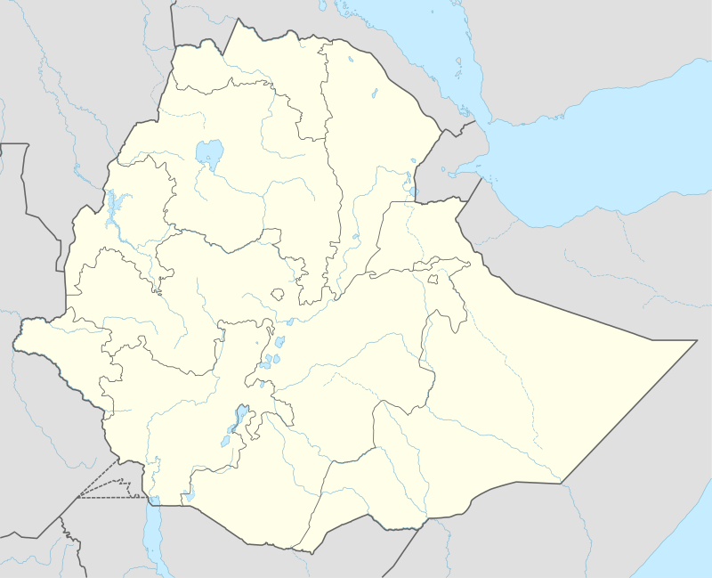 Addilal Location within Ethiopia | |
| Coordinates: 13°41′N 39°19′E | |
| Country | Ethiopia |
| Region | Tigray |
| Zone | Debub Misraqawi (Southeastern) |
| Woreda | Dogu'a Tembien |
| Area | |
| • Total | 73.59 km2 (28.41 sq mi) |
| Elevation | 2,200 m (7,200 ft) |
| Time zone | UTC+3 (EAT) |
Geography
The tabia stretches down from the Arebay peaks in Dogu'a Tembien towards Suluh river. The highest place is the top of the Amba Aradam Sandstone cliff high above Addilal village (2600 m a.s.l.) and the lowest place the junction of Suluh and Ch'eqofo Rivers (1830 m a.s.l.).
Geology
From the higher to the lower locations, the following geological formations are present:[1]
- Amba Aradam Formation
- Agula Shale[2]
- Mekelle Dolerite[3]
- Antalo Limestone
- Quaternary alluvium and freshwater tufa[4]
Geomorphology and soils
The main geomorphic unit is the incised Giba plateau (upstream of future Lake Giba). Corresponding soil types are:[5]
- Associated soil types
- Inclusions
Climate
The rainfall pattern shows a very high seasonality with 70 to 80% of the annual rain falling in July and August. Mean temperature in Ch'eqofo (a central place in the tabia at 2120 metres above sea level) is 21 °C, oscillating between average daily minimum of 11.9 °C and maximum of 29.7 °C. The contrasts between day and night air temperatures are much larger than seasonal contrasts.[6]
Water availability
As there are no permanent rivers besides Suluh, the presence of springs is of utmost importance for the local people. The main springs in the tabia are May Cheqofo in Addi Gedged and May Gura'ira'i in Haddinnet.[7] In this area with rains that last only for a couple of months per year, reservoirs of different sizes allow harvesting runoff from the rainy season for further use in the dry season. There are traditional surface water harvesting ponds, particularly in places without permanent springs, called rahaya. In addition, horoyo, household ponds, recently constructed with variable success through campaigns.[8]
Vegetation and exclosures
The tabia holds several exclosures, areas that are set aside for regreening.[9] Wood harvesting and livestock range are not allowed there. Besides effects on biodiversity,[10][11][12] water infiltration, protection from flooding, sediment deposition,[13] carbon sequestration,[14] people commonly have economic benefits from these exclosures through grass harvesting, beekeeping and other non-timber forest products.[15] The local inhabitants also consider it as “land set aside for future generations”.[16] In this tabia, some exclosures are managed by the EthioTrees project. They have as an additional benefit that the villagers receive carbon credits for the sequestered CO2,[17] as part of a carbon offset programme.[18] The revenues are then reinvested in the villages, according to the priorities of the communities;[19] it may be for an additional class in the village school, a water pond, or conservation in the exclosures. Addilal (exclosure), near the tabia centre (144.81 ha) is managed by the Ethiotrees project.[20]
Settlements
The tabia centre Addilal holds a few administrative offices, a health post, a primary school, and some small shops. There are a few more primary schools across the tabia. The main other populated places are:[21]
- Addi Gedged
- Hutsa
- Ch'eqofo
- Dagiyergis
Agriculture and livelihood
The population lives essentially from crop farming, supplemented with off-season work in nearby towns. The land is dominated by farmlands which are clearly demarcated and are cropped every year. Hence the agricultural system is a permanent upland farming system.[22] The farmers have adapted their cropping systems to the spatio-temporal variability in rainfall.[23] Extensive areas with steep slopes have been protected and there is strong vegetation regrowth.
History and culture
History
The history of the tabia is strongly confounded with the history of Tembien.
Religion and churches
Most inhabitants are Orthodox Christians. Among others, the following churches are located in the tabia: Giyergis and Addilal Maryam.
Inda Siwa, the local beer houses
In the main villages, there are traditional beer houses (Inda Siwa), often in unique settings, which are a good place for resting and chatting with the local people. The most renown are in the tabia's main village Addilal: Tekle Berhe, Nigisti Teka and Mulubrhan Kindeya.[7]
Roads and communication
The main road Mekelle – Hagere Selam – Abiy Addi runs 5–10 km south of the tabia. Further, a rural access road links Addilal village to the main asphalt road. Inhabitants need to walk long distances on foot to get transportation service.
Tourism
Its mountainous nature and proximity to Mekelle makes the tabia fit for tourism, yet its potential is largely unexplored.[24]
Two trekking routes cross the southern part of this tabia.[25] The tracks are not marked on the ground but can be followed using downloaded .GPX files.[26]
- Trek 23, from the three olive trees ("Mi'iraf Janhoy" at 1940 metres above sea level in Addi Azmera), across Addilal, and further up towards Ekli Imba the peak of the Medayq massif that dominates the landscape at the north (2799 m)
- Trek 24, from the main bridge on Giba River, through Emni Ankelalu to Addilal village
Facilities are very basic.[27] One may be invited to spend the night in a rural homestead or ask permission to pitch a tent. Hotels are available in Hagere Selam and Mekelle.
More detailed information
For more details on environment, agriculture, rural sociology, hydrology, ecology, culture, etc., see the overall page on the Dogu'a Tembien district.
References
- Sembroni, A.; Molin, P.; Dramis, F. (2019). Regional geology of the Dogu'a Tembien massif. In: Geo-trekking in Ethiopia's Tropical Mountains - The Dogu'a Tembien District. SpringerNature. ISBN 978-3-030-04954-6.
- Bosellini, A.; Russo, A.; Fantozzi, P.; Assefa, G.; Tadesse, S. (1997). "The Mesozoic succession of the Mekelle Outlier (Tigrai Province, Ethiopia)". Mem. Sci. Geol. 49: 95–116.
- Tefera, M.; Chernet, T.; Haro, W. Geological Map of Ethiopia (1:2,000,000). Addis Ababa, Ethiopia: Ethiopian Institute of Geological Survey.
- Moeyersons, J. and colleagues (2006). "Age and backfill/overfill stratigraphy of two tufa dams, Tigray Highlands, Ethiopia: Evidence for Late Pleistocene and Holocene wet conditions". Palaeogeography, Palaeoclimatology, Palaeoecology. 230 (1–2): 162–178. doi:10.1016/j.palaeo.2005.07.013.
- Nyssen, Jan; Tielens, Sander; Gebreyohannes, Tesfamichael; Araya, Tigist; Teka, Kassa; Van De Wauw, Johan; Degeyndt, Karen; Descheemaeker, Katrien; Amare, Kassa; Haile, Mitiku; Zenebe, Amanuel; Munro, Neil; Walraevens, Kristine; Gebrehiwot, Kindeya; Poesen, Jean; Frankl, Amaury; Tsegay, Alemtsehay; Deckers, Jozef (2019). "Understanding spatial patterns of soils for sustainable agriculture in northern Ethiopia's tropical mountains". PLOS ONE. 14 (10): e0224041. doi:10.1371/journal.pone.0224041. PMC 6804989. PMID 31639144.
- Jacob, M. and colleagues (2019). Dogu'a Tembien's Tropical Mountain Climate. In: Geo-trekking in Ethiopia's Tropical Mountains - The Dogu'a Tembien District. SpringerNature. doi:10.1007/978-3-030-04955-3_3. ISBN 978-3-030-04954-6.
- What do we hear from the farmers in Dogu'a Tembien? [in Tigrinya]. Hagere Selam, Ethiopia. 2016. p. 100.
- Developers and farmers intertwining interventions: the case of rainwater harvesting and food-for-work in Degua Temben, Tigray, Ethiopia
- Aerts, R; Nyssen, J; Mitiku Haile (2009). "On the difference between "exclosures" and "enclosures" in ecology and the environment". Journal of Arid Environments. 73 (8): 762–763. doi:10.1016/j.jaridenv.2009.01.006.
- Aerts, R.; Lerouge, F.; November, E. (2019). Birds of forests and open woodlands in the highlands of Dogu'a Tembien. In: Geo-trekking in Ethiopia's Tropical Mountains - The Dogu'a Tembien District. SpringerNature. ISBN 978-3-030-04954-6.
- Mastewal Yami, and colleagues (2007). "Impact of Area Enclosures on Density and Diversity of Large Wild Mammals: The Case of May Ba'ati, Douga Tembien Woreda, Central Tigray, Ethiopia". East African Journal of Sciences. 1: 1–14.
- Aerts, R; Lerouge, F; November, E; Lens, L; Hermy, M; Muys, B (2008). "Land rehabilitation and the conservation of birds in a degraded Afromontane landscape in northern Ethiopia". Biodiversity and Conservation. 17: 53–69. doi:10.1007/s10531-007-9230-2.
- Descheemaeker, K. and colleagues (2006). "Sediment deposition and pedogenesis in exclosures in the Tigray Highlands, Ethiopia". Geoderma. 132 (3–4): 291–314. doi:10.1016/j.geoderma.2005.04.027.
- Wolde Mekuria, and colleagues (2011). "Restoration of Ecosystem Carbon Stocks Following Exclosure Establishment in Communal Grazing Lands in Tigray, Ethiopia". Soil Science Society of America Journal. 75 (1): 246–256. doi:10.2136/sssaj2010.0176.
- Bedru Babulo, and colleagues (2006). "Economic valuation methods of forest rehabilitation in exclosures". Journal of the Drylands. 1: 165–170.
- Jacob, M. and colleagues (2019). Exclosures as Primary Option for Reforestation in Dogu'a Tembien. In: Geo-trekking in Ethiopia's Tropical Mountains - The Dogu'a Tembien District. SpringerNature. ISBN 978-3-030-04954-6.
- Reubens, B. and colleagues (2019). Research-based development projects in Dogu'a Tembien. In: Geo-trekking in Ethiopia's Tropical Mountains - The Dogu'a Tembien District. SpringerNature. ISBN 978-3-030-04954-6.
- EthioTrees on Plan Vivo website
- EthioTrees on Davines website
- De Deyn, Jonathan (2019). Benefits of reforestation on Carbon storage and water infiltration in the context of climate mitigation in North Ethiopia. Master thesis, Ghent University, Belgium.
- Jacob, M. and colleagues (2019). Geo-trekking map of Dogu'a Tembien (1:50,000). In: Geo-trekking in Ethiopia's Tropical Mountains - The Dogu'a Tembien District. SpringerNature. ISBN 978-3-030-04954-6.
- Naudts, J (2002). Les Hautes Terres de Tembien, Tigré, Ethiopie; Résistance et limites d'une ancienne civilisation agraire; Conséquences sur la dégradation des terres [MSc dissertation]. CNEARC, Montpellier, France.
- Frankl, A. and colleagues (2013). "The effect of rainfall on spatio‐temporal variability in cropping systems and duration of crop cover in the Northern Ethiopian Highlands". Soil Use and Management. 29 (3): 374–383. doi:10.1111/sum.12041.
- Geo-trekking in Ethiopia's Tropical Mountains - The Dogu'a Tembien District. SpringerNature. 2019. ISBN 978-3-030-04954-6.
- Nyssen, Jan (2019). Description of Trekking Routes in Dogu'a Tembien. GeoGuide. Springer-Nature. pp. 557–675. doi:10.1007/978-3-030-04955-3_38. ISBN 978-3-030-04954-6.
- https://www.openstreetmap.org/traces/tag/nyssen-jacob-frankl
- Nyssen, Jan (2019). "Logistics for the Trekker in a Rural Mountain District of Northern Ethiopia". Geo-trekking in Ethiopia's Tropical Mountains. GeoGuide. Springer-Nature. pp. 537–556. doi:10.1007/978-3-030-04955-3_37. ISBN 978-3-030-04954-6.
Places adjacent to Addilal | ||||||||||
|---|---|---|---|---|---|---|---|---|---|---|
| ||||||||||