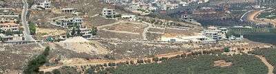
Adaisseh
Adaisseh (Arabic: العديسة / BGN: Aadaïssé / ISO 233: Al `Udaysah; also Adessé; Odeissé and other spellings) is a village in South Lebanon. It is located close to the Blue Line border with Israel, near the Israeli kibbutz Misgav Am.[1]
Adaisseh العديسة | |
|---|---|
Village | |
 Adaisseh | |
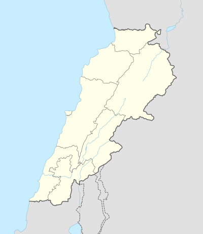 Adaisseh Location within Lebanon | |
| Coordinates: 33°15′15″N 35°32′33″E | |
| Grid position | 201/295 PAL |
| Country | |
| Governorate | Nabatieh Governorate |
| District | Marjeyoun District |
| Elevation | 700 m (2,300 ft) |
| Time zone | UTC+2 (EET) |
| • Summer (DST) | UTC+3 (EEST) |
| Dialing code | +961 |
Name
According to E. H. Palmer, the name Odeithat et Tahta means "the lower ’Odeitha".[2]
History
Just north of Adaisseh is the place, formerly called 'Odeitha el Foka. In 1875, Victor Guérin described it as "an elevated plateau crowned with the ruins of a small fort of rectangular form, measuring forty paces long by thirty broad. It is in rubble work, with an external casing of regular stones of small size, and is divided in the interior into several compartments."[3] In 1881, the PEF's Survey of Western Palestine (SWP) found here: "A ruined Saracenic building with one cistern."[4]
In 1881, SWP found at the village (which it called Odeitha et Tahtâ) "Cisterns and several lintels.""[4] It further described it as "A village, built of stone, containing about 250 Metawileh, situated in valley surrounded by arable land. A market is held here one day each week. Water supply from spring in village, spring near, and several cisterns."[5]
Modern era
The village was the site of the 2010 Adaisseh incident, when Israeli and Lebanese forces engaged in cross-border combat. Some Israeli shells hit the village during the fighting.
References
Bibliography
- Conder, C.R.; Kitchener, H.H. (1881). The Survey of Western Palestine: Memoirs of the Topography, Orography, Hydrography, and Archaeology. 1. London: Committee of the Palestine Exploration Fund.
- Guérin, V. (1880). Description Géographique Historique et Archéologique de la Palestine (in French). 3: Galilee, pt. 2. Paris: L'Imprimerie Nationale.
- Palmer, E.H. (1881). The Survey of Western Palestine: Arabic and English Name Lists Collected During the Survey by Lieutenants Conder and Kitchener, R. E. Transliterated and Explained by E.H. Palmer. Committee of the Palestine Exploration Fund.
External links
- Aadaysseh, Localiban
- Survey of Western Palestine, Map 2: IAA, Wikimedia commons
| Capital | 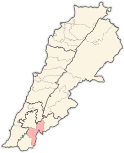 | |
|---|---|---|
| Towns and villages | ||
| Other | ||