Aadchit
Aadchit, Atshis, (Arabic: عدشيت) is a village in the Marjeyoun District in South Lebanon.
Aadchit عدشيت | |
|---|---|
Village | |
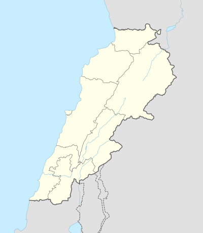 Aadchit Location within Lebanon | |
| Coordinates: 33°16′38″N 35°28′51″E | |
| Grid position | 195/198 PAL |
| Country | |
| Governorate | Nabatieh Governorate |
| District | Marjeyoun District |
| Time zone | UTC+2 (EET) |
| • Summer (DST) | UTC+3 (EEST) |
| Dialing code | +961 |
Name
According to E. H. Palmer, the name Atshis comes from a personal name.[1]
History
In 1881, the PEF's Survey of Western Palestine (SWP) described it: "a small village, built of mud and stone, containing about 100 Metawileh, situated on a low ridge surrounded by small gardens and olives. The water supply is from four rock-cut cisterns."[2]
Bibliography
- Conder, C.R.; Kitchener, H.H. (1881). The Survey of Western Palestine: Memoirs of the Topography, Orography, Hydrography, and Archaeology. 1. London: Committee of the Palestine Exploration Fund.
- Guérin, V. (1880). Description Géographique Historique et Archéologique de la Palestine (in French). 3: Galilee, pt. 2. Paris: L'Imprimerie Nationale.
- Palmer, E.H. (1881). The Survey of Western Palestine: Arabic and English Name Lists Collected During the Survey by Lieutenants Conder and Kitchener, R. E. Transliterated and Explained by E.H. Palmer. Committee of the Palestine Exploration Fund.
External links
- Aadchit (Qoussair), Localiban
- Survey of Western Palestine, Map 2: IAA, Wikimedia commons
| Capital | 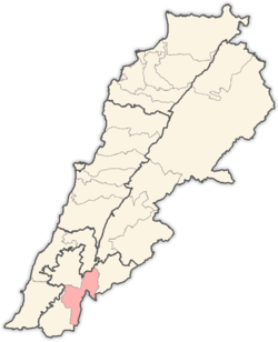 | |
|---|---|---|
| Towns and villages | ||
| Other | ||
This article is issued from Wikipedia. The text is licensed under Creative Commons - Attribution - Sharealike. Additional terms may apply for the media files.