Acquafondata
Acquafondata (Campanian: Acuaf'ûnnata, Latin: Aquafundata) is a comune (municipality) in the Province of Frosinone in the Italian region Lazio, located in the Monti della Meta area, about 130 kilometres (81 mi) southeast of Rome and about 50 kilometres (31 mi) east of Frosinone.
Acquafondata | |
|---|---|
| Comune di Acquafondata | |
 | |
Location of Acquafondata 
| |
 Acquafondata Location of Acquafondata in Italy 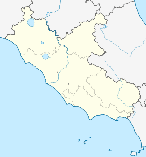 Acquafondata Acquafondata (Lazio) | |
| Coordinates: 41°33′N 13°57′E | |
| Country | Italy |
| Region | Lazio |
| Province | Frosinone (FR) |
| Frazioni | Casal Cassinese, Fontana |
| Government | |
| • Mayor | Antonio Di Meo |
| Area | |
| • Total | 25.32 km2 (9.78 sq mi) |
| Elevation | 926 m (3,038 ft) |
| Population (31 December 2017)[2] | |
| • Total | 267 |
| • Density | 11/km2 (27/sq mi) |
| Demonym(s) | Acquafondatari |
| Time zone | UTC+1 (CET) |
| • Summer (DST) | UTC+2 (CEST) |
| Postal code | 03040 |
| Dialing code | 0776 |
| Patron saint | St. John the Baptist |
| Saint day | August 29 |
| Website | Official website |
History
During World War II, Acquafondata was occupied by the Germans, who guarded the Gustav Line on the Cassino side and the Reinhard Line on the Molise side. The liberation of Acquafondata took place on 12 January 1944 by the French Expeditionary Corps who broke through on the Venafro side.[3] Two survivors, Romano Neri and Domenico Mancone, were awarded knighthoods by the Presidency of the Republic for their role in the liberation.
Geography
Located in the middle of a valley and surrounded by the Monti della Meta, the built-up area is located at 926 m asl, on a limestone hillock dominated by Monte Monna Casale, (1395 m asl) in the southern Mainarde area. The valley produces potatoes and legumes. Reclamation work, through the construction of a tunnel for draining unhealthy waters, began in 1882 and saw its completion in 1901.[4][5] Near the hamlet of Casalcassinese there are the springs of the Rava stream, which flows south-east, in the direction of Pozzilli, before flowing into the San Bartolomeo River, a tributary of the Volturno.[6]
Architecture
The commune contains the Chiesa parrocchiale di sant'Antonio di Padova, Santuario della Madonna del Carmin, Chiesa di san Rocco and Chiesa di Santa Maria in Centumcellis and a number of notable World War II monuments, including to the Italians and the Polish.
References
- "Superficie di Comuni Province e Regioni italiane al 9 ottobre 2011". Istat. Retrieved 16 March 2019.
- All demographics and other statistics: Italian statistical institute Istat.
- Free France. French Press & Information Service. 1945. p. 535.
- "Censimento" (PDF) (in Italian). ebiblio.istat.it. Archived from the original (PDF) on 18 October 2017. Retrieved 13 August 2019.
- "Gazzetta ufficiale del Regno d'Italia" (in Italian). Augusto.agid.gov.it. Archived from the original on 18 October 2017. Retrieved 13 August 2019.
- Il Frammento Sabatini: un documento per la storia di San Vincenzo al Volturno (in Italian). Via. 2003. p. 55.