Aytat
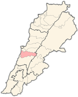
Aitat, or Aytat (Arabic: عيتات), is a town located 5 kilometres (3.1 mi) west of the town of Aley within the district of the same name in the Lebanese governorate of Mount Lebanon. It was a strategic place during the Lebanese Civil War (1975–1990), due to its view to Beirut.
Aitat | |
|---|---|
Town | |
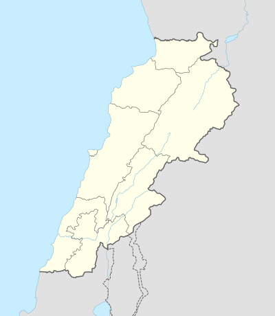 Aitat Aitat shown within Lebanon | |
| Coordinates: 33.791607°N 35.557253°E | |
| Country | Lebanon |
| Governorate | Mount Lebanon |
| District | Aley |
| City | Aley |
| Time zone | UTC+2 |
| • Summer (DST) | UTC+3 |
| ISO 3166 code | LB |
With its neighboring Christian town of Souk El-Gharb, this town remains one of the most memorable places in Lebanon for the Druze and the Christians as a reminder the fierce and deadly battles that occurred during the Lebanese Civil War. Today Aitat and Souk El-Gharb are considered to be the symbol of unity and forgiveness.
The Abi Saab's, Talhouq's, and Timani's are the most well known families of Aitat and the Aley district.
References
This article is issued from Wikipedia. The text is licensed under Creative Commons - Attribution - Sharealike. Additional terms may apply for the media files.