2020 Caribbean earthquake
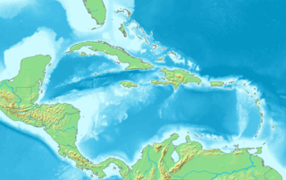
At 2:10 p.m. local time (UTC-5) on 28 January 2020, an earthquake of 7.7 Mw struck on the north side of the Cayman Trough, north of Jamaica and west of the southern tip of Cuba, with the epicenter being 80 miles (130 km) ESE of Cayman Brac, Cayman Islands [3] or 83 miles (134 km) north of Montego Bay, Jamaica.[4] Schools in Jamaica and buildings in Miami were evacuated after shaking was observed in parts of the U.S. state of Florida.[5][6] Light shaking was also reported on the Yucatan peninsula in Mexico.[7] It is the largest earthquake in the Caribbean since 1946.[8] A tsunami warning for the Caribbean Sea was issued by the Pacific Tsunami Warning Center and later withdrawn.[9] It is, thus far, the largest earthquake in 2020 by magnitude.[10]
.jpg) Shakemap from USGS | |
 | |
| UTC time | 2020-01-28 19:10:24 |
|---|---|
| ISC event | 617210084 |
| USGS-ANSS | ComCat |
| Local date | 28 January 2020 |
| Local time | 14:10:25 |
| Magnitude | 7.7 Mw[1] |
| Depth | 14.9 km (9 mi) |
| Epicenter | 19.419°N 78.756°W |
| Fault | Septentrional-Oriente fault zone |
| Type | Strike-slip |
| Areas affected | Cayman Islands Jamaica Cuba |
| Max. intensity | VI (Strong) |
| Tsunami | 0.46 m (1.5 ft) at George Town, Cayman Islands |
| Aftershocks | Up to 6.1 Mw[2] |
| Casualties | 0 |
Tectonic setting
The eastern part of the Cayman Trough forms part of the Gonâve Microplate, which lies between the North American Plate and the Caribbean Plate. It is bounded to both north and south by large transform faults that together accommodate the relative displacement of the two major plates. To the north the boundary is the western part of the Septentrional-Oriente fault zone, which accommodates 6–11 mm per year of plate boundary motion, while to the south the boundary is formed by the Walton fault zone to the west of Jamaica and the Enriquillo–Plantain Garden fault zone to the east, accommodating about 8 mm per year.[11]
Earthquake
The earthquake had a magnitude of 7.7 Mww and an estimated depth of 14.8 km (9.2 mi).[1] The focal mechanism, combined with an analysis of seismic waveforms, is consistent with strike-slip motion on the Septentrional-Oriente fault zone.[12] The mainshock was followed by a series of aftershocks, with the largest being a 6.1 Mww event that occurred less than three hours later, to the southeast of Grand Cayman.[13] The modelled rupture zone extends from just west of the epicenter of the M 6.1 aftershock to just east of the mainshock epicenter, suggesting unilateral westward propagation.[12]
Impact
Cayman Islands
There were cracked roads and many sinkholes.[14] A minor tsunami of 46 cm (1 ft 6 in) was recorded.[15] All government schools were closed to allow inspections for possible damage, but they were all reopened on January 30 as no major damage had been found that related to the earthquake.[16]
Jamaica
A six-story building on the Mona campus of the University of the West Indies, containing approximately 300 students, was evacuated.[17] Damage was reported from at least two parishes in western Jamaica.[18]
Several buildings in and around the New Kingston vicinity were evacuated promptly after the earthquake, with several reports of shaking. The area was virtually shut down.
Cuba
Tremors were felt on the southern coast of the island. A spokesman for Guantanamo Bay Naval Base stated that there were no reports of damages or injuries.[19] Granma Province was affected by the strongest shaking, being closest to the epicenter. A survey carried out by the National Center for Seismological Research, found that one house had completely collapsed and another 300 showed some damage. The houses affected were all ones that were not in good condition before the earthquake. Damage was also reported from some schools and daycare centers.[20]
United States
Tremors were felt throughout southern Florida and several buildings were evacuated, particularly in Miami-Dade County (450 miles away) and the Florida Keys.[21] Several government buildings in Downtown Miami were evacuated, initially on a volunteer basis until a full evacuation was ordered by the local fire department.[22]
See also
- 2020 in the Caribbean
- 2020 coronavirus pandemic in North America
- 2010 Haiti earthquake
- 2019-20 Puerto Rico earthquakes
- List of earthquakes in 2020
- 2020s
References
- ANSS. "Cayman Trough 2020 : M 7.7 - 125km NNW of Lucea, Jamaica". Comprehensive Catalog. U.S. Geological Survey. Retrieved 28 January 2020
- "6.1-magnitude tremor follows 7.7-magnitude earthquake between Cuba and Jamaica". Global News. Retrieved 29 January 2020.
- Cayman Prepared (28 January 2020). "Earthquake Tsunami Update". Cayman Islands National Emergency Website. Retrieved 25 February 2020.
- Allen, Karma (28 January 2020). "Powerful earthquake strikes between Jamaica and Cuba". ABC. Retrieved 28 January 2020.
- Almasy, Steve; Eshchenko (28 January 2020). "Tsunami threat message issued after magnitude 7.7 earthquake off the coast of Jamaica". CNN. Retrieved 28 January 2020.
- Dalton, Jane (28 January 2020). "Jamaica earthquake: Huge 7.7-magnitude tremor hits off island's coast". independent.co.uk. Retrieved 28 January 2020.
- Rice, Doyle (28 January 2020). "Powerful 7.7 earthquake strikes in Caribbean between Cuba and Jamaica". USA Today. Retrieved 28 January 2020.
- Cappucci, Matthew; Samenow, Jason (28 January 2020). "7.7-magnitude earthquake strikes between Jamaica and Cuba, one of the strongest on record in Caribbean". The Washington Post. Retrieved 28 January 2020.
- "Caribbean earthquake of 7.7 prompts office evacuations in Miami". BBC News. 28 January 2020. Retrieved 28 January 2020.
- "All earthquakes M7+ in 2020". earthquake.usgs.gov. Retrieved 13 June 2020.
- DeMets, C.; Wiggins-Grandison W. (2007). "Deformation of Jamaica and motion of the Gonâve microplate from GPS and seismic data" (PDF). Geophysical Journal International. 168 (1): 362–378. Bibcode:2007GeoJI.168..362D. doi:10.1111/j.1365-246X.2006.03236.x. Retrieved 7 December 2011.
- ANSS: Cayman Trough 2020, Finite Fault (as of February 6, 2020)
- ANSS. "Cayman Trough 2020b : M 6.1 - 57km SE of East End, Cayman Islands". Comprehensive Catalog. U.S. Geological Survey. Retrieved 6 February 2020
- Mindock, Clark (28 January 2020). "Jamaica earthquake - live updates: Caribbean rocked by huge tremor near Cuba, with buildings evacuated in parts of US". independent.co.uk. Retrieved 28 January 2020.
- Cayman Prepared (29 January 2020). "Earthquake Communications Timeline". Cayman Islands National Emergency Website. Retrieved 25 February 2020.
- Cayman Prepared (29 January 2020). "Government Schools Reopen". Cayman Islands National Emergency Website. Retrieved 6 February 2020.
- "Tsunami warning after Jamaica hit by 7.7 magnitude earthquake - follow live". The Independent. 28 January 2020. Retrieved 28 January 2020.
- "7.7 Magnitude Earthquake Off The Shores of Cuba". Office of Disaster Preparedness and Emergency Management. 29 January 2020. Retrieved 6 February 2020.
- Press, The Associated (29 January 2020). "7.7 magnitude earthquake strikes between Cuba and Jamaica". WPBF. Retrieved 29 January 2020.
- OnCuba Staff (4 February 2020). "Earthquake-damaged buildings in Cuba were in "poor condition"". On Cuba News. Retrieved 6 February 2020.
- "Miami Buildings Shake After Powerful Earthquake Between Cuba and Jamaica". NBC 6 South Florida. Retrieved 29 January 2020.
- Charles, Jacqueline; Torres, Nora Gámez; Ocasio, Bianca Padró (28 January 2020). "Powerful Caribbean earthquake shakes buildings in Jamaica, Cuba — even downtown Miami". Miami Herald. Retrieved 29 January 2020.