2020 Arizona wildfires
The 2020 Arizona wildfire season is the series of wildfires across the state of Arizona that occur year-round but are most numerous and typically burn the largest swaths of land during spring and summer. Peak fire season in the Southwest typically runs from May, when conditions are windy, hot, and dry, through mid-July, when the North American Monsoon provides the region with precipitation to slow fire activity.[1]
| 2020 Arizona wildfires | |
|---|---|
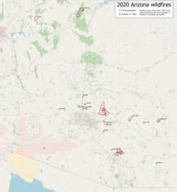 Map of fires during the 2020 Arizona wildfire season | |
| Statistics | |
| Cost | unknown |
| Deaths | 0 |
| Non-fatal injuries | 0 |
| Season | |
← 2019
2021 → | |
As of June 15, 2020, at least thirteen fires larger than 1,000 acres (400 ha) have burned within the state. However, the most notable fire of the season, the Ocotillo Fire, burned only 980 acres (400 ha) over four days and threatened the town of Cave Creek. It destroyed 20 buildings, including 8 homes.[2]
Early outlook
In April, the Arizona Department of Forestry and Fire Management expected a "potentially active" fire season reminiscent of the 2019 season. Increased grass load from a wet winter is expected to contribute to an elevated risk of fire in the Central Arizona deserts.[3] Southwest Coordination Center Predictive Services forecasted an Above Normal risk for significant wildland fires from May through July for most of Arizona (excepting the Colorado Plateau), with fire potential returning to Normal by August with the arrival of a climatologically average monsoon. They cited above normal fine fuel loading in southern Arizona deserts and an active weather pattern through mid-June to support this risk.[4]
Wildfires
The following is a list of fires that burned more than 1,000 acres (400 ha), or produced significant structural damage or casualties.
| Name | County | Acres | Start date | Containment date | Notes | Ref |
|---|---|---|---|---|---|---|
| Basin | Mohave | 38,804 | May 10 | May 21 | Lightning-caused | [5][6] |
| East Desert | Maricopa | 1,492 | May 17 | May 22 | Human-caused | [7] |
| Jackrabbit | Maricopa | 2,034 | May 25 | May 26 | [8] | |
| Range | Pinal | 3,286 | May 29 | June 1 | Cause unknown | [9] |
| Ocotillo | Maricopa | 980 | May 30 | June 2 | Human-caused; 20 buildings destroyed in Cave Creek | [2] |
| Sawtooth | Pinal | 24,729 | May 30 | June 19 | Lightning-caused | [10] |
| Sunset | Yavapai | 4,000 | May 31 | June 1 | Forced closure of I-17 both directions on May 31; cause unknown | [11] |
| Tortolita | Pinal | 3,140 | June 5 | June 11 | Lightning-caused | [12] |
| Bighorn | Pima | 88,046 | June 5 | 40% contained as of June 26 | Lightning-caused; around 80 homes in Catalina were forced to evacuate on June 12 Summerhaven and surrounding areas on Mt. Lemmon were given evacuation notice on June 16. The Willow Canyon region of Mt. Lemmon and some parts of Oracle were told to evacuate on June 18 Further evacuations were announced for the eastern slopes of the Santa Catalinas on June 26 | [13][14] |
| Blue River | Gila | 30,400 | June 5 | 85% contained as of June 18 | Lightning-caused | [15] |
| Emigrant | Cochise | 4,756 | June 6 | June 14 | [16] | |
| Dry Lake | Graham | 4,266 | June 6 | 93% contained as of June 18 | Lightning-caused | [17] |
| Bringham | Greenlee | 22,903 | June 6 | 37% contained as of June 25 | 36-mile closure of US 191; lightning-caused | [18] |
| Mangum | Coconino | 71,420 | June 8 | 46% contained as of June 26 | Closure of US 89A and SR 67, making the North Rim of Grand Canyon National Park inaccessible Evacuations were issued for areas along House Rock Road east of Jacob Lake on June 17 | [19] |
| Bush | Maricopa | 190,269 | June 13 | 90% contained as of June 26 | Human-caused; Evacuations issued for: Tonto Basin, Punkin Center (June 14), Sunflower, Apache Lake (June 16) Brownsville, Jake's Corner, Slate Creek, and Pioneer Pass (June 18) Gila County evacuation orders were lifted on June 20 | [20] |
| Central | Maricopa | 4,499 | June 20 | 80% contained as of June 26 | Human-caused | [21][22] |
| Aquila | Maricopa | 893 | June 23 | June 26 | 6 structures destroyed; human-caused | [23][24] |
References
- "Fire Behavior Field Reference Guide, PMS 437 - Fire Season Climatology". nwcg.gov. National Wildfire Coordinating Group. Retrieved June 14, 2020.
- "Ocotillo Fire destroys iconic Cave Creek business, 8 homes". AZ Family. June 2, 2020.
- "2020 Arizona Wildfire Outlook". dffm.az.gov. Department of Forestry and Fire Management. Retrieved April 8, 2020.
- "2020 Fire Season Considerations and Outlook". Southwest Coordination Center. May 5, 2020. Retrieved June 15, 2020.
- "Basin Fire burns 36,000 acres in northwest Arizona". Wildfire Today. May 11, 2020. Retrieved June 13, 2020.
- "Basin Fire Information". InciWeb. May 21, 2020. Archived from the original on June 8, 2020.
- "East Desert Fire Information". InciWeb. May 25, 2020. Archived from the original on June 12, 2020.
- Wegner, Helena (May 26, 2020). "Jackrabbit Fire near Wickenburg grows to more than 2,000 acres". The Arizona Republic.
- "Range Fire Information". InciWeb. June 1, 2020. Archived from the original on June 14, 2020.
- "Sawtooth Fire Information". InciWeb. June 10, 2020. Retrieved June 13, 2020.
- "Sunset Fire closes Interstate 17 north of Phoenix". Wildfire Today. May 31, 2020. Retrieved June 13, 2020.
- "AZ Dept. of Forestry & Fire Management: Tortolita Fire 100% contained". KVOA - News 4 Tucson. June 11, 2020.
- "Bighorn Information". InciWeb. June 15, 2020. Retrieved June 15, 2020.
- "Arizona Wildfire Closes North Rim of Grand Canyon; In Southern Arizona, Bighorn Wildfire Continues To Grow". The Weather Channel. June 12, 2020.
- "Blue River Fire Information". InciWeb. June 15, 2020. Retrieved June 15, 2020.
- "Open Incidents - WildCAD AZ-Tucson Interagency Dispatch Center". WildWeb. Archived from the original on June 15, 2020.
- "Dry Lake Fire Information". InciWeb. June 15, 2020. Retrieved June 15, 2020.
- "Bringham Fire Information". InciWeb. June 15, 2020. Retrieved June 15, 2020.
- "Mangum Fire Information". InciWeb. June 15, 2020. Retrieved June 15, 2020.
- "Bush Fire Information". InciWeb. June 15, 2020. Retrieved June 15, 2020.
- "Central Fire burning near New River grows to 1,500 acres". AZ Family. June 20, 2020.
- "Central Fire Information". InciWeb. June 21, 2020. Retrieved June 21, 2020.
- "Open Incidents - WildCAD Arizona Dispatch Center". WildWeb. Retrieved June 23, 2020.
- "Aquila Fire Information". InciWeb. June 24, 2020. Retrieved June 24, 2020.