118 Avenue, Edmonton
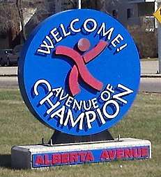
118 Avenue is the designated name of two major arterial roads in central Edmonton, Alberta, Canada, separated by the Edmonton City Centre Airport. The west side services both an industrial area, and a residential area, while the east 118 Avenue, originally Alberta Avenue, is one of the oldest streets in Edmonton outside the downtown core.[1] The name was changed to 118 Avenue in 1914 with the adoption of the grid system. Historically, it was a route between the City of Edmonton in the west and the Town of Beverly in the east. It is also sometimes called the Avenue of Champions. When Beverly was still a separate community from Edmonton, the portion of Alberta Avenue in Beverly was the central business district. Beverly amalgamated with Edmonton on December 31, 1961.[2] Following the amalgamation, Beverly's central business district went into a period of decline. The avenue boasts several major landmarks, including Northlands and the Coliseum.
Start/End points of west and east segments of 118 Avenue. | |
| Maintained by | City of Edmonton |
|---|---|
| Location | Edmonton, Alberta |
| ----
118 Avenue (Westside) | |
| Length | 7.6 km (4.7 mi) |
| West end | 184 Street |
| Major junctions | 170 Street, 156 Street, 149 Street, 142 Street, St. Albert Trail, 127 Street, 124 Street |
| East end | 121 Street / Kingsway |
| ----
118 Avenue (Eastside) | |
| Length | 8.5 km (5.3 mi) |
| West end | 109 Street |
| Major junctions | Princess Elizabeth Avenue, 97 Street, 82 Street, Wayne Gretzky Drive, 66 Street, 50 Street |
| East end | Yellowhead Trail / Victoria Trail |
Prior to the opening of Yellowhead Trail in the early 1980s, Highway 16 followed 118 Avenue between Edmonton's eastern city limit and Princess Elizabeth Avenue before continuing west on 111 Avenue.[3]
The Alberta Avenue name only applies for the portion from 109 Street to Wayne Gretzky Drive. Alberta Avenue is targeted for revitalization as part of the Alberta Avenue-Eastwood Business Revitalization Zone.
Neighbourhoods
List of neighbourhoods 118 Avenue runs through, in order from west to east:[4]
Eastside
Major intersections
This is a list of major intersections, starting at the west end of 118 Avenue.[4] The entire route is in Edmonton.
| km | mi | Destinations | Notes | ||||
|---|---|---|---|---|---|---|---|
| 0.0 | 0.0 | Continues west as 116 Avenue | |||||
| 184 Street | At-grade (traffic lights) | ||||||
| 1.2 | 0.75 | 178 Street | At-grade (traffic lights) | ||||
| 1.9 | 1.2 | 170 Street | At-grade (traffic lights) | ||||
| 3.6 | 2.2 | 156 Street | At-grade (traffic lights) | ||||
| 4.4 | 2.7 | 149 Street | At-grade (traffic lights) | ||||
| 5.2 | 3.2 | 142 Street | At-grade (traffic lights) | ||||
| 6.3 | 3.9 | Traffic circle (traffic lights) | |||||
| 6.9 | 4.3 | 127 Street | At-grade (traffic lights) | ||||
| 7.2 | 4.5 | 124 Street | At-grade (traffic lights) | ||||
| 7.6 | 4.7 | 121 Street | At-grade (traffic lights); roadway turns southeast | ||||
| Continues as Kingsway | |||||||
| 1.5 km (0.9 mi) gap in 118 Avenue (former City Centre Airport) | |||||||
| 0.0 | 0.0 | 109 Street | At-grade; roadway turns north | ||||
| 0.3 | 0.19 | 106 Street (NAIT Way) | At-grade (traffic lights) | ||||
| 0.8– 0.9 | 0.50– 0.56 | Princess Elizabeth Avenue / 102 Street / 101 Street | 6 exit traffic circle | ||||
| 1.0 | 0.62 | At-grade (traffic lights) | |||||
| 1.3 | 0.81 | 95 Street | At-grade (traffic lights) | ||||
| 2.6 | 1.6 | 82 Street (to Fort Road south) | At-grade (traffic lights) | ||||
| 2.9 | 1.8 | 80 Street (to Fort Road north) | At-grade (traffic lights) | ||||
| 3.2 | 2.0 | Passes under | |||||
| 3.6– 3.7 | 2.2– 2.3 | Wayne Gretzky Drive – Northlands Coliseum, Northlands | Split intersection (traffic lights) | ||||
| 4.2 | 2.6 | 66 Street | At-grade (traffic lights) | ||||
| 4.9 | 3.0 | At-grade (traffic lights) | |||||
| 7.5 | 4.7 | 34 Street | At-grade (traffic lights) | ||||
| 8.2– 8.5 | 5.1– 5.3 | Partial cloverleaf interchange (traffic lights); exit 397 on Hwy 16 | |||||
| Continues north as Victoria Trail | |||||||
1.000 mi = 1.609 km; 1.000 km = 0.621 mi
| |||||||
References
- Mundy's Map of The Twin Cities Edmonton & Strathcona (Map). The Mundy Blueprint Co. 1911.
- History of Annexations (PDF) (Map). City of Edmonton, Planning and Development Department. Retrieved December 29, 2014.
- Travel Alberta. Alberta Official Road Map (Map) (1978-79 ed.). Government of Alberta. Edmonton inset.
- "City of Edmonton map utility". Archived from the original on 2009-06-25. Retrieved 2009-06-23.