Zutendaal
| Zutendaal | |||
|---|---|---|---|
| Municipality | |||
| |||
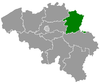
 Zutendaal Location in Belgium
Location of Zutendaal in Limburg 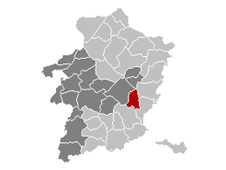 | |||
| Coordinates: 50°56′N 05°34′E / 50.933°N 5.567°ECoordinates: 50°56′N 05°34′E / 50.933°N 5.567°E | |||
| Country | Belgium | ||
| Community | Flemish Community | ||
| Region | Flemish Region | ||
| Province | Limburg | ||
| Arrondissement | Hasselt | ||
| Government | |||
| • Mayor | Ann Schrijvers (Nieuw ZVP)[1] | ||
| • Governing party/ies | Nieuw ZVP, Samen Zutendaal | ||
| Area | |||
| • Total | 32.07 km2 (12.38 sq mi) | ||
| Population (1 January 2017)[2] | |||
| • Total | 7,270 | ||
| • Density | 230/km2 (590/sq mi) | ||
| Postal codes | 3690 | ||
| Area codes | 089 | ||
| Website | www.zutendaal.be | ||


Zutendaal, in English sometimes also referred to as Sweet Valley, is a municipality located in the Belgian province of Limburg. On 1 January 2017 Zutendaal had a total population of 7,269. The total area is 32.07 km², giving a population density of 227 inhabitants per km². [3]
In addition to Zutendaal itself, the municipality includes the following population centres: Gewaai, Papendaal, Besmer, Broek, Stalken, Roelen, Daal, and Wiemesmeer.
Etymology
The first written mention of Zutendaal was in 1292 under the name of Suerbroeck, indicating that the land around the village was acidic and swampy. From 1345 the name changed to Zuetendael which literally translates to "Sweet Valley". Indicating there were a lot of freshwater sources around the village. [4]
Demographic evolution

- Bronnen:NIS, Opm:1806 tot en met 1981=volkstellingen; 1990 en later= inwonertal op 1 januari
References
- ↑ samenstelling college van burgemeester en schepenen
- ↑ Population per municipality as of 1 January 2017 (XLS; 397 KB)
- ↑ "Zutendaal | Vlaanderen.be". vlaanderen.be.
- ↑ "Dialect en namen". users.telenet.be. Retrieved 2017-09-29.
External links

- Official website - Available only in Dutch
Places adjacent to Zutendaal | ||||||||||
|---|---|---|---|---|---|---|---|---|---|---|
| ||||||||||