Aranca River
| Aranca Zlatica (Златица) | |
| River | |
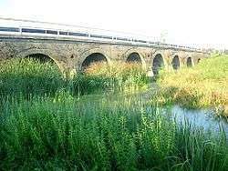
 Zlatica River at Padej (Serbia) | |
| Countries | Romania (Arad County, Timiș County) Serbia (Vojvodina Province) |
|---|---|
| Tributaries | |
| - left | Giucoșin |
| - right | Igriș |
| Mouth | Tisa River |
| - location | Ada, Serbia |
| - coordinates | 45°48′44″N 20°08′54″E / 45.8122°N 20.1482°ECoordinates: 45°48′44″N 20°08′54″E / 45.8122°N 20.1482°E |
| Length | 117 km (73 mi) |
| Basin | 1,470 km2 (568 sq mi) |
| Progression | Tisza→ Danube→ Black Sea |

The Aranca or Zlatica (Romanian: Aranca, Serbian: Златица / Zlatica, Hungarian: Aranka) is a 117 km long river in the Banat region of Romania and Serbia, left tributary of the Tisa River.
Hydronymy
The Serbian and Hungarian names of the river carry the meaning the golden river.
Course
The Aranca originates in Romania, in the northern part of Banat, southwest of the city of Arad. It flows to the west, next to the large villages of Sânpetru Mare, Saravale, the town of Sânnicolau Mare, Dudeștii Vechi and Vălcani, where it leaves Romania after the course of 76 km and enters Serbia as the Zlatica for the remaining 41 km.
In Serbia, the river turns southwest, receives from the right the Kikinda canal which connects it to the Canal Danube-Tisa-Danube to the south, flows next to the village of Padej and empties into the Tisa river at the town of Ada. Near the village of Banatski Monoštor the Zlatica receives from the right its main tributary, another Romanian-Serbian river, the Begej (not to be confused with larger Begej that flows into the Tisa).
Characteristics
The Aranca belongs to the Danube drainage basin, itself draining 1,470 km² (790 km² in Romania, 680 km² in Serbia). In the lower part it has been channelized, so its navigable for the last 10 km and also very important for the irrigation of the arable land in its valley. Near the village of Jazovo, waters of the Zlatica are used for the Ostojićevo fish pond, and a natural Celeruša bog is also located there.
Settlements located near the river
Romania
Serbia
References
- Mala Prosvetina Enciklopedija, Third edition (1985); Prosveta; ISBN 86-07-00001-2
- Jovan Đ. Marković (1990): Enciklopedijski geografski leksikon Jugoslavije; Svjetlost-Sarajevo; ISBN 86-01-02651-6
- Srpska porodična enciklopedija, Vol. X (2007); Narodna knjiga and Politika NM; ISBN 978-86-331-2739-4
- Administrația Națională Apelor Române – Cadastrul Apelor – Bucharest
- Institutul de Meteorologie și Hidrologie – Rîurile României – Bucharest, 1971
- ICPA – Comune vulnerabile – Județul Timiș
- Trasee turistice – județul Arad
- Trasee turistice – județul Timiș