Murchison Promontory
Murchison Promontory is a peninsula in northern Canada that is the northernmost point on mainland Canada and on the mainland of North America;[1][2] it is also one of the Extreme points of Earth.
The distance to the North Pole is 1,087 nautical miles (1,251 mi; 2,013 km), or 64 km (40 mi) closer than the distance from Point Barrow, Alaska (the northernmost point in the United States) to the Pole.
Geography
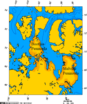
Murchison Promontory is situated in Nunavut on the northern part of the Boothia Peninsula in the northern Canadian Arctic. The northernmost point on the promontory is Zenith Point[3] with coordinates 72°00′00″N 94°38′59″W / 72.00000°N 94.64972°W.[4]
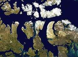
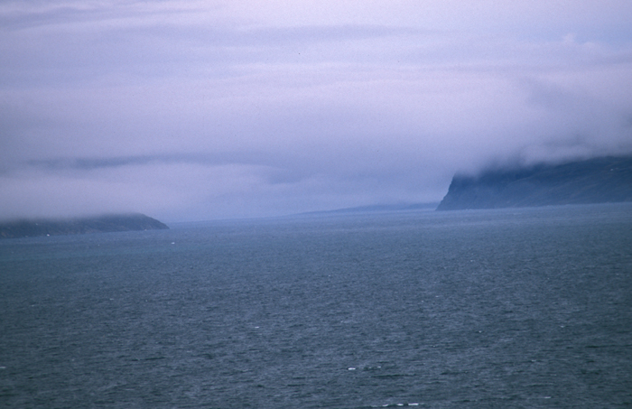
The cape is located on the south side of the 48 by 3 km (29.8 by 1.9 mi), Bellot Strait which separates it from Somerset Island and about 250 km (160 mi) north of the hamlet of Taloyoak.
Murchison Promontory is part of the Kitikmeot Region (Qitirmiut).
History
The area was first explored in April 1852 by Canadian Captain William Kennedy and French explorer Joseph René Bellot while searching for traces of John Franklin's lost Arctic expedition.[5][6] The strait was then named after Bellot.
Irish born Francis Leopold McClintock also wintered in the area with his ship Fox in the winter of 1858 - 1859 in his search for the Franklin expedition.[7]
In 1937 Scot E. J. "Scotty" Gall passed the promontory on his ship "Aklavik" on the first crossing of the Bellot Strait[8] travelling from the western shore to the eastern for the Hudson's Bay Company.
References
- ↑ Querying Geographical Names of Canada Archived 2011-06-08 at the Wayback Machine. at Natural Resources Canada
- ↑ Murchison Promontory Archived 2012-09-27 at the Wayback Machine. at the Atlas of Canada
- ↑ "Somerset Island". Archived from the original on December 23, 2010. Retrieved 2010-09-25. at Oceandots
- ↑ Zenith Point Archived 2012-10-02 at the Wayback Machine. at the Atlas of Canada
- ↑ Francis Leopold McClintock at the Dictionary of Canadian Biography
- ↑ The Columbia Gazetteer of North America 2000 Archived 2007-03-11 at the Wayback Machine.
- ↑ Bellot Strait at The Canadian Encyclopedia
- ↑ University of Calgary, Scotty Gall