Cape Sabine
| Cape Sabine | |
|---|---|
 | |
| Location |
Pim Island, Qikiqtaaluk Region, Nunavut, |
| Coordinates | 78°43′55″N 74°6′0″W / 78.73194°N 74.10000°WCoordinates: 78°43′55″N 74°6′0″W / 78.73194°N 74.10000°W |
| Offshore water bodies | Smith Sound |
| Area | Arctic |
Cape Sabine is a land point on Pim Island, off the eastern shores of the Johan Peninsula, Ellesmere Island, in the Smith Sound, Qikiqtaaluk Region, Nunavut, Canada.
History
This headland was the site of the winter camp of Adolphus Greely and the Lady Franklin Bay Expedition in 1883/84.[1]
This cape was named after Arctic explorer Sir Edward Sabine (1788-1883).
Views
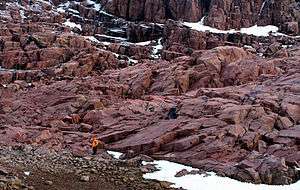 Pim Island. Photographed in 2005 |
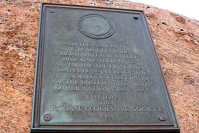 Pim Island to the memory of dead men from the expedition of Adolphus Greely. Photographed in 2005 |
Notable people
References
- ↑ Guttridge, Leonard F. (2000-09-01). "Ghosts of Cape Sabine: the harrowing true story of the Greely expedition". Arctic Institute of North America of the University of Calgary. Retrieved 2008-04-14.
External links
This article is issued from
Wikipedia.
The text is licensed under Creative Commons - Attribution - Sharealike.
Additional terms may apply for the media files.