Yuraccacsa (Arequipa)
| Yuraccacsa | |
|---|---|
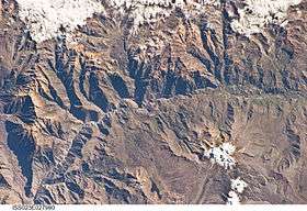 The Colca River and Yuraccacsa northwest of it (upper left) as seen from the ISS | |
| Highest point | |
| Elevation | 5,465 m (17,930 ft) [1] |
| Coordinates | 15°26′53″S 72°09′45″W / 15.44806°S 72.16250°WCoordinates: 15°26′53″S 72°09′45″W / 15.44806°S 72.16250°W |
| Geography | |
 Yuraccacsa Peru | |
| Location | Peru, Arequipa Region |
| Parent range | Andes, Chila |
Yuraccacsa or Yuraccasa (possibly from Quechua yuraq white, q'asa mountain pass, "white mountain pass") is a 5,465-metre-high (17,930 ft) mountain in the west of the Chila mountain range in the Andes of Peru. It is located in the Arequipa Region, Castilla Province, on the border of the districts Chachas and Choco.[2] Yuraccacsa lies south of Chila, the highest mountain in the range, and Choquepirhua, southeast of Asnohuañusja and northeast of a lake named Cochapunco (possibly from Quechua for "lake reservoir") and the peaks of Cerani and Casiri.
References
- ↑ "Cerro Yuraccacsa". IGN, Peru. Retrieved May 27, 2015.
- ↑ escale.minedu.gob.pe - UGEL map of the Castilla Province (Arequipa Region)
This article is issued from
Wikipedia.
The text is licensed under Creative Commons - Attribution - Sharealike.
Additional terms may apply for the media files.