Yumali, South Australia
| Yumali South Australia | |||||||||||||||
|---|---|---|---|---|---|---|---|---|---|---|---|---|---|---|---|
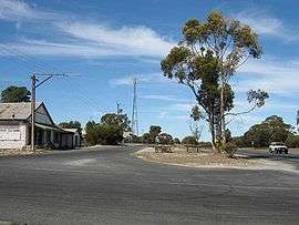 Main Street of Yumali - old General Store, Yumali Garage, payphone & Telstra tower | |||||||||||||||
 Yumali | |||||||||||||||
| Coordinates | 35°30′36″S 139°45′23″E / 35.509895°S 139.756449°ECoordinates: 35°30′36″S 139°45′23″E / 35.509895°S 139.756449°E[1] | ||||||||||||||
| Population | 63 (2016 census)[2] | ||||||||||||||
| Established | 24 August 2000[3] | ||||||||||||||
| Location | 137 km (85 mi) SE of Adelaide via | ||||||||||||||
| LGA(s) | The Coorong District Council[1] | ||||||||||||||
| Region | Murray and Mallee[1] | ||||||||||||||
| County | Buccleuch[1] | ||||||||||||||
| State electorate(s) | Hammond[4] | ||||||||||||||
| Federal Division(s) | Barker[5] | ||||||||||||||
| |||||||||||||||
| |||||||||||||||
| Footnotes | Adjoining localities[1] | ||||||||||||||
Yumali is a very small country town in South Australia 162 km (100 miles) southeast of Adelaide on the Dukes Highway (A8). Yumali belongs to The Coorong District Council and is in the State electorate of Hammond and the Federal electorate of Barker. Yumali is in the County of Buccleuch.
Yumali is an aboriginal word meaning "the great land", before that it was known as Wahpunyah Siding. Yumali is situated 100 miles from Adelaide on the Adelaide to Melbourne Express route. Bore water was used to water the community, surrounding farms and Coomandook in 1915, but ceased when the River Murray pipeline was accessible in 1971.
There are tennis courts that still have an active tennis club belonging to the 'Border-Downs Tennis Association'. There is also an old football clubrooms from when Yumali had a team.
The town hall was opened in 1960.
The newly bitumised Tynan Road (Yumali-Sherlock) and then Kulkawarra Rd (Sherlock-Karoonda) gives a more comfortable drive for those traveling between Karoonda and the upper South East and vice versa.
References
| Wikimedia Commons has media related to Yumali, South Australia. |
- 1 2 3 4 5 "Search results for 'Yumali, LOCB' with the following datasets selected - 'Suburbs and Localities', 'Counties'. 'Hundreds', 'Local Government Areas', 'SA Government Regions' and 'Gazetteer',". Location SA Map Viewer. South Australian government. Retrieved 8 February 2018.
- ↑ Australian Bureau of Statistics (27 June 2017). "Yumali". 2016 Census QuickStats. Retrieved 9 February 2018.

- ↑ "GEOGRAPHICAL NAMES ACT 1991, Notice to Assign Boundaries and Names to Places" (PDF), The South Australian Government Gazette: 596, 24 August 2000, retrieved 28 December 2017
- ↑ "District of Hammond Background Profile". Electoral Commission SA. Retrieved 12 June 2016.
- ↑ "Commonwealth Electoral Division of Barker" (PDF). Australian Electoral Commission. Retrieved 12 June 2016.
- 1 2 3 "Monthly climate statistics: Summary statistics Summary statistics Tailem Bend (nearest weather station)". Commonwealth of Australia , Bureau of Meteorology. Retrieved 9 February 2018.